Satellite imagery is one of the most widely used sources of geospatial data in the world. It supports environmental monitoring, engineering, mining, agriculture, defence, mapping, urban planning and scientific research. What was once limited to governments and space agencies is now accessible to universities, businesses and individuals, with both free and commercial imagery available for many different purposes.
Despite this accessibility, satellite imagery can be confusing for new users. Terms such as spatial resolution, multispectral bands, revisit frequency, orthorectification, tasking and pan-sharpening are often used without explanation. As a result, users may request the wrong data, misunderstand what imagery can show, or select datasets that are not suitable for their project.
This guide explains satellite imagery from the ground up. It is intended as a practical reference for students, GIS users, engineers, researchers and anyone working with Earth observation data for the first time.
What Is Satellite Imagery?
Satellite imagery is a collection of images of the Earth captured by sensors mounted on satellites orbiting the planet. These satellites form part of the global Earth observation system, which continuously monitors land, oceans, atmosphere and human activity from space.
Most imaging satellites orbit between approximately 400 km and 800 km above the Earth. From this altitude, sensors measure reflected sunlight, thermal energy or radar signals coming from the surface. These measurements are processed into images that can be used for mapping, measurement and monitoring.
Satellite imagery is not limited to normal photography. Many sensors record wavelengths outside the visible spectrum, including near-infrared, shortwave infrared, thermal and microwave radar. These additional wavelengths allow users to analyse vegetation health, soil moisture, mineral composition, surface temperature and other properties that cannot be seen with the human eye.
Because the data is collected remotely without touching the ground, satellite imagery is part of the field known as remote sensing.
How Satellite Imagery Works
Most Earth observation satellites operate in sun-synchronous orbits, meaning they pass over the same location at roughly the same local time on each revisit. This keeps lighting conditions consistent and makes it easier to compare imagery captured on different dates.
However, not all modern satellites follow a strict sun-synchronous pattern. Some newer constellations use mid-inclination orbit (MIO), allowing more frequent revisits throughout the day. These systems can capture the same location multiple times within a single day, which is useful for monitoring change, tracking activity and time-sensitive projects.
Satellites do not capture the entire Earth at once. Instead, they collect data in swathes as they move along their orbit. Each swath is transmitted to ground stations, processed and stored in an archive where it can later be downloaded or ordered.
Each image is made up of pixels, and each pixel represents a small area on the ground. The size of that area determines how much detail can be seen in the imagery.
| Resolution | Ground Size per Pixel |
|---|---|
| 30 m | 30 x 30 metres |
| 10 m | 10 x 10 metres |
| 3 m | 3 x 3 metres |
| 50 cm | 0.5 x 0.5 metres |
| 30 cm | 0.3 x 0.3 metres |
Smaller pixels provide more detail, but usually result in larger file sizes, higher cost and smaller coverage per scene.
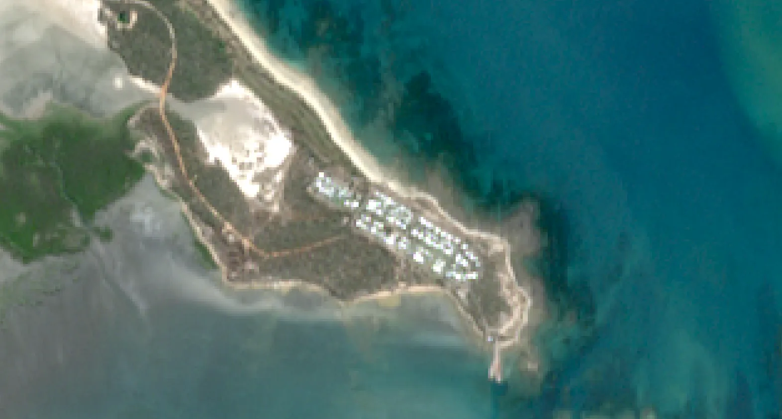
Sentinel-2 - 10 m resolution (free)
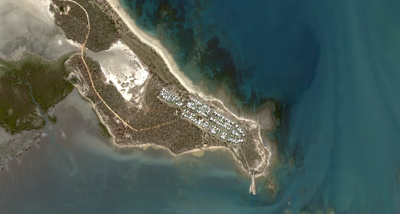
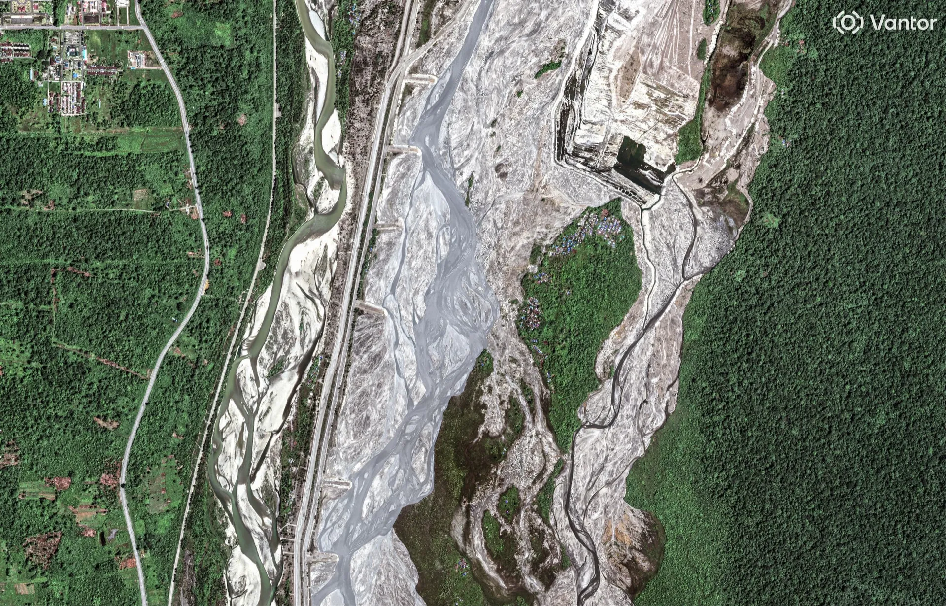
KOMPSAT-3 - 40 cm resolution (commercial)
The Four Types of Resolution
In satellite imagery, the term resolution does not refer to only one property. There are four different types of resolution and each one affects how the data can be used.
Spatial Resolution
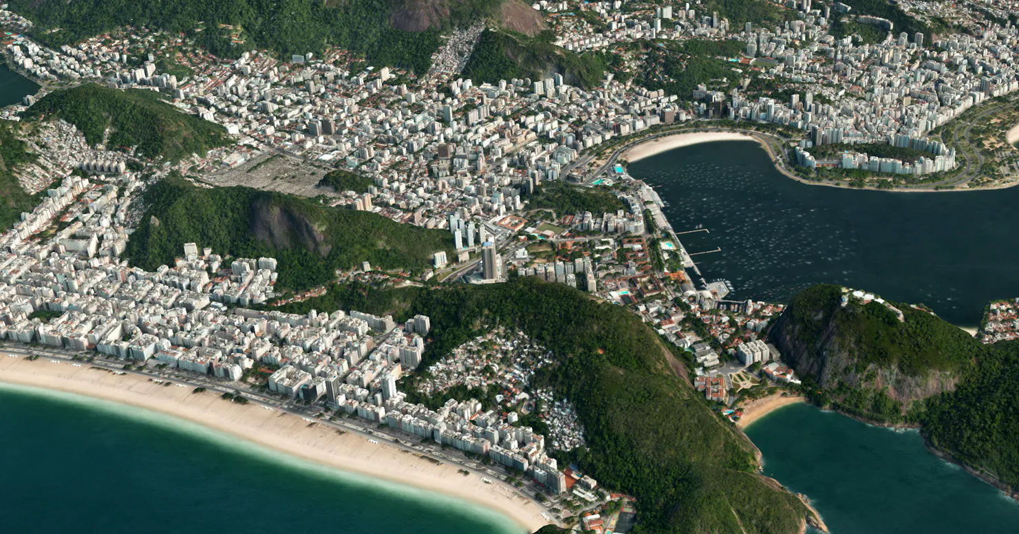
Spatial resolution describes how large each pixel is on the ground. Lower resolution imagery covers large areas but shows less detail, while higher resolution imagery shows more detail but covers smaller areas.
| Resolution | Typical Use |
|---|---|
| 30 m | Climate, land cover |
| 10 m | Environment, agriculture |
| 3–5 m | Monitoring, mapping |
| 50 cm | Engineering, planning |
| 30 cm | Detailed inspection |
Higher resolution is not always better. Large regional studies often use lower resolution data because it is easier to process and significantly cheaper to acquire.
Spectral Resolution
Spectral resolution describes how many wavelengths of light a sensor records. Different materials reflect light differently, so capturing multiple wavelengths allows analysis that is not possible with normal colour imagery.
| Type | Description |
|---|---|
| Panchromatic | Black and white |
| RGB | Standard colour |
| Multispectral | Several wide bands |
| Hyperspectral | Many narrow bands |
| SAR | Radar instead of light |
Higher spectral resolution allows more advanced analysis, particularly for vegetation, water, soil and mineral studies. For a deeper look at what different band combinations and indices can reveal, see our dedicated guide.
RGB (True Colour)
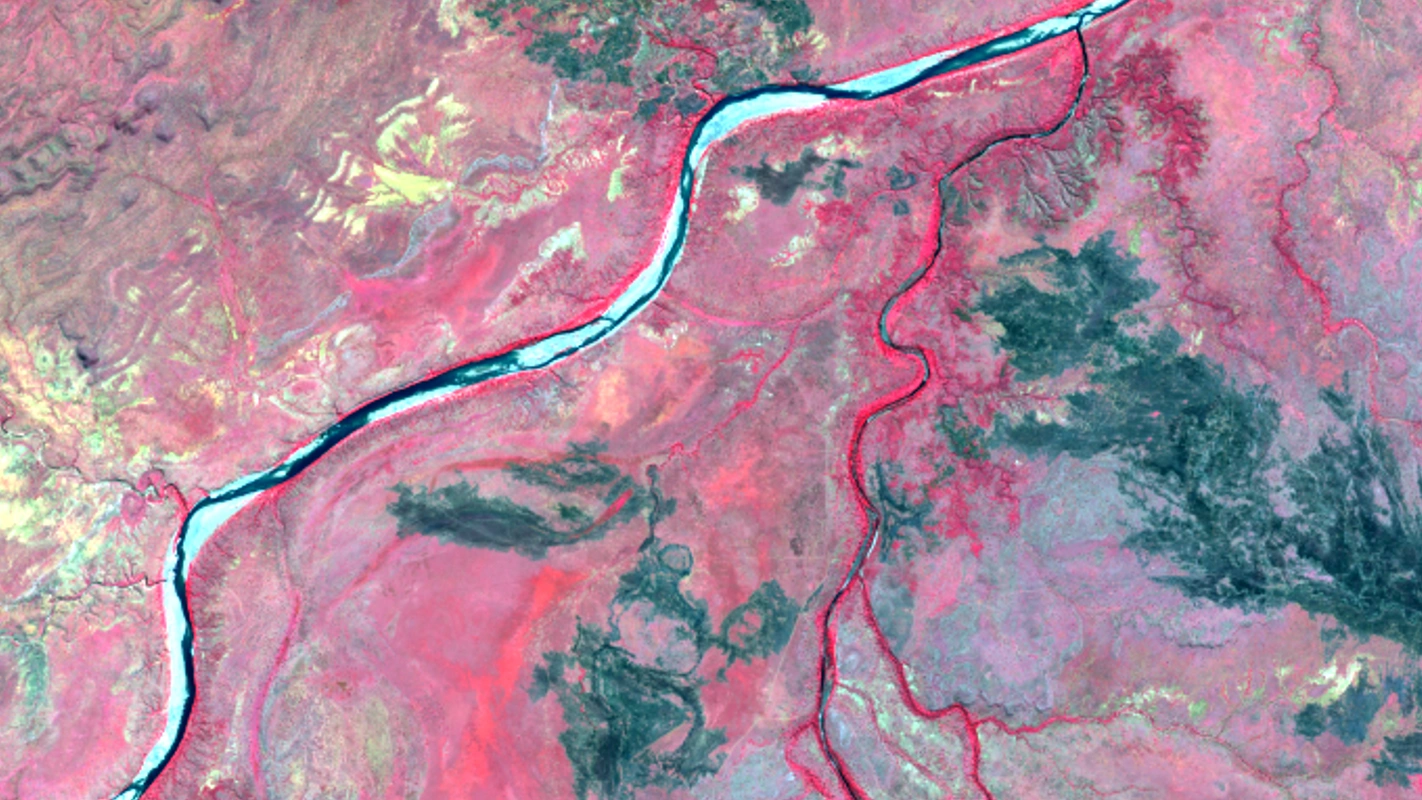
Colour Infrared (CIR)
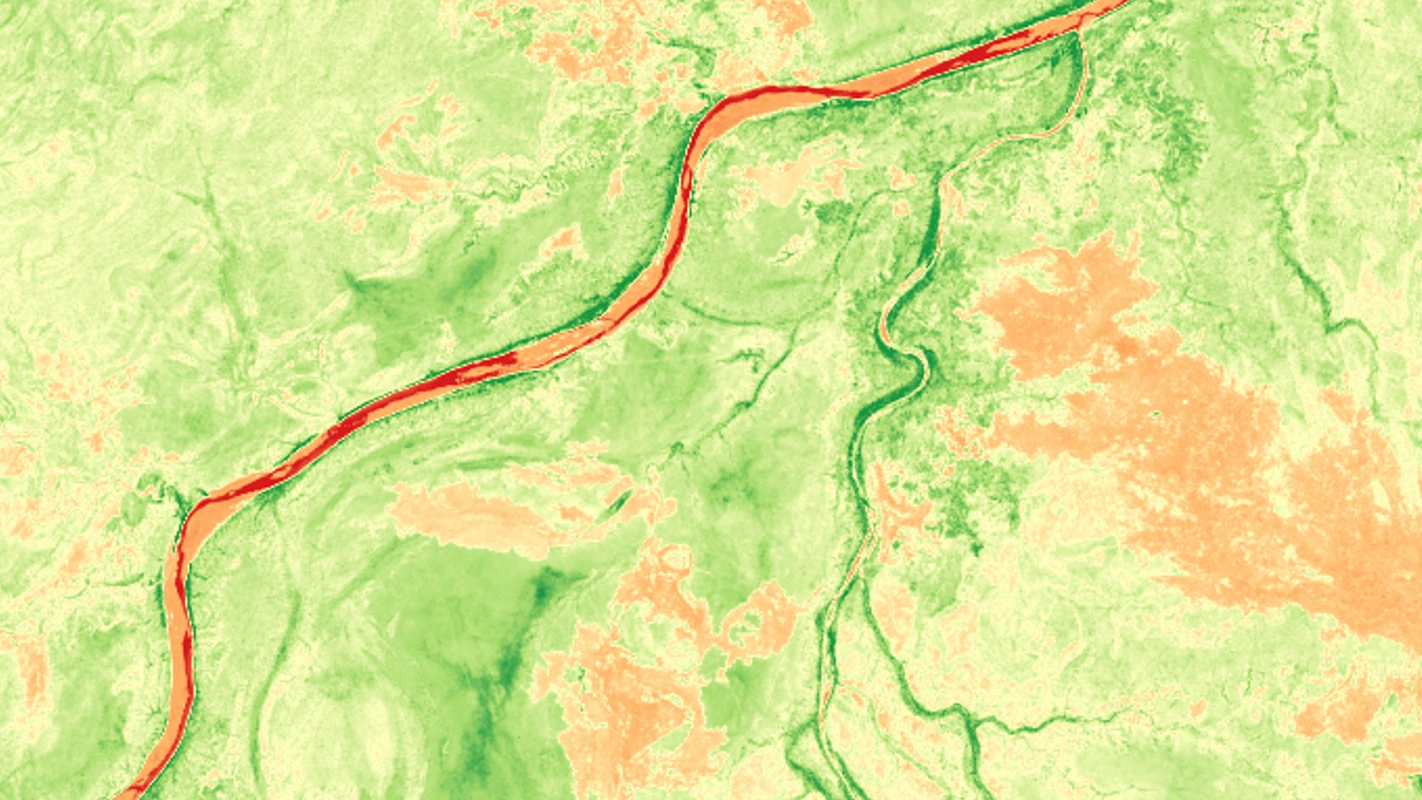
NDVI (Vegetation Index)
Temporal Resolution
Temporal resolution describes how often a satellite can capture the same location. Some satellites revisit every few days, while others operate in constellations that allow daily or even multiple captures per day.
| System Type | Typical Revisit |
|---|---|
| Scientific missions | Days to weeks |
| Monitoring constellations | Daily |
| Commercial tasking | On demand / intraday |
High temporal resolution is important for monitoring change, construction progress, disasters and time-critical projects.
Radiometric Resolution
Radiometric resolution describes how precisely brightness values are recorded. Sensors with higher radiometric resolution can detect smaller differences in reflectance, which is important in scientific and environmental analysis.
For most users, spatial and spectral resolution are the most important, but radiometric resolution becomes more relevant in advanced remote sensing workflows.
Types of Satellite Imagery
Different satellites capture different types of data depending on the sensor design.
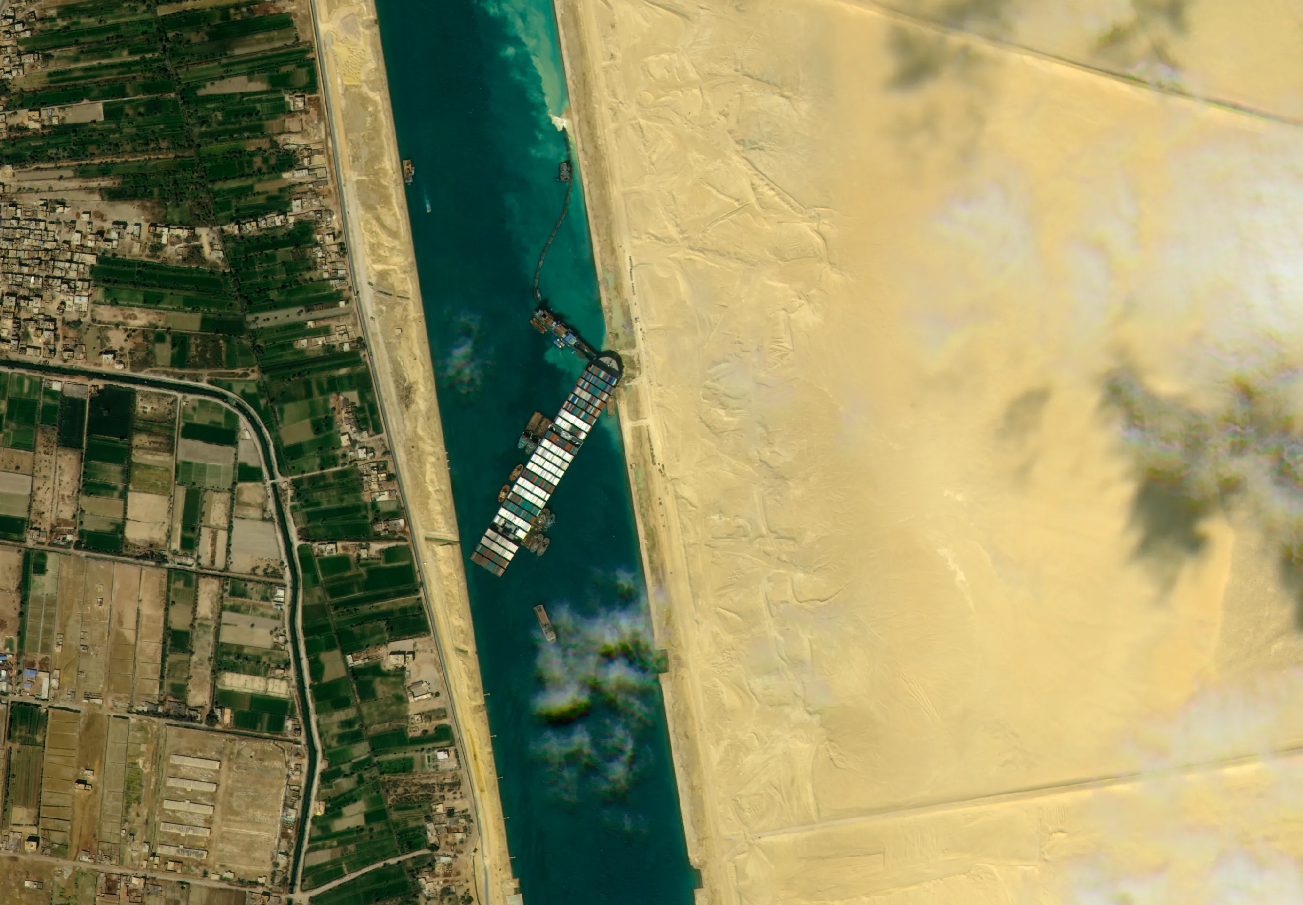
Optical imagery records reflected sunlight and produces images similar to aerial photography. These datasets are commonly used for mapping, planning, agriculture, environmental monitoring and mining. Because optical sensors rely on sunlight, they require daylight and are affected by cloud cover.
Multispectral imagery records several wavelengths of light, including near-infrared and shortwave infrared in addition to the visible bands. This allows materials to be distinguished based on their spectral response rather than only their appearance. Multispectral data is widely used for vegetation analysis, water monitoring, soil studies, land classification and change detection, and most modern satellites provide it as a standard product.
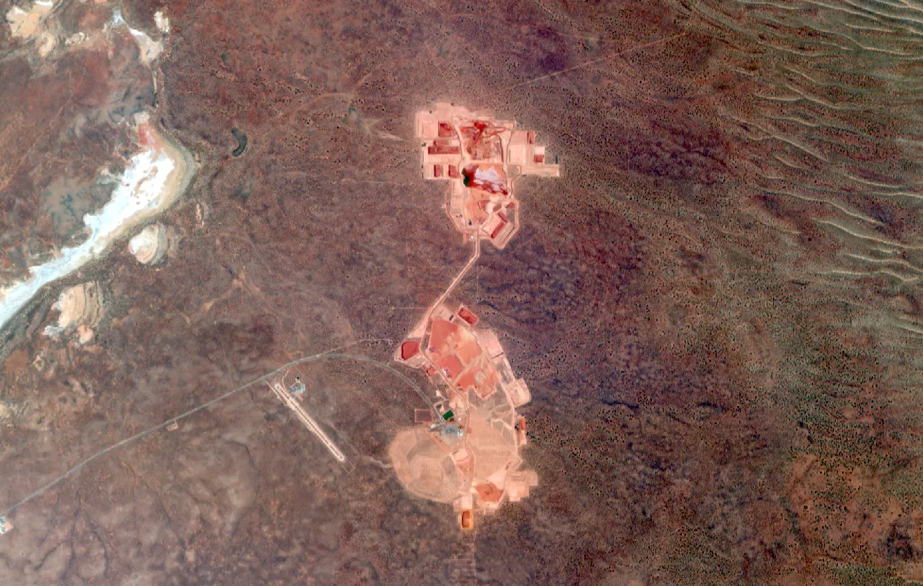
RGB
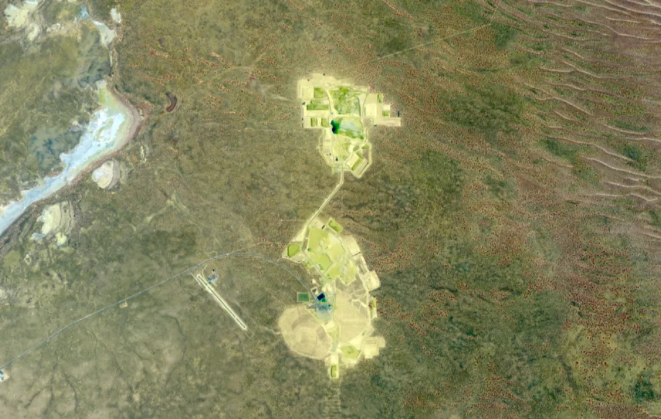
Infrared Composite (IRG)
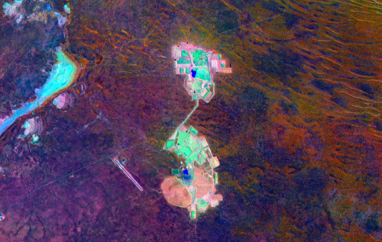
Red-Edge Decorrelation
Panchromatic imagery is high-resolution black-and-white data captured using a single broad wavelength band. Because more light reaches the sensor, panchromatic images are usually sharper than colour imagery. High-resolution colour images are often created by combining panchromatic data with multispectral bands in a process known as pan-sharpening.
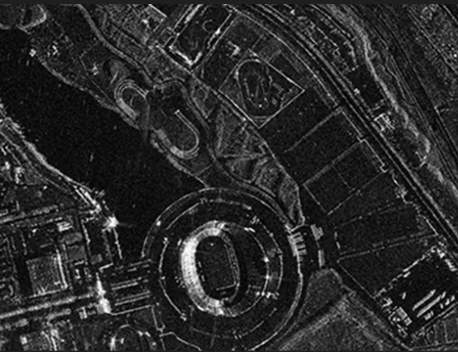
Synthetic Aperture Radar (SAR) imagery uses microwave signals instead of visible light. This allows the satellite to capture data at night and through cloud, smoke and haze. Radar imagery is commonly used for flood mapping, ground movement detection, ice monitoring and terrain analysis, although it requires specialised processing to interpret.
Free vs Commercial Satellite Imagery
Free satellite imagery is widely used for education, research and environmental monitoring, but professional projects often require commercial data to achieve higher resolution, more recent capture dates or greater acquisition control.
| Satellite | Resolution | Cost |
|---|---|---|
| Landsat | 30 m | Free |
| Sentinel-2 | 10 m | Free |
| MODIS | 250 m+ | Free |
Free imagery is suitable for regional studies and time-series analysis, but it has limitations in spatial resolution, capture timing and acquisition flexibility.
Commercial satellites provide higher resolution, faster delivery and more flexible acquisition options. These systems are widely used in engineering, mining, environmental monitoring and infrastructure projects where accuracy and timing are critical.
| Provider | Typical Strength | Common Uses |
|---|---|---|
| SI Imaging Services | High-resolution optical / SAR | Mapping, engineering, emergency management |
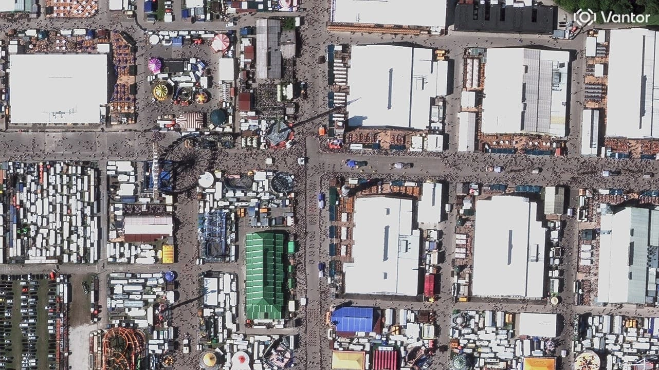
| Vantor | Very high-resolution optical | Monitoring, GIS, premium quality |
| BlackSky | High-revisit constellation | Change detection, monitoring |
| Wyvern | Hyperspectral | Mineral / vegetation analysis |
For a detailed comparison of the best sources of satellite imagery available in Australia, see our dedicated guide.
Archive vs Tasking Imagery
Satellite imagery can usually be ordered from an existing archive or captured on demand. For a detailed comparison, see our guide on archive vs tasking.
Archive imagery already exists in the satellite database and is usually cost-effective and faster to deliver, but it may not be recent or cloud-free. With operators like Vantor contributing over 32,000 swath footprints across Australia in just 12 months, the probability of finding suitable archive coverage is higher than ever.
Tasking means requesting a new capture. This allows control over the capture window, resolution and specifications, but depends on weather conditions and satellite availability. For time-critical projects, urgent tasking options are also available.
| Type | Advantages | Limitations |
|---|---|---|
| Archive | Lower cost, fast delivery | May not be recent |
| Tasking | Recent, custom capture | Weather dependent |
Common Processing Terms
Orthorectified imagery is corrected so that it matches real-world coordinates and can be used accurately in GIS and mapping software. For more on imagery formats and processing, see our guide on COG, GeoTIFF, ECW and WMTS formats.
Pan-sharpened imagery combines high-resolution panchromatic data with multispectral colour bands to produce detailed colour images. This is a standard processing step for most commercial very high-resolution products.
COG (Cloud Optimised GeoTIFF) is the most common file format for satellite imagery and contains coordinate information so the image can be used directly in GIS software.
DEM and DSM products are elevation models created from stereo imagery and are used for terrain analysis, contour generation, volume calculations and engineering studies.
Choosing the Right Imagery
The correct resolution depends on the project requirements, the size of the area and the level of detail needed. For a comprehensive breakdown of what to consider when purchasing satellite data, see our complete guide to buying satellite imagery.
| Use | Typical Resolution |
|---|---|
| Global studies | 30 m |
| Regional environmental work | 10 m |
| Mapping | 3–5 m |
| Baseline or basemaps | 50 cm |
| Detailed inspection | 30 cm |
Higher resolution usually means higher cost, so the goal is to select the lowest resolution that still meets the requirement.
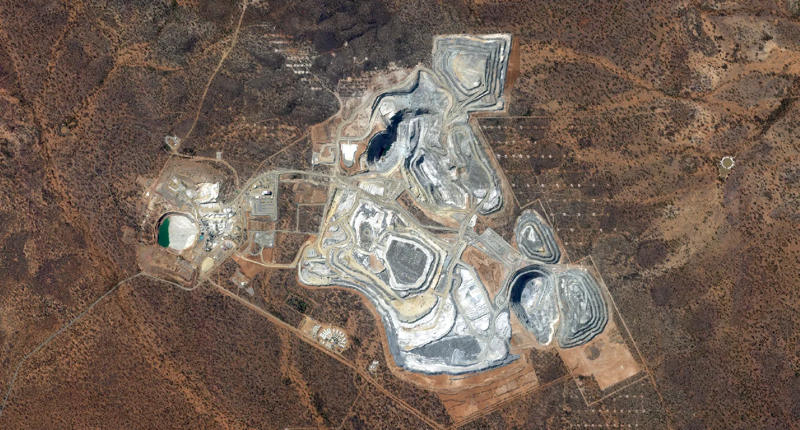
2024
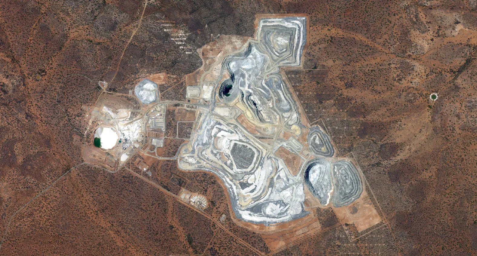
2025
Conclusion
Satellite imagery is no longer limited to government programmes and space agencies. It is now a practical and widely available data source used across science, engineering, environmental monitoring and industry.
Understanding the fundamentals - resolution, spectral bands, revisit frequency, archive vs tasking and processing - makes it much easier to choose the correct data and avoid common mistakes when ordering or working with Earth observation data.
Modern satellite constellations now provide higher resolution, faster revisit times and more flexible acquisition options than ever before. With the right sensor selection and processing, satellite imagery has become one of the most powerful tools available for monitoring the world.
Terrabit works with a range of commercial satellite providers and can help recommend suitable imagery based on project requirements, accuracy needs and timeframe. We also provide access to Albatross, our order management platform, which allows users to track capture progress, manage tasking requests and download deliverables in one place.
If you are unsure what resolution, sensor type or acquisition method is required, contact the Terrabit team to discuss your project and we can recommend the most suitable satellite data solution.