Loading...
Solutions / Industries / Infrastructure
High-resolution imagery and elevation models for transport, utilities, dams and remote construction sites, delivered ready to use in your existing workflow.
Asset classes
Transport, utilities, water, construction and remote sites - one tasking pipeline gives asset teams a consistent, current picture across the whole portfolio.
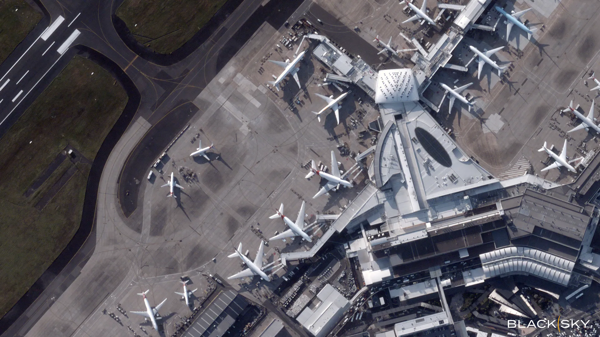
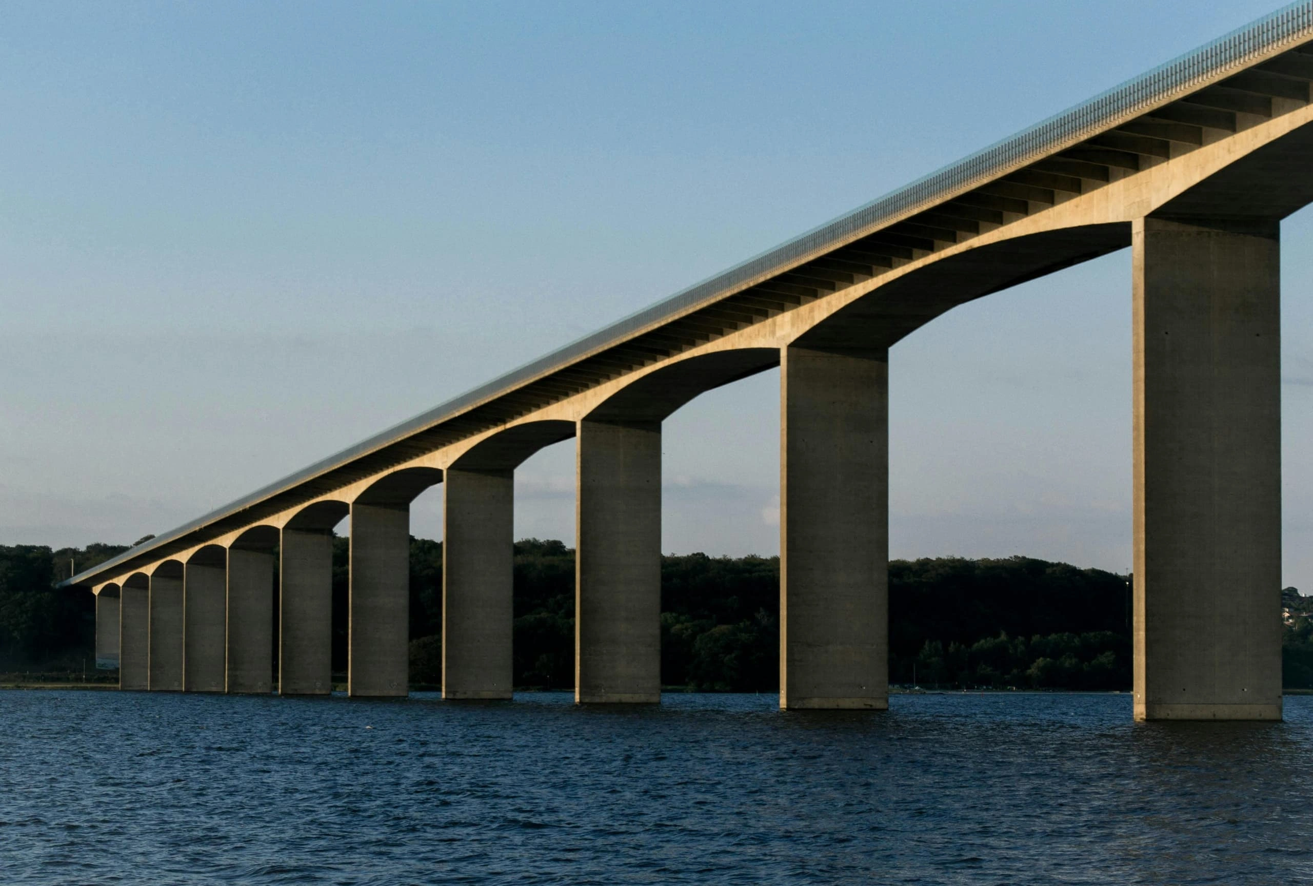
Rail, road, port and airport assets - ground movement, base-map refresh and change detection across long linear networks.
Transmission corridors, pipelines and telecoms towers - vegetation encroachment, third-party interference and right-of-way compliance.
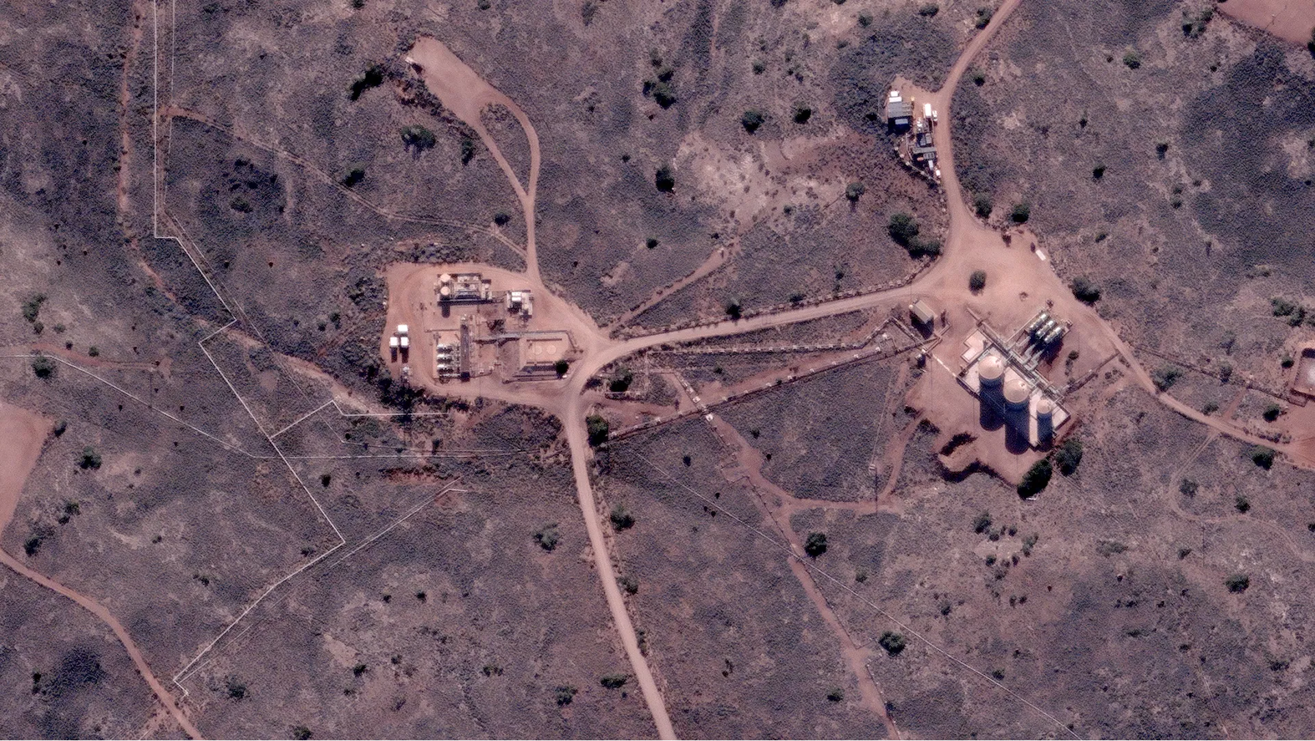
Dam crest and downstream-face condition, reservoir extent, water quality and tailings integrity through scheduled capture.
Progress monitoring, disturbance footprint and contractor accountability on remote and linear projects, without mobilising crews.
Renewable sites, exploration camps and distributed field assets - scheduled captures replace ad-hoc inspections.
In the field
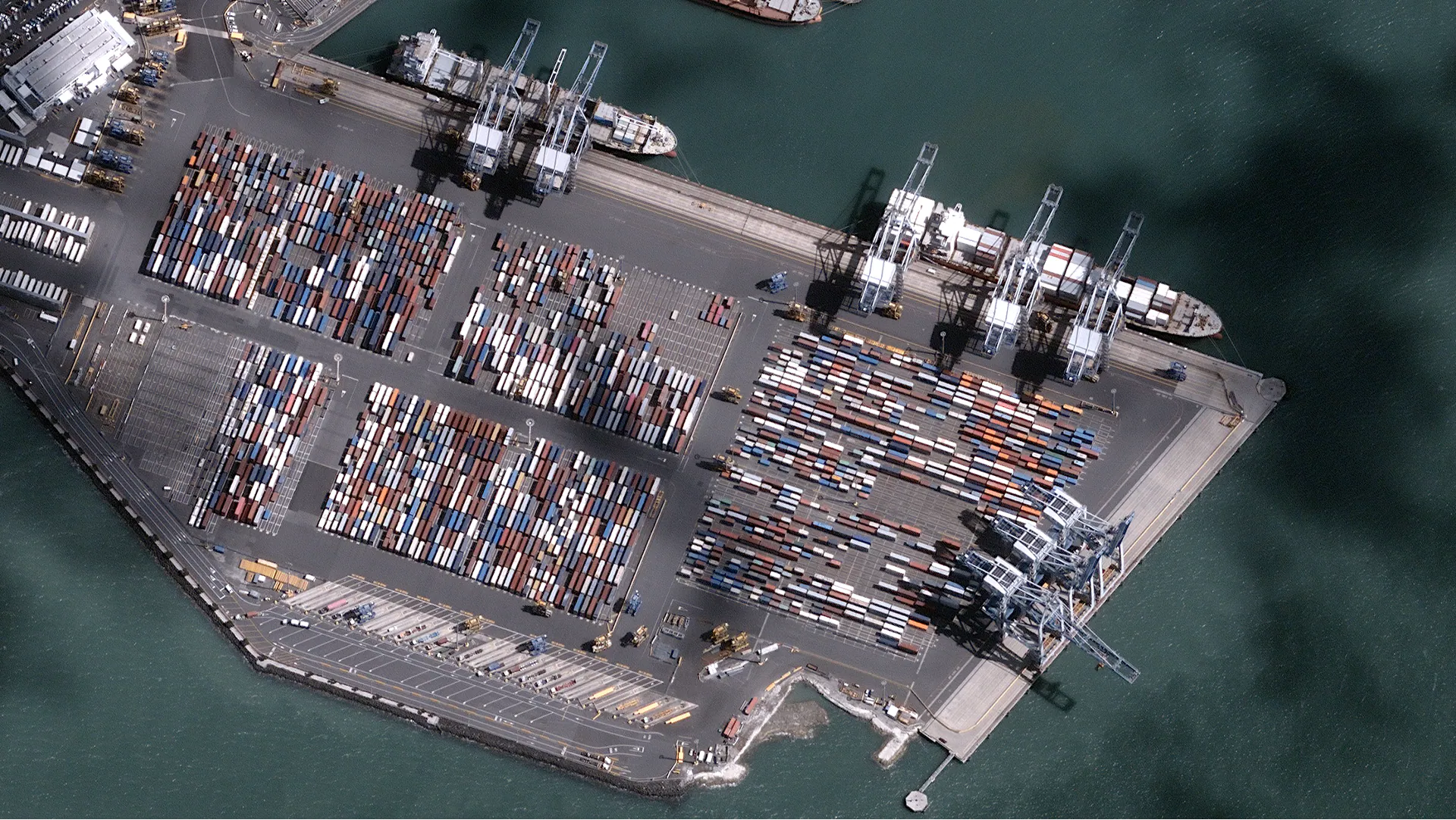
High-resolution optical · 7 Mar 2025
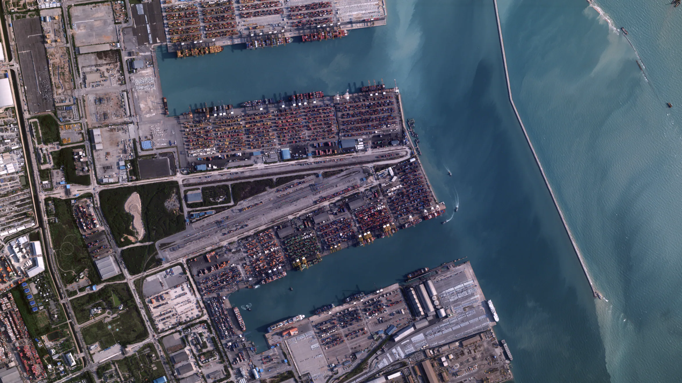
Port activity · Auckland, NZ
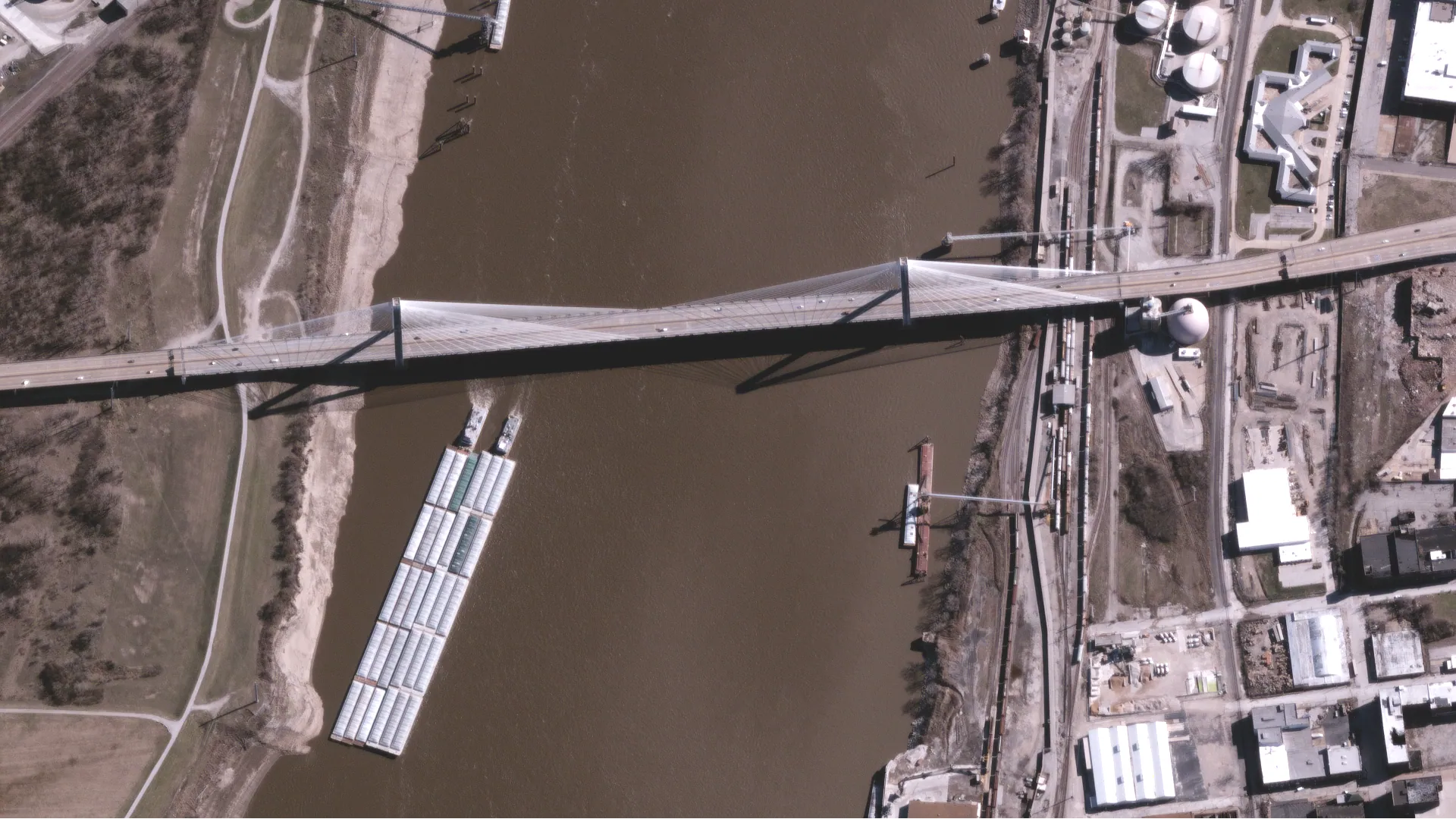
High-resolution optical · 16 Mar 2025
Bridge & structural · St. Louis, US
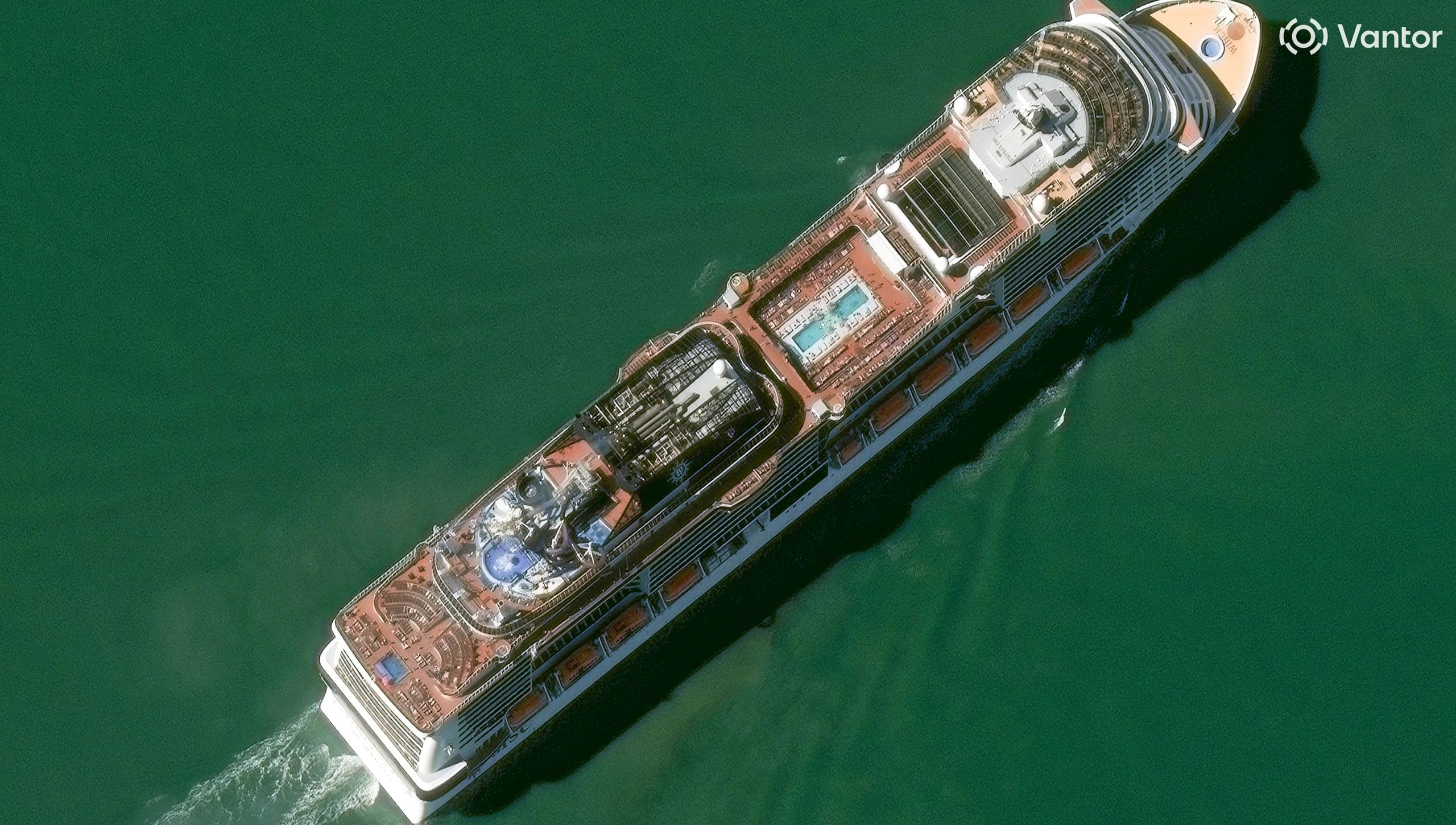
High-resolution optical · 21 Oct 2025
Port & vessel · Port Canaveral, US
Capabilities
Rail, road, pipeline and transmission corridors monitored end-to-end, with base maps and digitisation layers refreshed on schedule. Vegetation indices rank encroachment risk so crews go to the corridors that need clearance most - timestamped evidence for the entire right-of-way, not a sampled few.
Scheduled high-resolution capture of bridge piers, dam crests, downstream faces and abutments, with optical time series and elevation models building an independent, auditable record for owners, insurers and regulators. All-weather radar layers in where deformation measurement is needed; reservoir extent and water quality complete the picture for dams.
Vessel movement, apron activity, taxiway change, stockpile reshape and build-out, captured on a cadence suited to operational oversight. Sub-metre tasking delivers the detail; the open-data archive fills the gaps between captures.
Monthly or fortnightly captures across remote renewable sites, transport projects and construction corridors. Disturbance footprints and progress packs arrive on schedule, without drones or ad-hoc flights, so teams can see how a site is tracking at any point in time.
A single capture
Structural change
New alignments, widening, berth extensions and infrastructure build-out between capture dates.
Vegetation encroachment
Growth and clearance on corridors, embankments and right-of-way - risk ranked for crews.
Activity signals
Vessel movement, apron activity, rail stock and haulage - proxies for throughput and operations.
Post-event damage
Rapid-task optical, with all-weather radar layered in for flood, storm, fire and incident assessment when cloud blocks the optical view.
The problem
Infrastructure operators see the world one asset at a time. Drone flights, aerial surveys and field inspections each capture one moment at one place, so portfolios stay under-monitored, inspections stay reactive and the evidence trail rarely survives audit.
The Terrabit approach
Terrabit delivers analysis-ready imagery and elevation models across every asset in the portfolio, straight into your GIS - see the current state of every asset, track change over time and act on one consistent spatial record.
Lifecycle
Planning, construction and operation - each phase served by the sensors and cadence that answer the question at hand.

01
Route selection, corridor elevation models, environmental baselines and historical context, so capital projects start on the same record the operations team will inherit.
02
Remote construction progress, disturbance tracking and contractor accountability, captured on a cadence your project controls, not the weather or the flight schedule.
03
Scheduled change detection, vegetation encroachment, activity signals and post-event damage assessment across every asset in the portfolio.
Outputs
Concrete products infrastructure operators receive across transport, utilities, water and remote construction - not abstract capabilities.
Platform
Coordinate imagery, elevation and specialised data tasking across every asset and stakeholder, with centralised budgets, multi-team access and audit-ready archives.
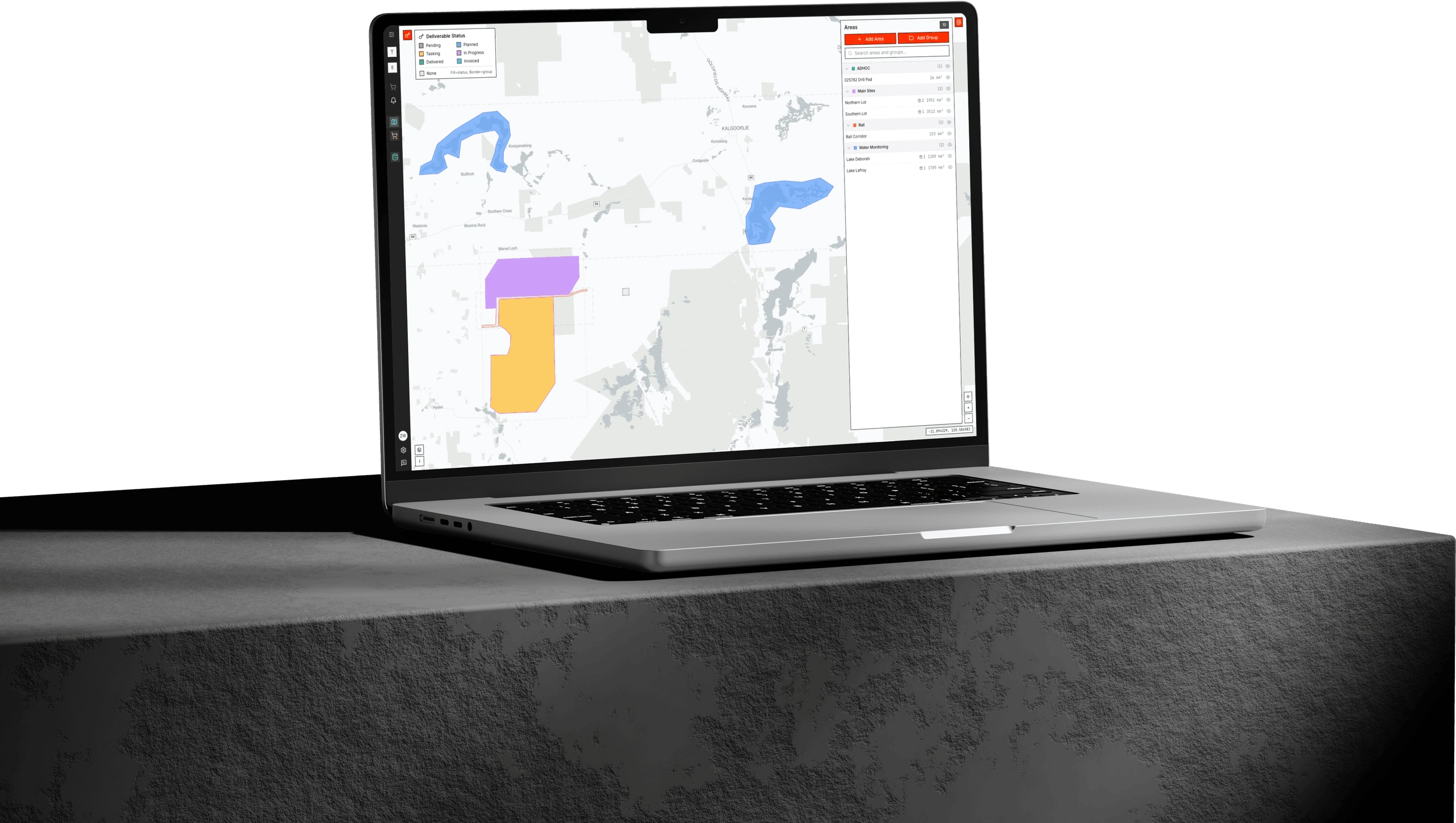
Albatross is where your whole portfolio orders and manages satellite data. Submit tasking, approve budgets, track deliveries and keep a consistent spatial record of every asset, from transport corridors and dam faces to remote construction sites.
Products
Products
Analysis-ready optical and multispectral commercial imagery - colour-balanced, orthorectified, pansharpened and atmospherically corrected - for asset monitoring, construction progress, vegetation management and post-event assessment.
Products
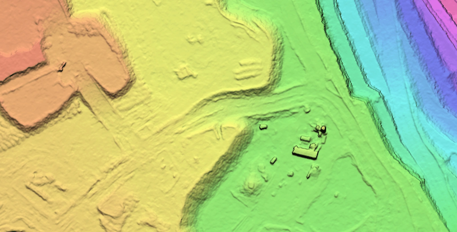
DEM, DSM and DTM products from 0.5 m to 5 m resolution for corridor design, drainage planning, site assessment and ground baselines.
Talk to the team about imagery, elevation and analytics for your assets, delivered ready to use in your existing workflow.