Loading...
Solutions / Industries / Government
High-resolution imagery and elevation models for emergency management, environmental compliance, land administration and maritime awareness.
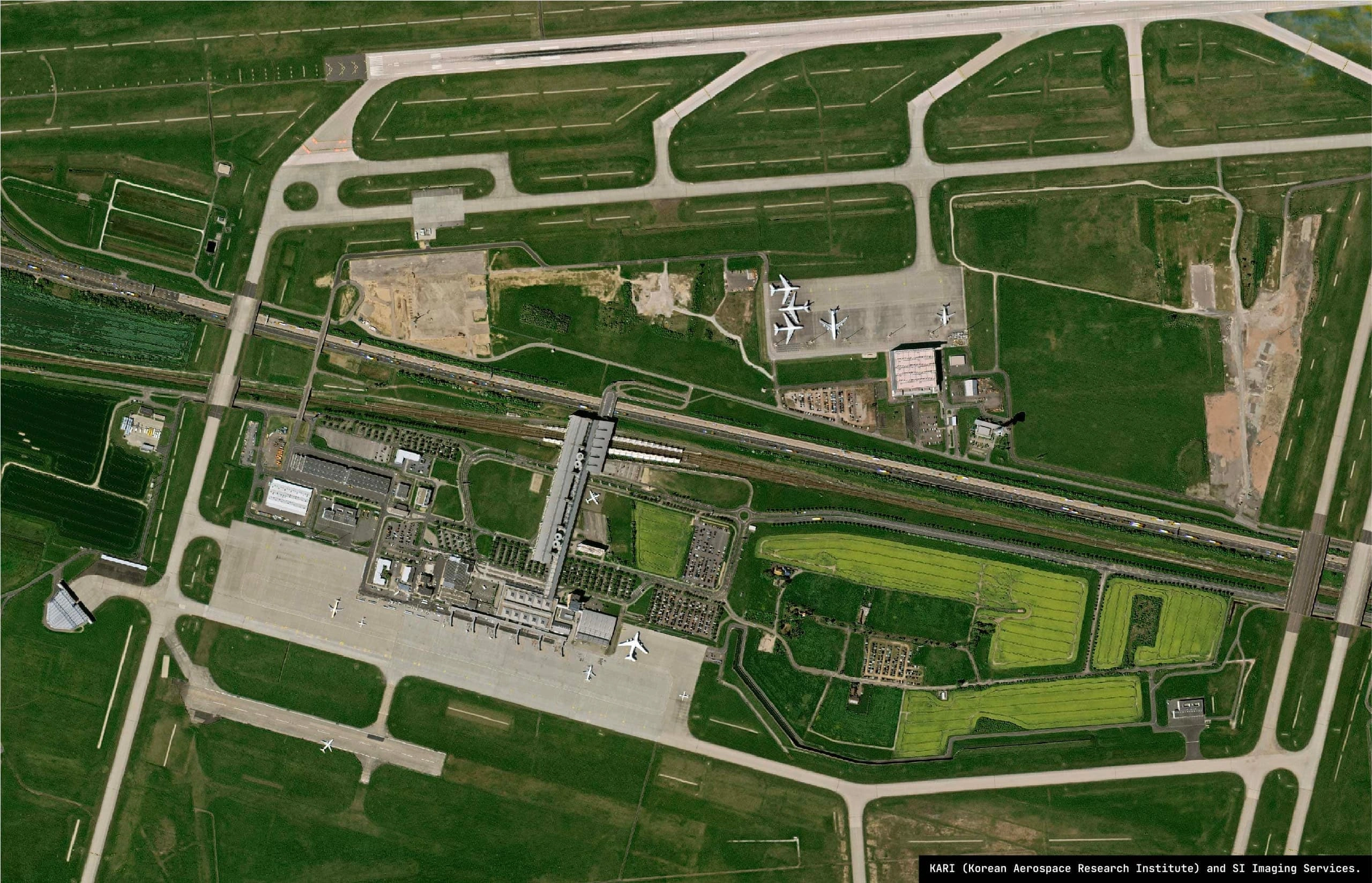
High-resolution optical imagery, processed and sharpened for individual-asset detail.
Priority tasking within hours for emergencies, through to scheduled monitoring of the same area.
From regional open-data coverage to street-level detail, through one platform and one integration.
Analysis-ready data aligned to Australian government standards and delivered into Digital Earth Australia workflows.
Agency domains
Federal, state and local - emergency services, environmental regulators, lands agencies, planners and maritime authorities, all served from one sovereign tasking pipeline.
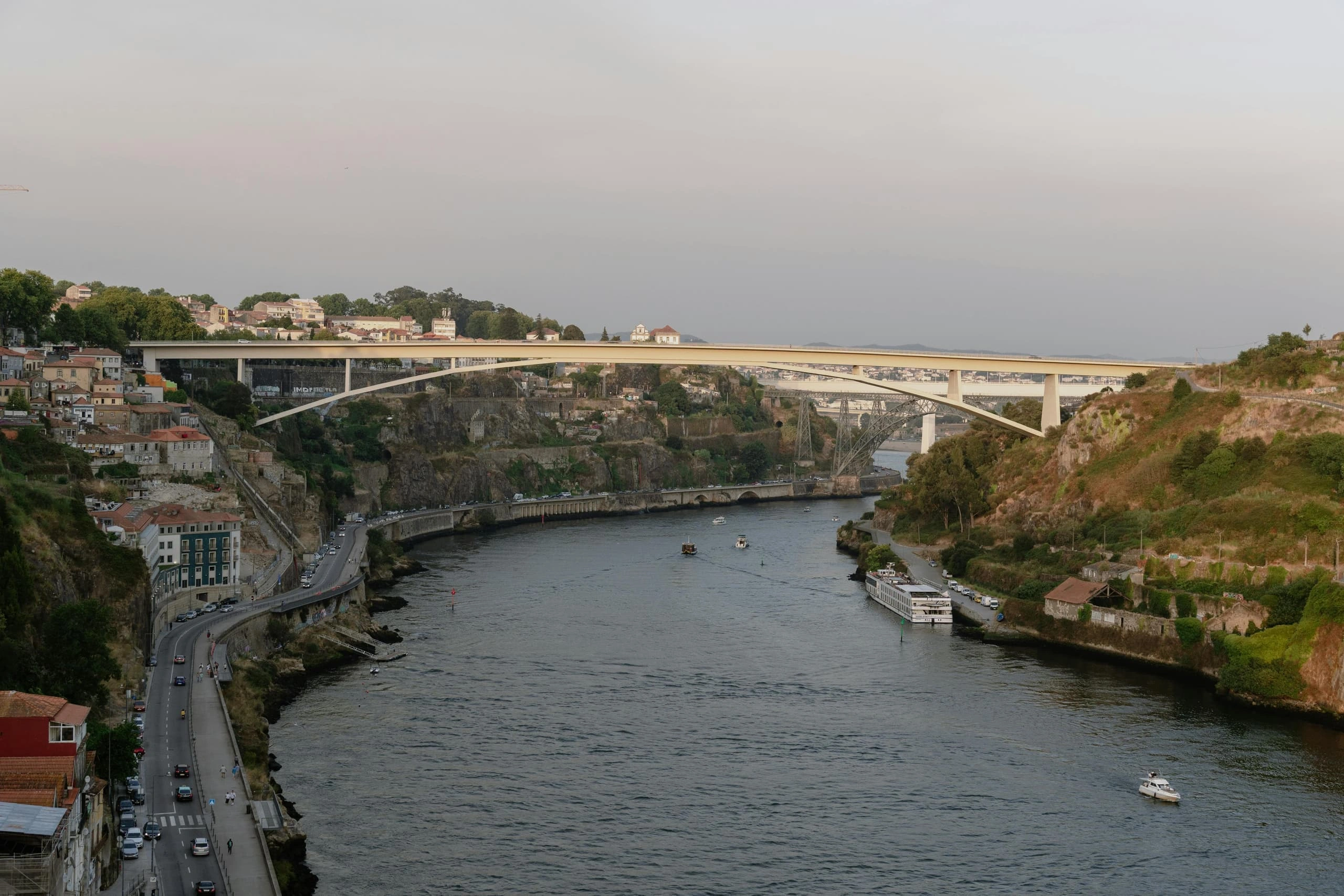
Rapid bushfire, flood and cyclone mapping delivered straight into state and national operations rooms, with all-weather radar layered in when cloud or smoke blocks the optical view.
Illegal clearing, wetland disturbance, deforestation and biodiversity tracking for environmental regulators and Indigenous rangers.
Cadastral boundary updates, topographic refresh and national mapping support, aligned to ICSM and GDA2020 standards.
Urban growth tracking, zoning compliance, critical-asset monitoring and corridor change detection for rail, road and water assets.
Maritime domain awareness, dark-vessel detection and monitoring of illegal fishing across the exclusive economic zone.
In the field
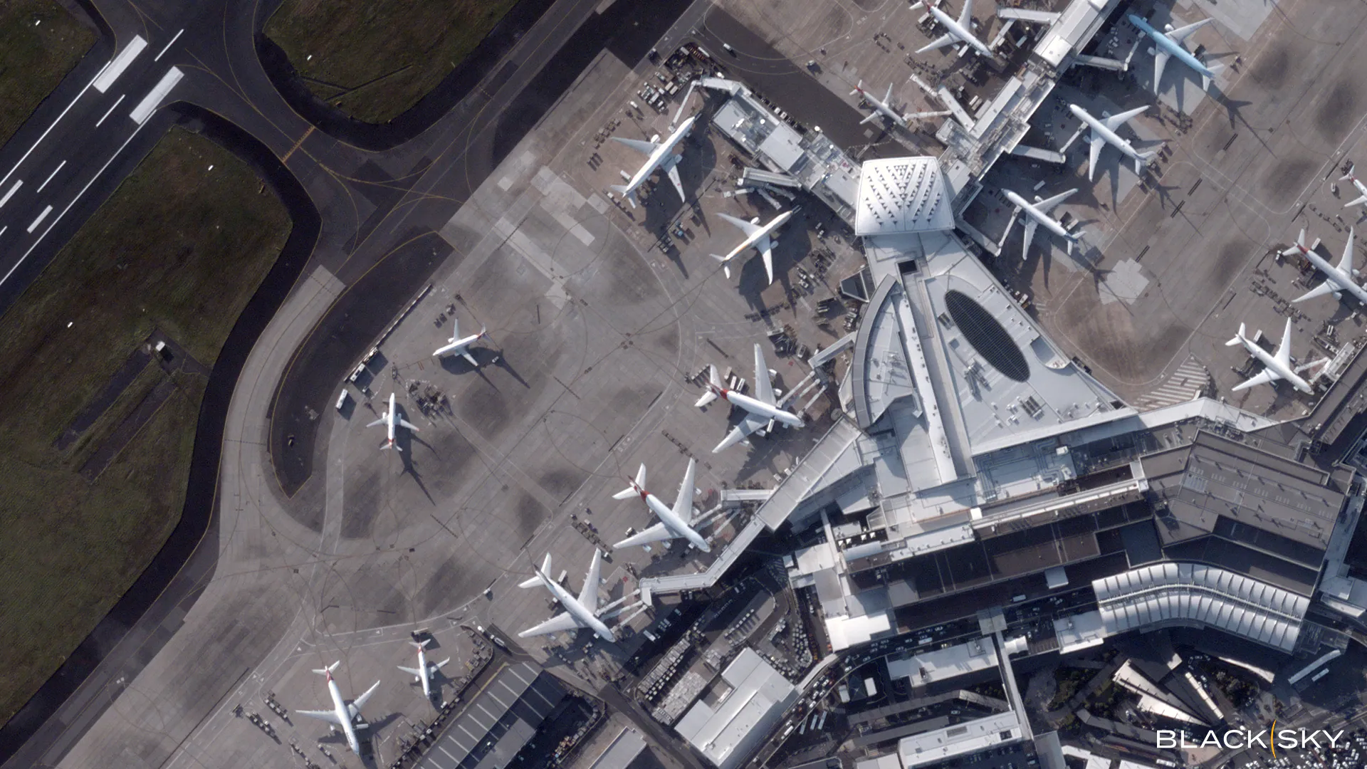
High-resolution optical · 7 Mar 2025
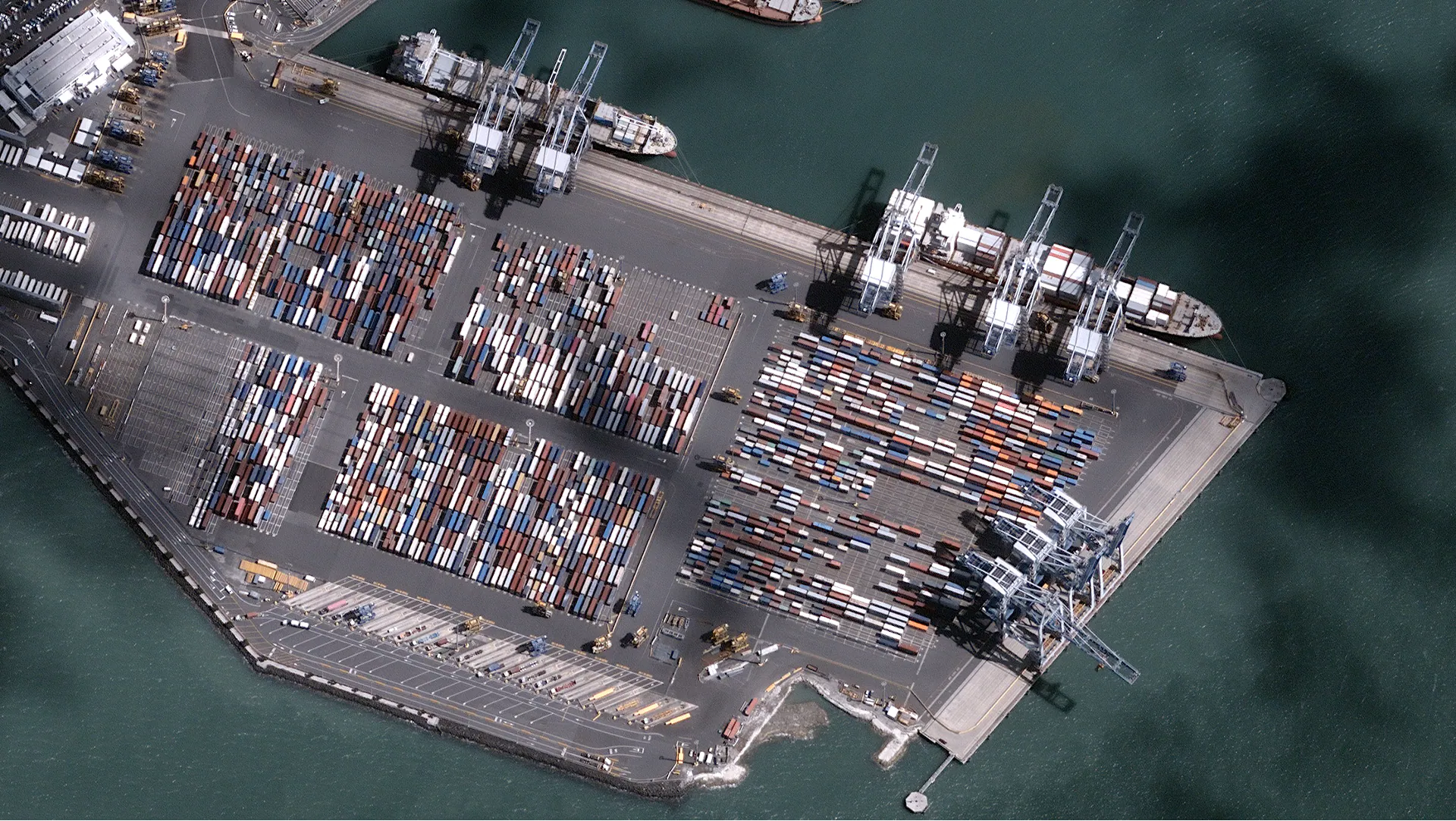
Maritime · Auckland container port
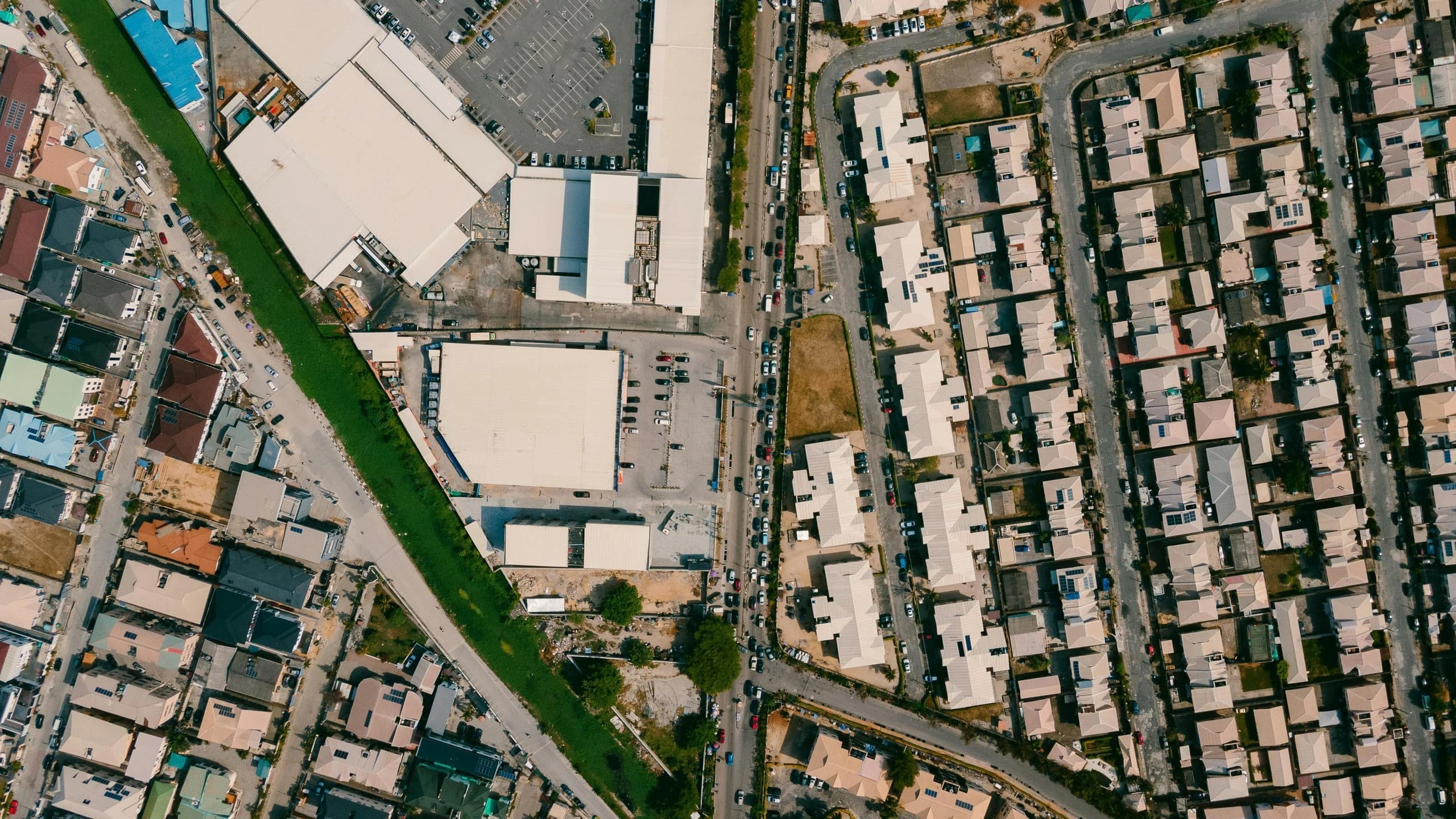
High-resolution optical
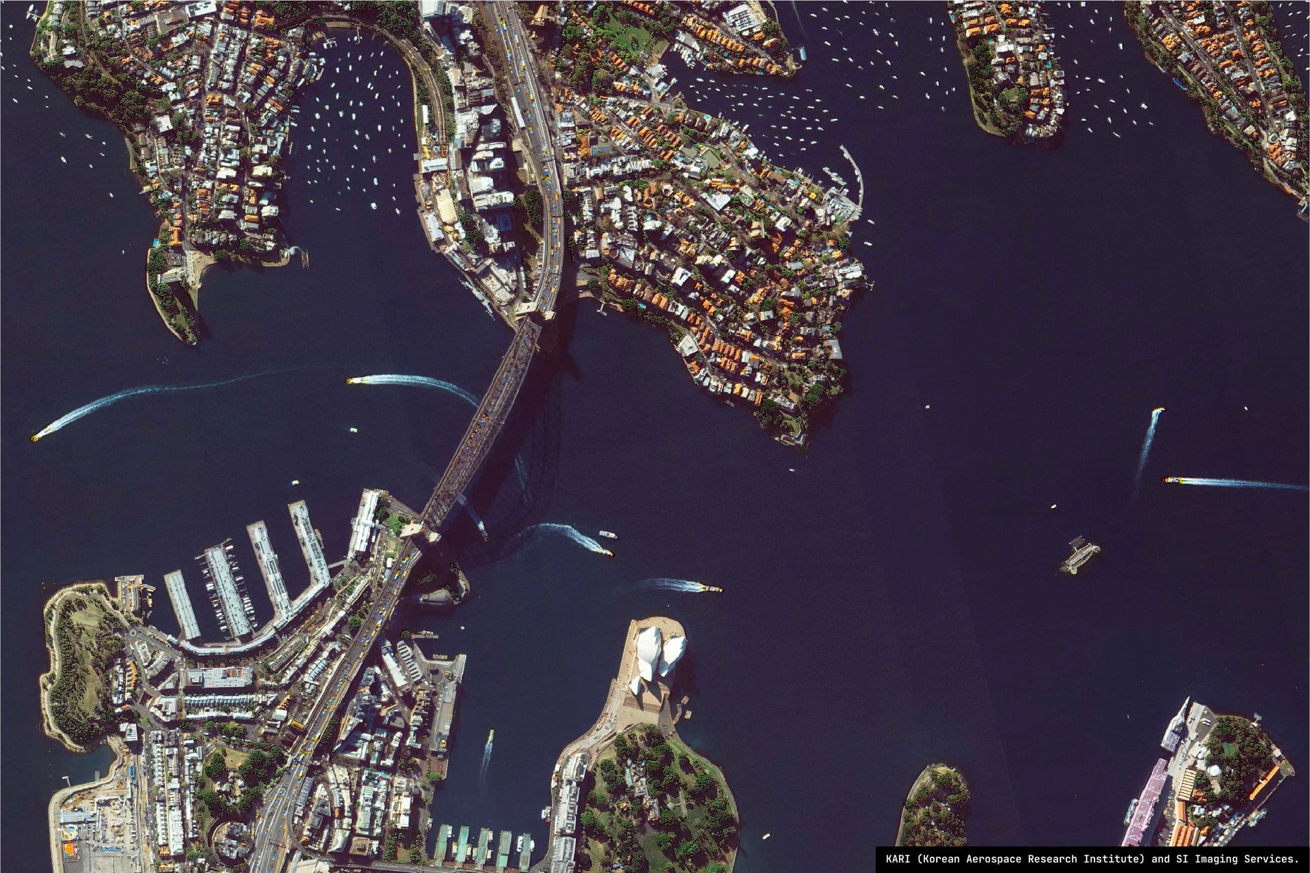
Urban · Sydney planning & cadastre
High-resolution optical
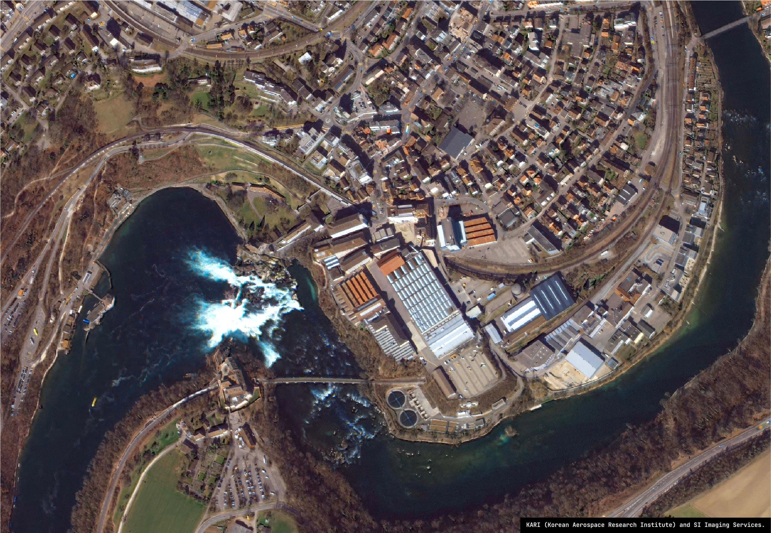
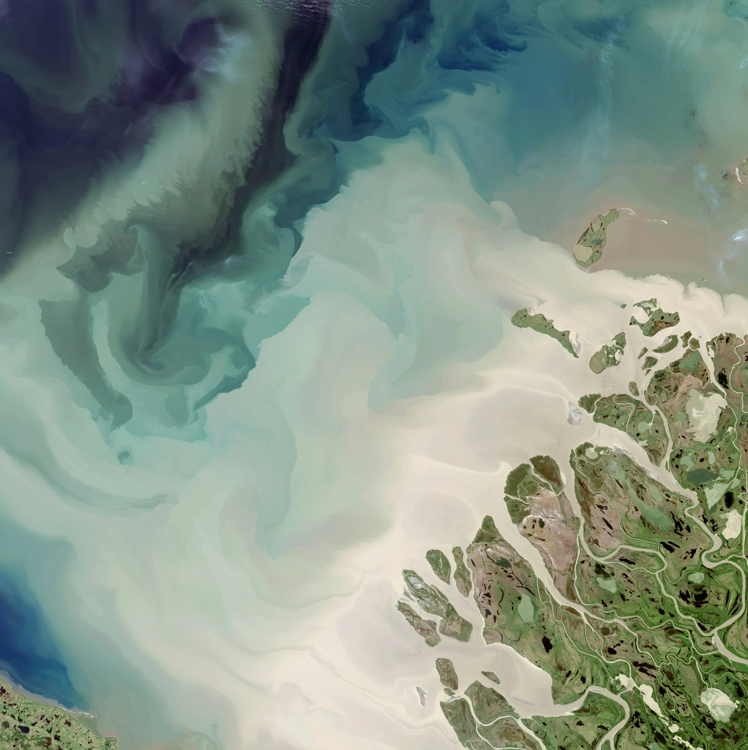
Water resources · reservoir and dam
A single capture
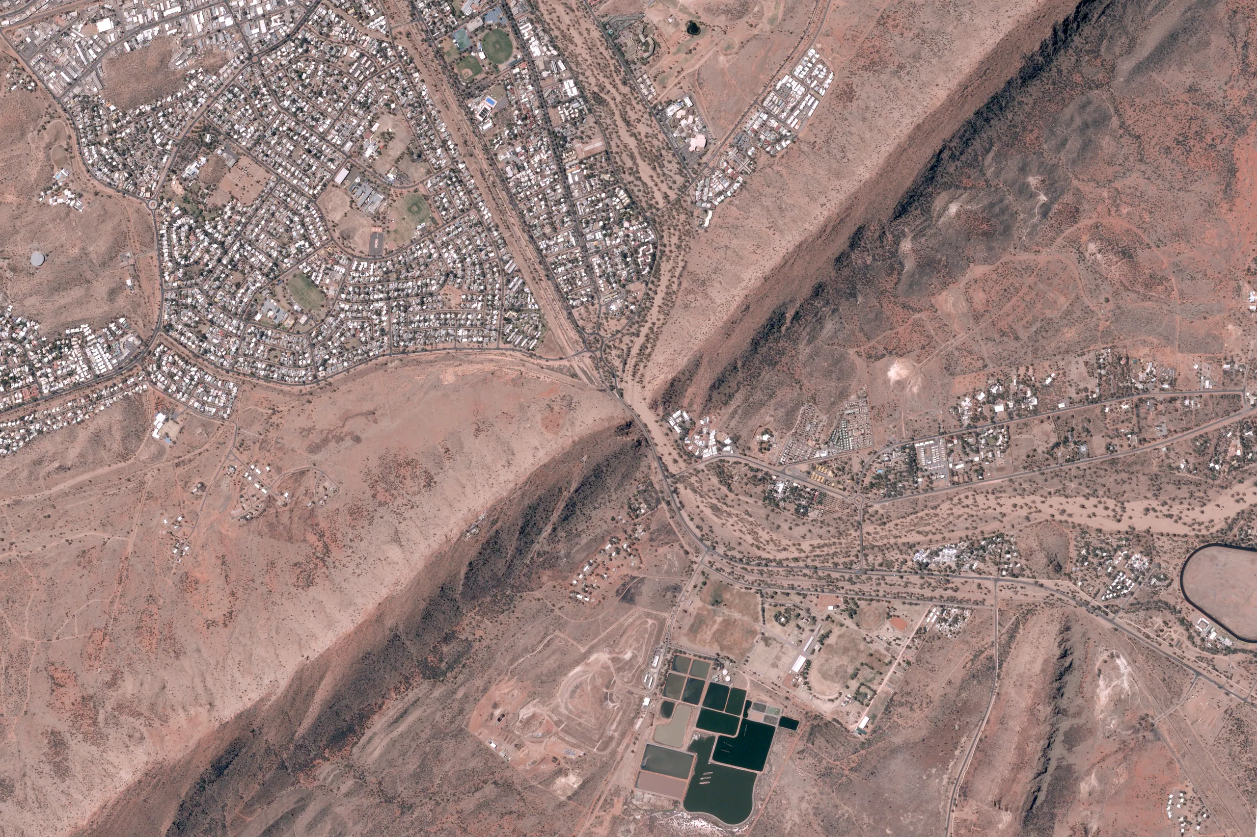
Land & tenure monitoring
Sub-metre optical resolves cadastral boundaries, land-use change and tenure encroachments across vast remote holdings - without a site visit.
Infrastructure & asset status
Roads, airstrips, water infrastructure and remote facilities tracked against baseline for condition assessment and maintenance planning.
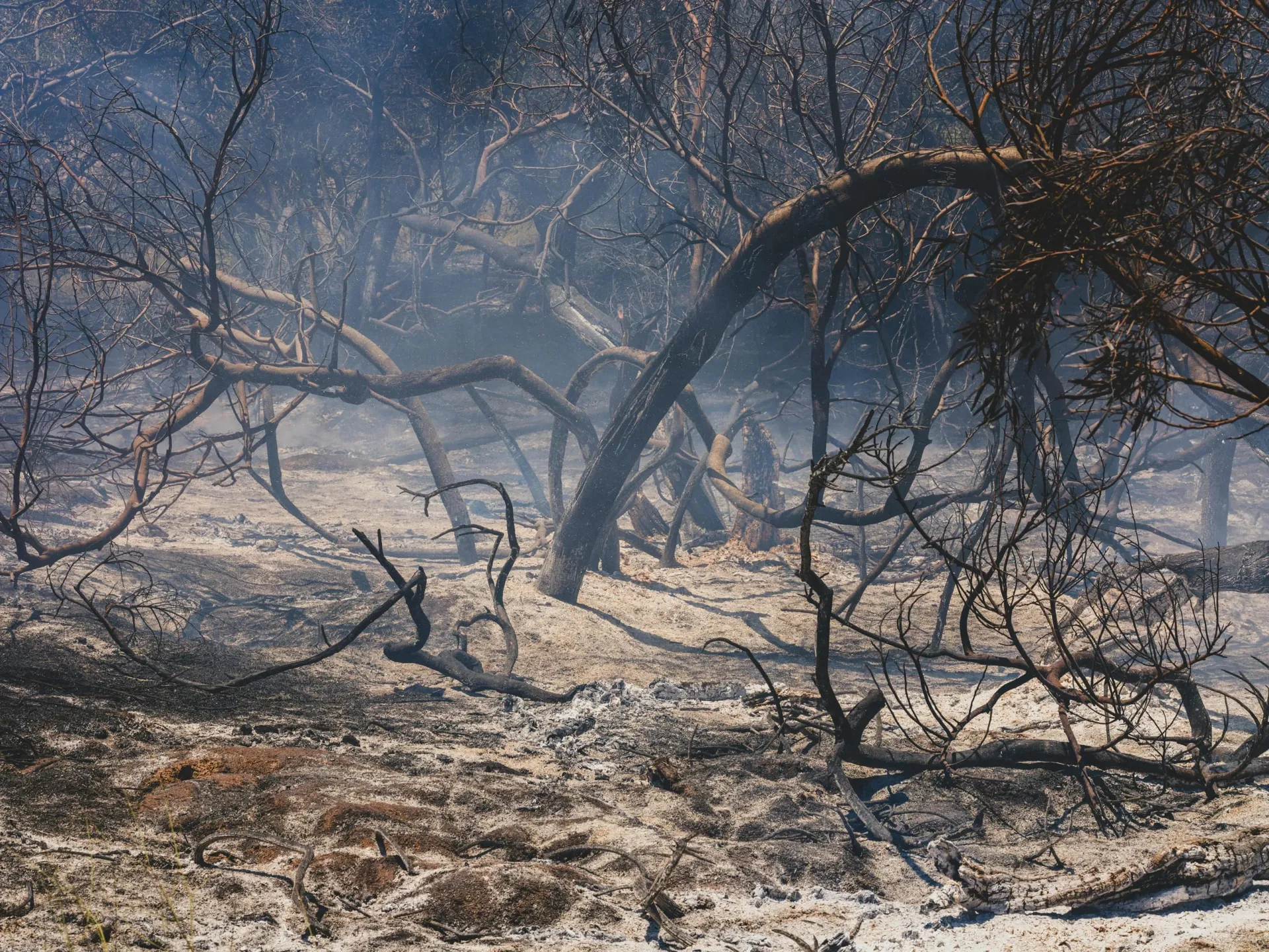
Fire scar & vegetation
Post-fire scar extent, Normalised Difference Vegetation Index (NDVI) recovery and fuel-load change detection for land managers, Indigenous rangers and biosecurity programmes.
Baseline change
Time-series stacks detect new activity, illegal clearing and strategic-site development across areas where ground patrol is impractical.
Capabilities
Tasking within hours of a bushfire, flood or cyclone, with flood extent, fire scars and damage mapping delivered straight into operations rooms. Radar sees through smoke and cloud; high-resolution optical quantifies asset-level damage within 24 hours.
Illegal clearing, wetland disturbance, deforestation and biodiversity tracking for regulators and Indigenous land managers. Vegetation indices run across open-data archives and high-resolution stacks, with fire-scar time series supporting ranger and biosecurity programmes.
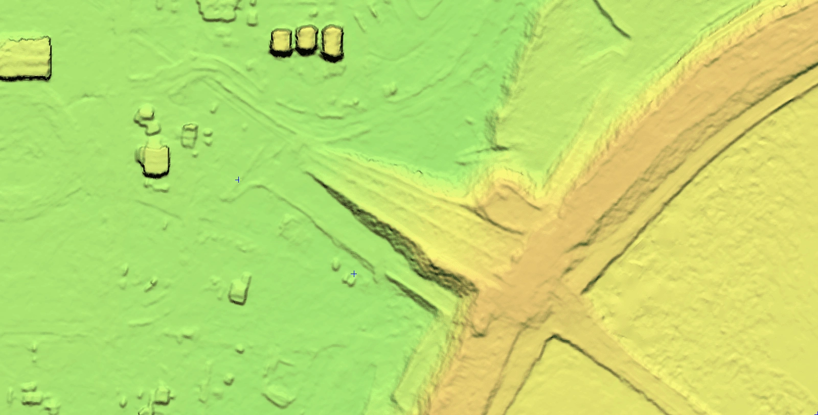
Sub-metre refresh of cadastral boundaries, base maps and parcel change, aligned to ICSM, ANZLIC and GDA2020. Stereo-derived elevation models cover corridors and floodplains, giving lands agencies audit-ready, timestamped evidence.
High-resolution imagery and all-weather radar for maritime traffic monitoring, dark-vessel detection and illegal fishing across the EEZ. Daily sub-metre follow-up confirms vessel activity with timestamped, georeferenced evidence for compliance and enforcement.
The problem
Government teams juggle emergency response, regulatory oversight, cadastral updates and maritime security across fragmented data and vendor silos. Evidence arrives late, at mixed resolutions, in formats that don’t stack across agencies or survive audit.
The Terrabit approach
Terrabit delivers analysis-ready imagery and elevation models through one sovereign platform, aligned to ANZLIC, ICSM, AFAC and AIDR standards. Everything lands in your GIS, Digital Earth Australia or sovereign cloud with audit-ready provenance.
Lifecycle
Three stages of the decision cycle. The same tasking pipeline answers each - from baseline monitoring to incident response to audit-ready archive.

01
Federated commercial optical, multispectral and specialised data tasking across 20+ constellations - scheduled captures covering every asset and tenure in your remit.
02
Analysis-ready products at scale - colour-balanced, orthorectified to control, atmospherically corrected and pansharpened - with change detection, fire-scar, flood-extent, vegetation indices and damage.
03
Evidence into your operations - ArcGIS, QGIS, Copernicus, Digital Earth Australia or sovereign cloud - with timestamped provenance your regulator, command centre and audit trail can stand behind.
Data & methods
Every capture arrives fully processed - colour-balanced, orthorectified, atmospherically corrected and pansharpened - so it slots straight into your workflow. Specialised data follows where the question needs it.
How it works
Same pipeline, same provenance - every agency, every mission.
Platform
Coordinate imagery, elevation and specialised data tasking across departments, with centralised budgets, multi-user access and audit-ready archives.
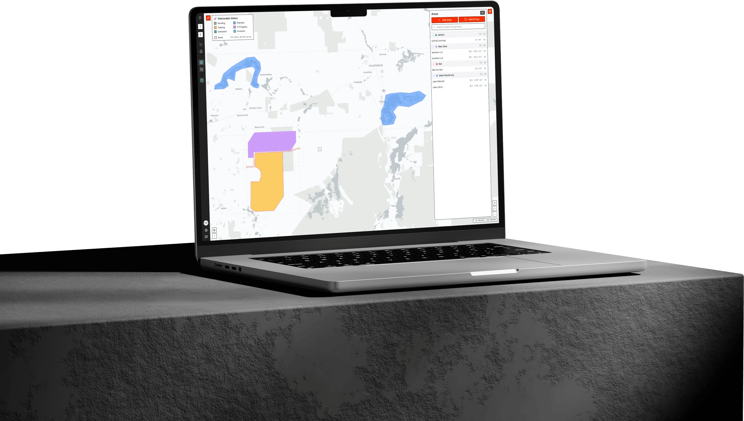
Albatross is where every agency orders and manages satellite data. Submit tasking, approve budgets, track deliveries and keep a defensible audit trail, all in one platform aligned to ANZLIC and ICSM standards.
Products
Products
Analysis-ready optical and multispectral commercial imagery - colour-balanced, orthorectified, pansharpened and atmospherically corrected - for emergency response, ISR, environmental compliance, cadastral refresh and maritime domain awareness.
Products
DEM, DSM and DTM products from 0.5m to 5m resolution for flood modelling, cadastral work, corridor planning and ground baselines - GDA2020-aligned.
Talk to the team about imagery, elevation and specialised data for your mission, delivered through one sovereign pipeline.