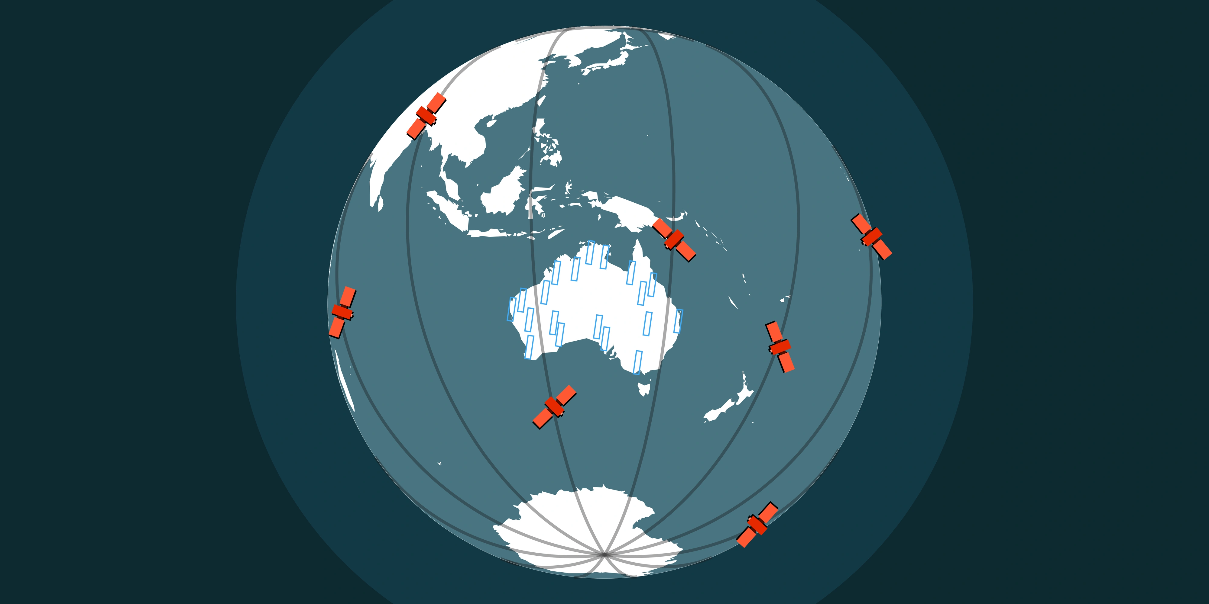
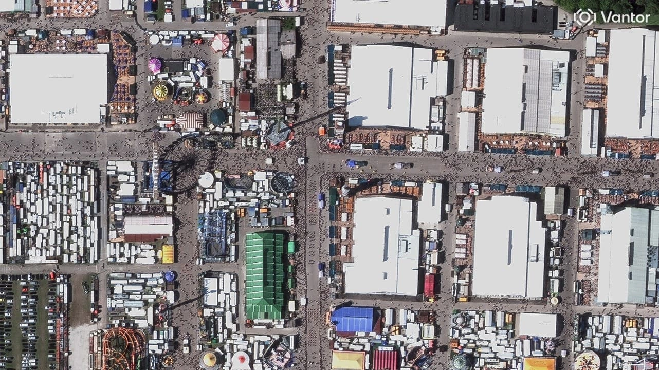
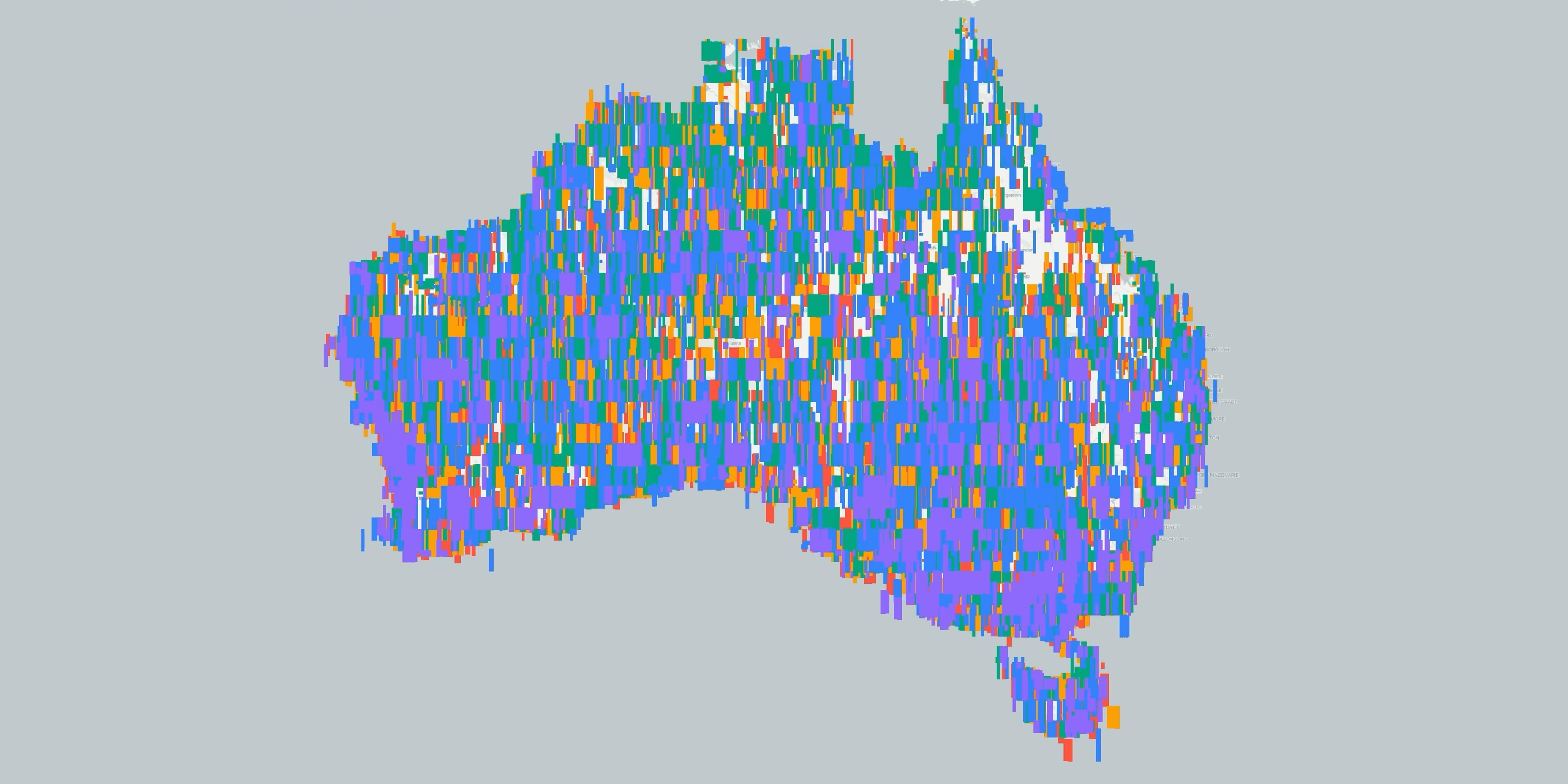
Over 32,000 swath footprints captured across Australia in just 12 months. Vantor's growing archive means high-resolution satellite imagery is already waiting for your area of interest.
Satellite data is never just a single snapshot. It is a time-series of captures that reveals how landscapes, infrastructure, and environments evolve over weeks, months, and years. That accumulating record is what makes archive satellite imagery so powerful, and so essential for projects across mining, environmental management, agriculture, and infrastructure development in Australia.
Whether you are tracking rehabilitation progress at a remote mine site in the Pilbara, assessing vegetation recovery after bushfire in the Blue Mountains, or establishing a pre-development baseline along the east coast, archived high-resolution satellite imagery gives you the historical evidence you need, without waiting for a new satellite pass.
In this guide, we cover everything you need to know about sourcing, evaluating, and ordering archive satellite imagery across Australia, including how Albatross makes the entire process fast, transparent, and reliable.
What Is Archive Satellite Imagery?
Archive satellite imagery refers to historical satellite data that has already been captured, processed, stored, and indexed by satellite operators. Instead of commissioning a new acquisition (known as "tasking"), you search the existing catalogue by location, date range, cloud cover, and resolution, then order exactly the swathes you need.
Because archive data already exists, it offers several immediate advantages over tasking new collections. Delivery is faster, often within days rather than weeks. Costs are typically lower since you are licensing data that has already been collected. And you can review metadata and preview footprints before committing to a purchase, removing much of the uncertainty that comes with ordering fresh captures over cloud-prone regions of Australia.
For professionals who need to buy satellite imagery in Australia, the archive should always be the first place to look.
Why Archive Satellite Data Matters in Australia
Australia's sheer scale, nearly 7.7 million square kilometres of diverse terrain, makes it one of the most compelling markets for satellite-based earth observation. Ground surveys and crewed aerial flights are expensive, logistically complex, and time-consuming, particularly in remote and semi-arid regions where many mining and environmental projects are located.
High-resolution archive satellite imagery solves this by providing a cost-effective, repeatable, and spatially consistent record of change across vast distances. Rather than mobilising a field team every quarter, project managers can pull successive archive captures to measure progress, validate compliance, and build visual evidence for stakeholders.
Australia also benefits from comparatively low cloud cover across much of its interior, which means satellite archives tend to contain a higher proportion of usable, cloud-free imagery than many other parts of the world. The result is dense temporal coverage that supports detailed time-series analysis for sites from the tropical north to the temperate south.
Key Applications for Archive Satellite Imagery in Australia
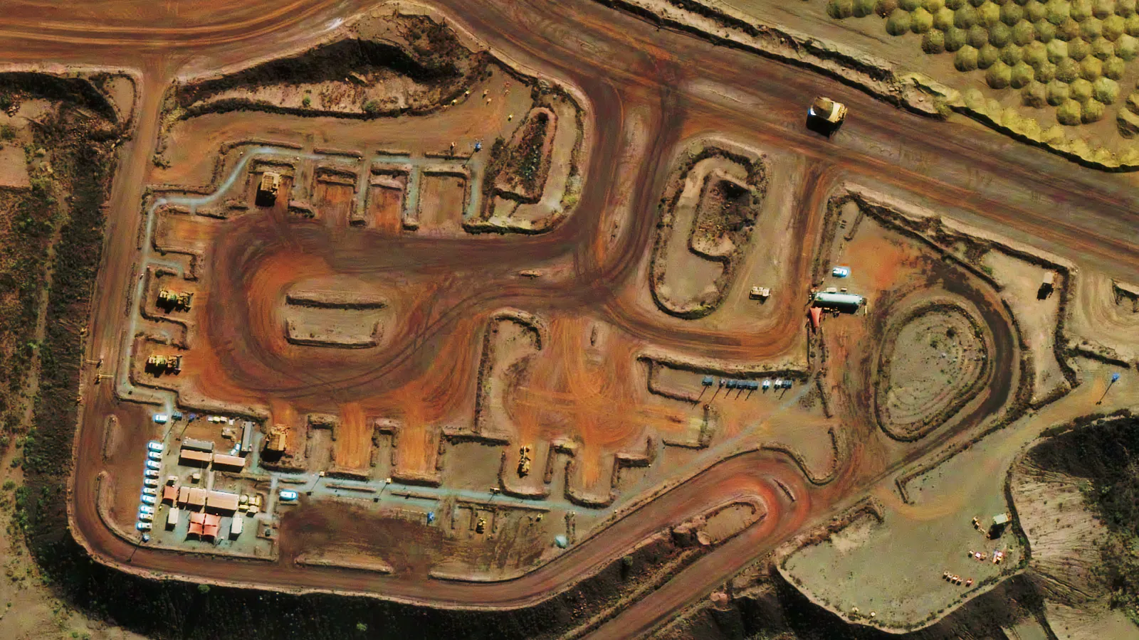
Mining and Resource Projects
The Australian mining sector is one of the largest consumers of commercial satellite imagery, and archive data plays a central role across the entire project lifecycle.
Baseline and change detection. Before any ground disturbance begins, archive imagery provides an objective record of pre-existing conditions. This baseline is critical for environmental impact assessments, for measuring subsequent change, and for demonstrating compliance with regulatory requirements such as Western Australia's Mining Rehabilitation Fund (MRF) and Queensland's Progressive Rehabilitation and Closure Plan (PRCP).
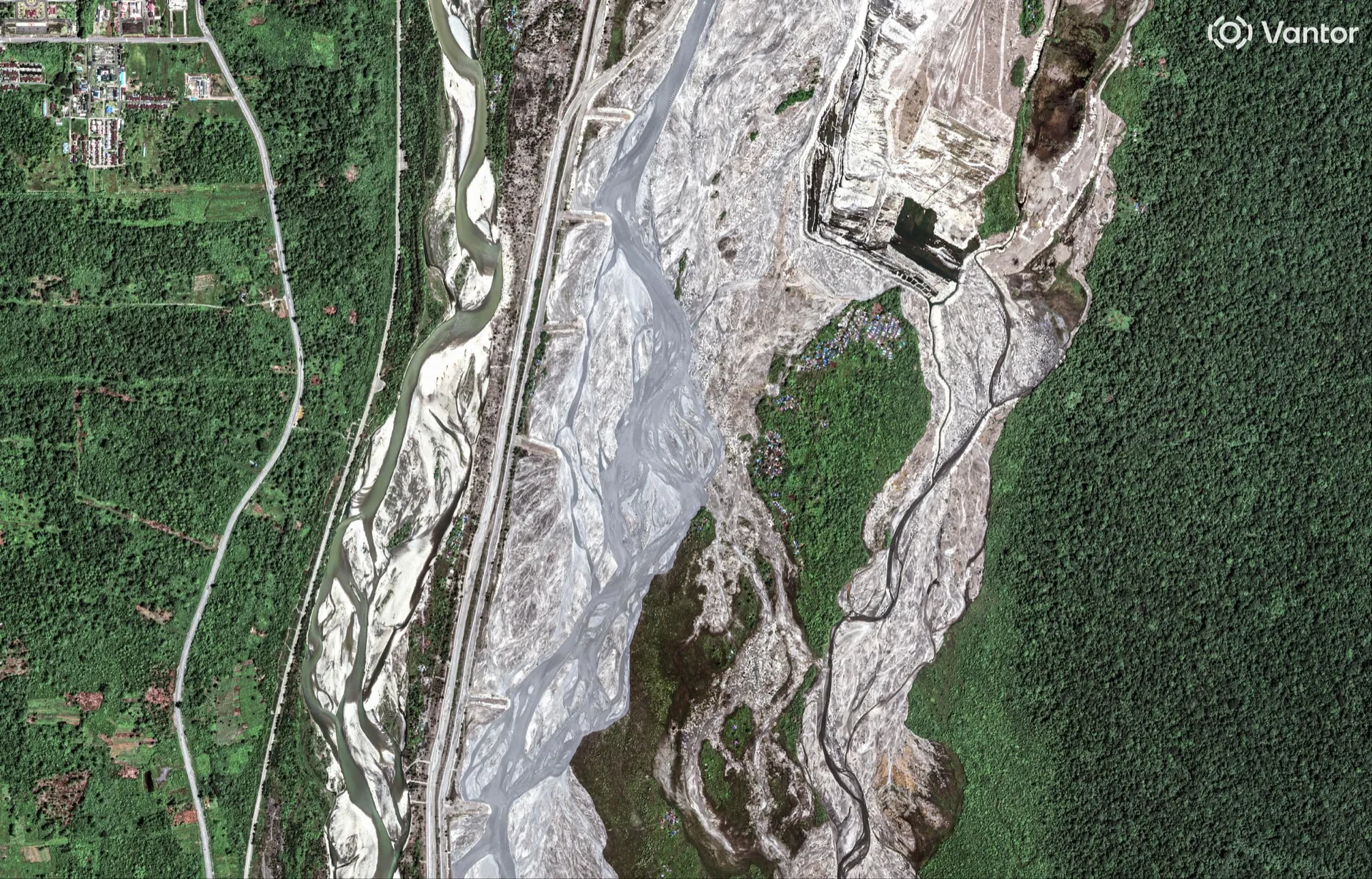
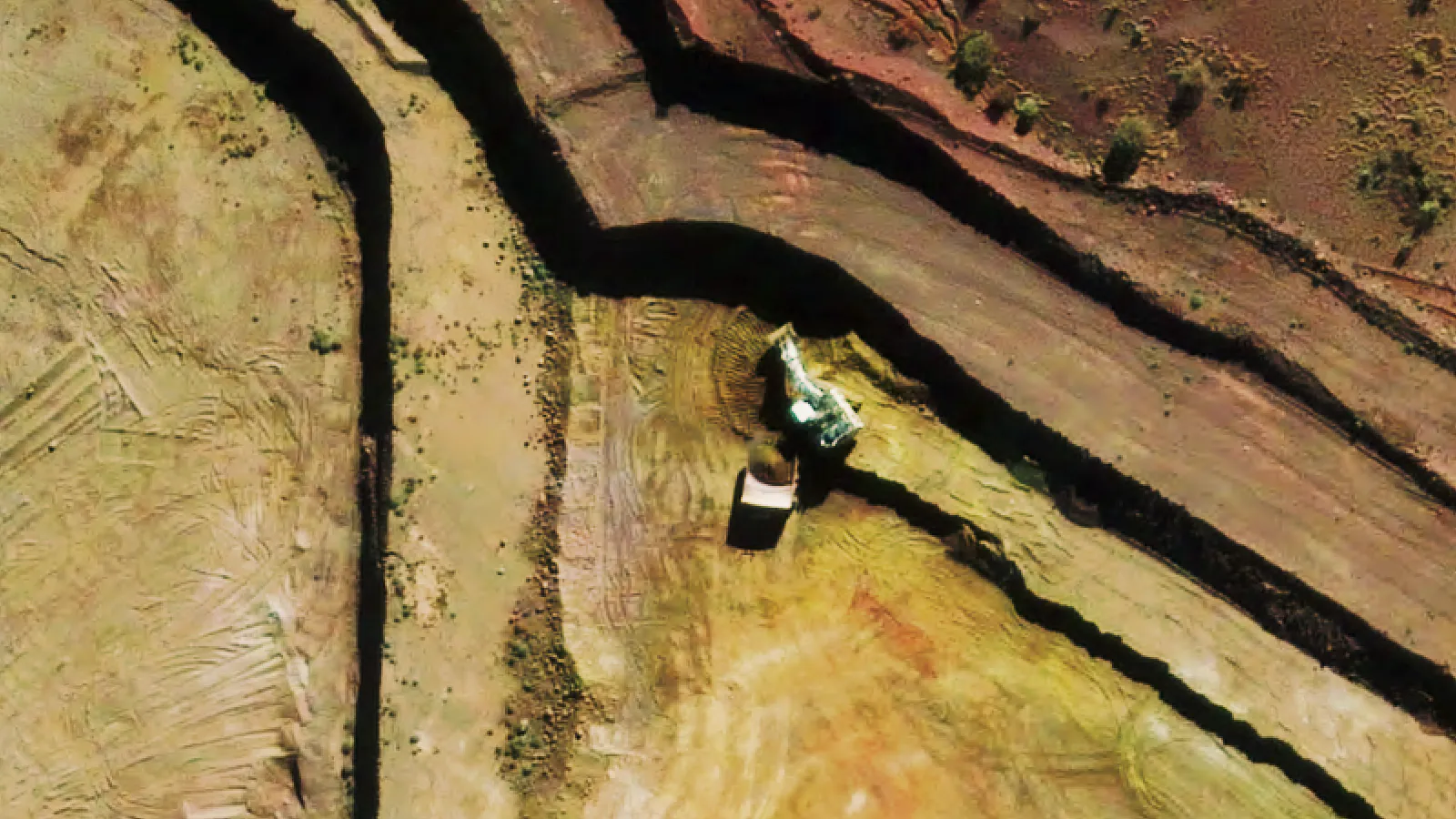
Disturbance and rehabilitation monitoring. Archive satellite imagery enables mining companies to track the footprint of operational disturbance over time and to measure rehabilitation progress without repeated field visits. Month-by-month or quarter-by-quarter comparisons at 30 cm or 50 cm resolution reveal the trajectory of revegetation, earthworks, and landform reshaping with high spatial detail.
Lifecycle reporting. From exploration through to closure, a well-curated archive provides the visual and analytical foundation for regulatory submissions, investor updates, and community engagement. Historical satellite imagery makes it straightforward to demonstrate that commitments have been met and that environmental outcomes are tracking against targets.
Environmental Monitoring and Land Management
Environmental scientists, consultants, and government agencies rely on archive satellite imagery to observe long-term trends that free, open-access datasets (such as Sentinel-2 at 10-metre resolution) cannot resolve at the required detail.
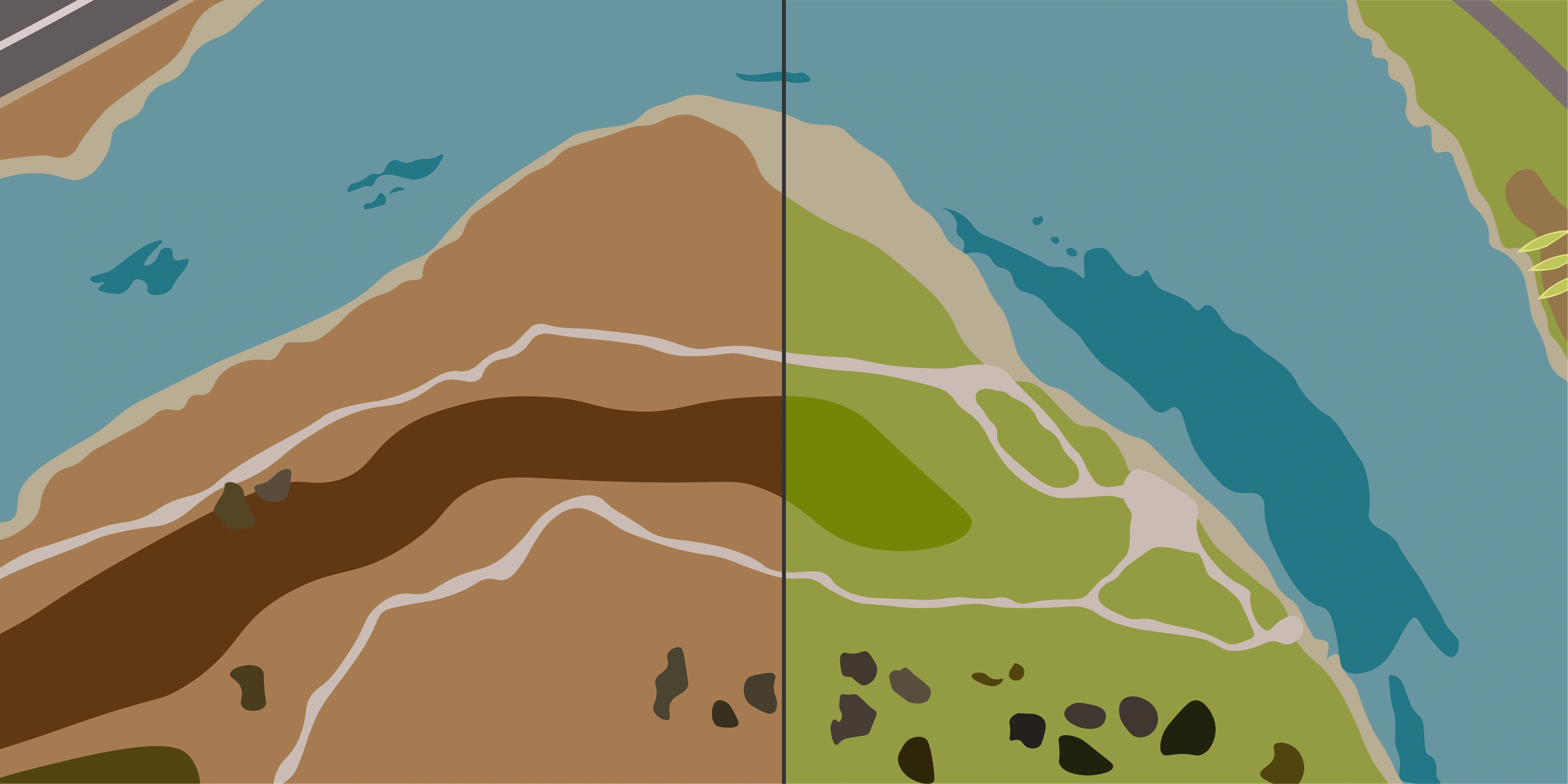
High-resolution archive data supports vegetation health assessment, coastal erosion tracking, wetland mapping, bushfire recovery analysis, and land-use change detection across seasons and years. For projects requiring sub-metre detail, such as identifying individual tree canopies, measuring erosion scarps, or delineating small water bodies, commercial archive imagery at 30 cm or 50 cm resolution is the most practical and cost-effective source.
Infrastructure and Urban Development
Infrastructure planners, engineers, and local governments use archive satellite data to monitor construction progress, verify as-built conditions, assess corridor options, and track urban expansion. Because archive imagery is already captured and indexed, it can be ordered and delivered within days. This is a significant advantage when project timelines are tight and decisions cannot wait for a new satellite pass.
Agriculture and Land Valuation
For agricultural monitoring, carbon accounting, and property due diligence, archive satellite imagery provides the temporal depth needed to assess productivity trends, quantify vegetation cover, and evaluate land condition over multiple growing seasons. This is particularly valuable in Australia, where seasonal variability and drought cycles can dramatically alter landscape appearance from one year to the next.
Archive Imagery vs Tasking: Choosing the Right Approach
One of the most common questions when ordering satellite imagery in Australia is whether to use archive data or commission a new tasking acquisition. For a detailed comparison, see our guide on archive vs tasking. The answer depends on a few practical considerations.
When to Start with Archive
Archive satellite imagery should be your default starting point. In most cases, recent high-resolution coverage already exists over your area of interest, particularly across Australia where satellite operators have been actively building dense archives.
Archive is the right choice when you need historical comparisons or time-series datasets spanning months or years, when recent captures at the required resolution are already available with acceptable cloud cover, when fast turnaround matters (archive orders are typically delivered in three to five business days through a premium workflow), and when cost efficiency is a priority, since archive licensing is generally more affordable than commissioning new collections.
With providers like Vantor contributing over 32,000 swath footprints across Australia in just 12 months, the probability of finding cloud-free, high-resolution archive coverage for your site is higher than ever.
When to Use Tasking
Tasking, which involves ordering a new satellite capture over a specific location and time window, is the right approach in a more limited set of circumstances. You may need tasking when no suitable archive coverage exists for your area of interest, when you require imagery from a very specific date or narrow time window, when persistent cloud cover in the archive prevents you from obtaining a usable capture, or when your project demands a particular sensor configuration, look angle, or spectral band combination that is not available in the existing catalogue.
A Practical Rule
The workflow we recommend is simple and effective. Start by searching the archive. If cloud-free, high-resolution swathes are available for the dates and location you need, order them. Most of Australia has been covered multiple times in the past twelve months, so the archive will satisfy the majority of requests. Add tasking only where archive coverage has gaps, for example persistently cloudy periods in tropical Queensland or specific timing requirements tied to project milestones.
This archive-first approach saves time and money while ensuring you get the data you need as quickly as possible.
Understanding Resolution: 30 cm and 50 cm Satellite Imagery
Resolution, technically known as Ground Sample Distance (GSD), determines how much detail is visible in a satellite image. For most professional applications in Australia, the choice comes down to two tiers of very high-resolution imagery.
30 cm resolution is the finest commercially available optical satellite imagery. At this level of detail, you can identify individual vehicles, fences, small structures, stockpiles and narrow tracks. It is essential for mining operations where disturbance boundaries, rehabilitation progress, and infrastructure condition need to be measured with precision.
50 cm resolution offers a strong balance between detail and cost. You can still identify buildings, roads, large vehicles, field boundaries, and broad vegetation structure. For environmental trend analysis, infrastructure corridor planning, and regional change detection, 50 cm imagery often provides more than sufficient detail at a lower price point.
Both resolution tiers are available in the archive. The right choice depends on what you are trying to measure and the scale of the features you need to resolve. A good satellite imagery partner will help you match resolution to your project requirements so that you are not over-purchasing detail you do not need or under-purchasing for critical applications.
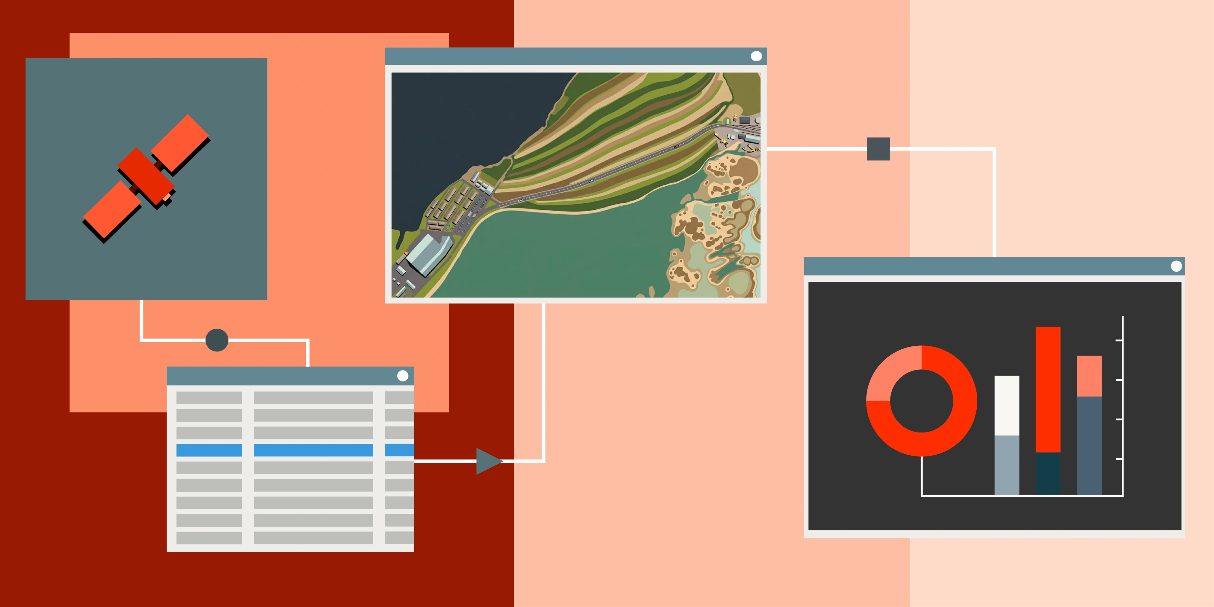
Inside Albatross: Search and Order Archive Satellite Imagery with Ease
Albatross is designed to make searching, evaluating, and ordering archive satellite imagery across Australia as straightforward as possible. Rather than navigating multiple provider catalogues with different interfaces and metadata standards, Albatross gives you a single platform to discover and compare available coverage.
Vantor Archive Highlights
Vantor's rapidly growing satellite imagery archive is a standout resource for Australian projects. Key highlights include 30 cm and 50 cm high-resolution imagery captured within the last twelve months, more than 32,000 individual swath footprints indexed across Australia in that period, and a premium delivery workflow that gets archive orders into your hands within three to five business days.
This density of recent coverage means that for the vast majority of locations in Australia, from coastal urban centres to remote outback sites, high-resolution archive imagery is already available and ready to order.
Multi-Provider Access
Beyond Vantor, Albatross also connects you to archive imagery from other leading satellite operators, giving you the widest possible selection of dates, resolutions, and sensor types. This multi-provider approach means you are more likely to find cloud-free coverage for any given date, and you can compare options side by side before placing an order.
How the Ordering Process Works
Using Albatross to order archive satellite imagery follows a simple sequence. First, define your area of interest on the map or by uploading a boundary file. Then set your filters (date range, maximum cloud cover, minimum resolution) and browse the available swathes. Preview footprints and metadata to confirm coverage and quality. Finally, place your order and receive delivery within days.
Albatross also supports configurable ordering permissions across your team. Administrators can define who is authorised to place orders and assign designated approvers who review and approve requests before they are processed. This means end users across your organisation can search the archive and submit orders independently, while maintaining the oversight and budget controls that project leads and procurement teams require. There is no need for every order to funnel through a single point of contact, which removes bottlenecks and speeds up data access across the business.
Your Team's Satellite Imagery Data Catalogue
Once imagery has been delivered, Albatross doubles as a centralised data catalogue for your organisation. All delivered datasets are indexed and accessible through the platform, allowing team members to browse, preview, and inspect imagery directly in the browser. There is no need to download large files, install specialised desktop software, or have GIS skills to view and interpret the data. Whether it is an environmental officer checking a recent capture, a project manager reviewing site progress, or a compliance lead pulling together evidence for a regulatory submission, everyone on the team can access the imagery they need without technical barriers.
The platform is built for professionals who need reliable, high-resolution satellite data without the complexity of dealing directly with satellite operators or navigating opaque procurement processes.
Common Use Cases for Archive Satellite Data in Australia
| Use Case | Why Archive Imagery Matters |
|---|---|
| Baseline change detection | Establishes what the landscape looked like before activity began, providing an objective reference for all subsequent comparisons |
| Progress and disturbance monitoring | Enables month-by-month or quarter-by-quarter visual comparison without the cost and logistics of repeated field visits or aerial surveys |
| Regulatory and compliance reporting | Delivers historic visual evidence that supports submissions under frameworks like the MRF, PRCP, and environmental impact assessments |
| Environmental trend analysis | Tracks vegetation health, surface water extent, erosion, and land-use change across seasons and years at resolutions far beyond free open data |
| Bushfire and natural disaster assessment | Provides before-and-after imagery to quantify damage extent, guide recovery planning, and support insurance claims |
| Infrastructure verification | Confirms as-built conditions, monitors construction progress, and validates corridor alignment against design specifications |
| Property and land due diligence | Supports investment decisions with visual evidence of historical land condition, use, and surrounding context |
How Archive Satellite Imagery Fits Into Your Project Workflow
Integrating archive satellite imagery into your existing workflows does not require specialist remote sensing expertise. A practical approach follows four steps.
Step 1: Define your requirements. Determine the date range you need (last three months, six months, twelve months, or longer), the resolution tier that matches your application, and any spectral or format preferences.
Step 2: Search the archive first. Use Albatross to discover all available high-resolution swathes from Vantor and other satellite imagery providers over your area of interest. In most cases, you will find multiple cloud-free options covering your required timeframe.
Step 3: Add tasking only where needed. If the archive does not cover a specific date or period, for example due to persistent cloud during a wet season, place a tasking order to fill the gap. This hybrid approach gives you the best balance of speed, cost, and temporal completeness.
Step 4: Receive and integrate your data. Archive orders are delivered in industry-standard formats compatible with GIS platforms, CAD software, and analytical workflows. The Terrabit team ensures fast turnaround and can advise on processing, orthorectification, and format options to suit your environment.
Why the Archive-First Approach Is Gaining Ground in Australia
The traditional model of satellite imagery procurement in Australia, where you commission a new capture and wait, is increasingly being replaced by an archive-first philosophy. Several factors are driving this shift.
Archive density has reached a tipping point. With operators like Vantor contributing hundreds of thousands of recent, high-resolution swathes across the continent, the likelihood of finding suitable archive data for any given project is now very high. This was not the case even a few years ago, when archive catalogues were thinner and less frequently updated.
Delivery speed matters more than ever. Project timelines are tightening across mining, infrastructure, and environmental sectors. Archive orders that arrive in three to five days, rather than the weeks or months a new tasking can take, allow teams to make faster decisions and keep projects on schedule.
Cost pressures are real. Archive imagery is inherently more cost-effective than tasking because the data already exists. For organisations managing multiple sites or requiring frequent updates, the savings from an archive-first strategy compound quickly.
And quality has caught up. Modern very high-resolution satellites produce 30 cm and 50 cm imagery with excellent radiometric quality, positional accuracy, and spectral fidelity. Archive data from these sensors is not a compromise. It is professional-grade imagery that meets the demands of rigorous analytical and reporting workflows.
Get Started with Archive Satellite Imagery in Australia
If you are looking to buy high-resolution satellite imagery in Australia, whether for mining compliance, environmental monitoring, infrastructure planning, or any other application that benefits from a historical perspective, the archive is the smartest place to start.
With Vantor's extensive recent coverage available through Albatross, alongside imagery from other leading providers, finding and ordering the right data for your area of interest has never been faster or more straightforward.