Loading...
Satellite-Derived Elevation Data
Resolution
0.5m to 5m per pixel
Vertical Accuracy
±0.5m LE90 with GCPs
Coverage
Global
Generate accurate elevation data from stereo satellite imagery without ground surveys or aerial capture.
0.5m
Generate Digital Surface Models (DSMs) and Digital Terrain Models (DTMs) at resolutions from 0.5m to 5m, ideal for site planning, slope analysis and 3D visualisation applications.
Global
Obtain elevation data for any location worldwide without the need for ground crews, aircraft, or permits. Ideal for remote and inaccessible areas.
DSM + DTM
Receive both Digital Surface Models and bare-earth Digital Terrain Models processed from the same source data.
We provide Digital Surface Models (DSM), capturing all surface features including vegetation, buildings and infrastructure, as well as Digital Terrain Models (DTM), representing the bare-earth surface. Both products are generated from stereo satellite imagery using advanced photogrammetric processing.
Our satellite-derived DEMs offer resolution options from 0.5m to 5m resolution, with vertical accuracy specifications designed to meet planning and volumetric requirements. Higher accuracy products are available with ground control integration.
Digital Elevation Models support a wide range of terrain analysis applications including volumetric calculations for stockpiles, cut and fill analysis for earthworks, slope and aspect mapping, flood and hydrological modelling, viewshed analysis, and 3D visualisation.
Receive your elevation data in industry-standard formats suitable for use with all major GIS and CAD platforms.
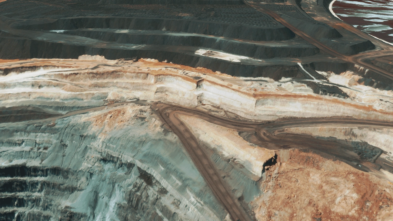
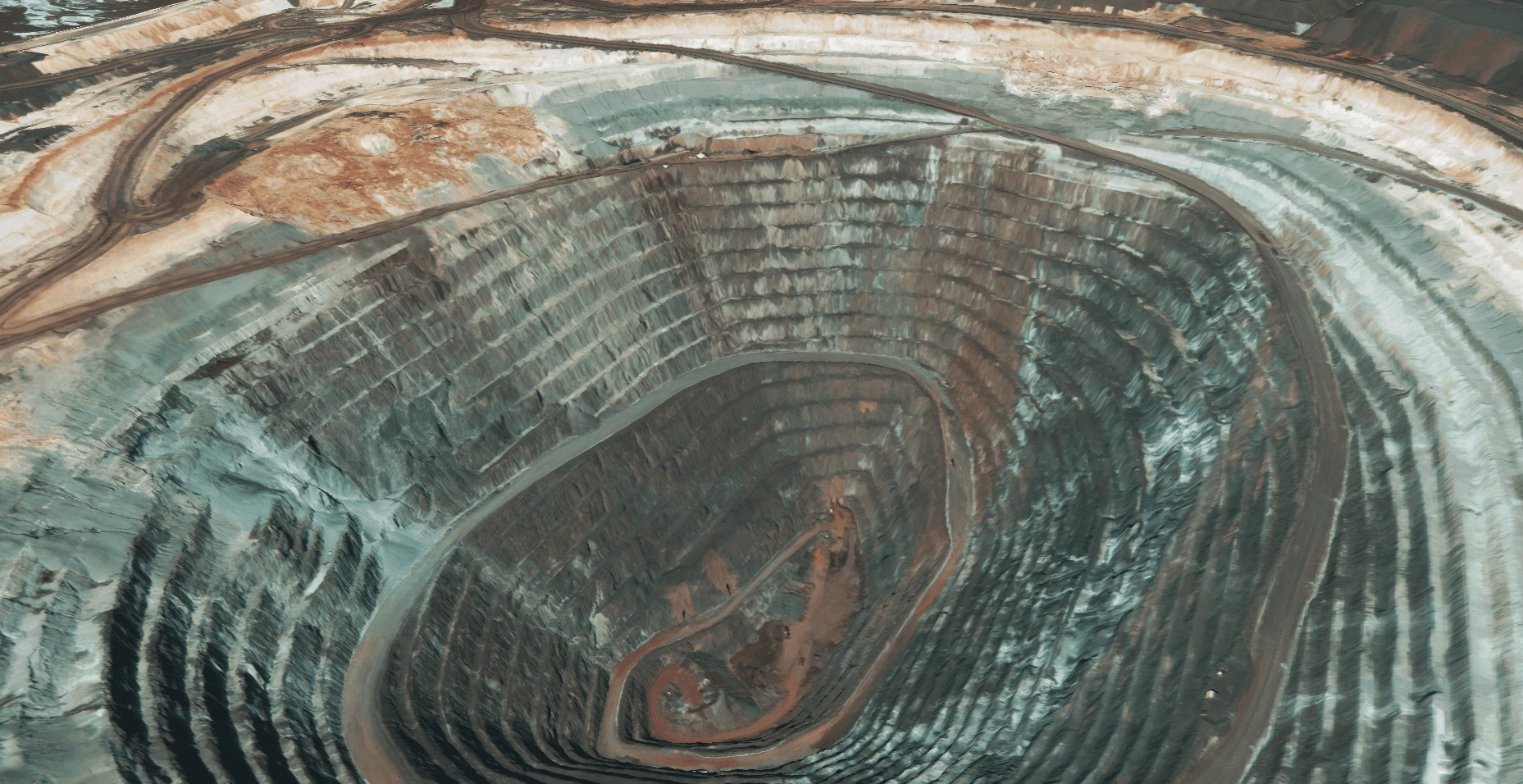
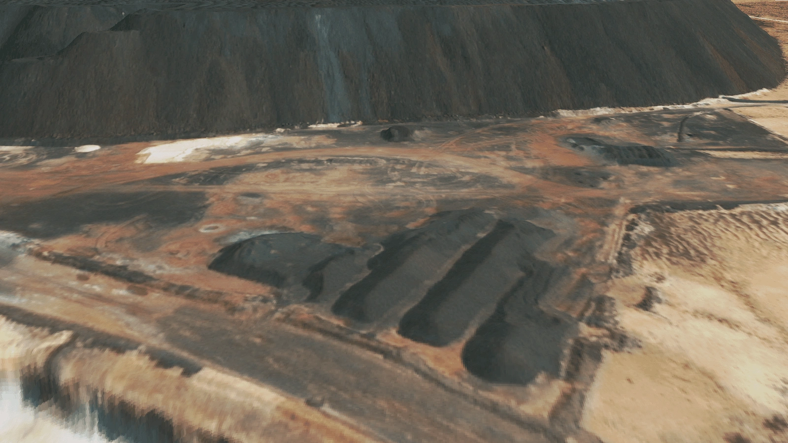
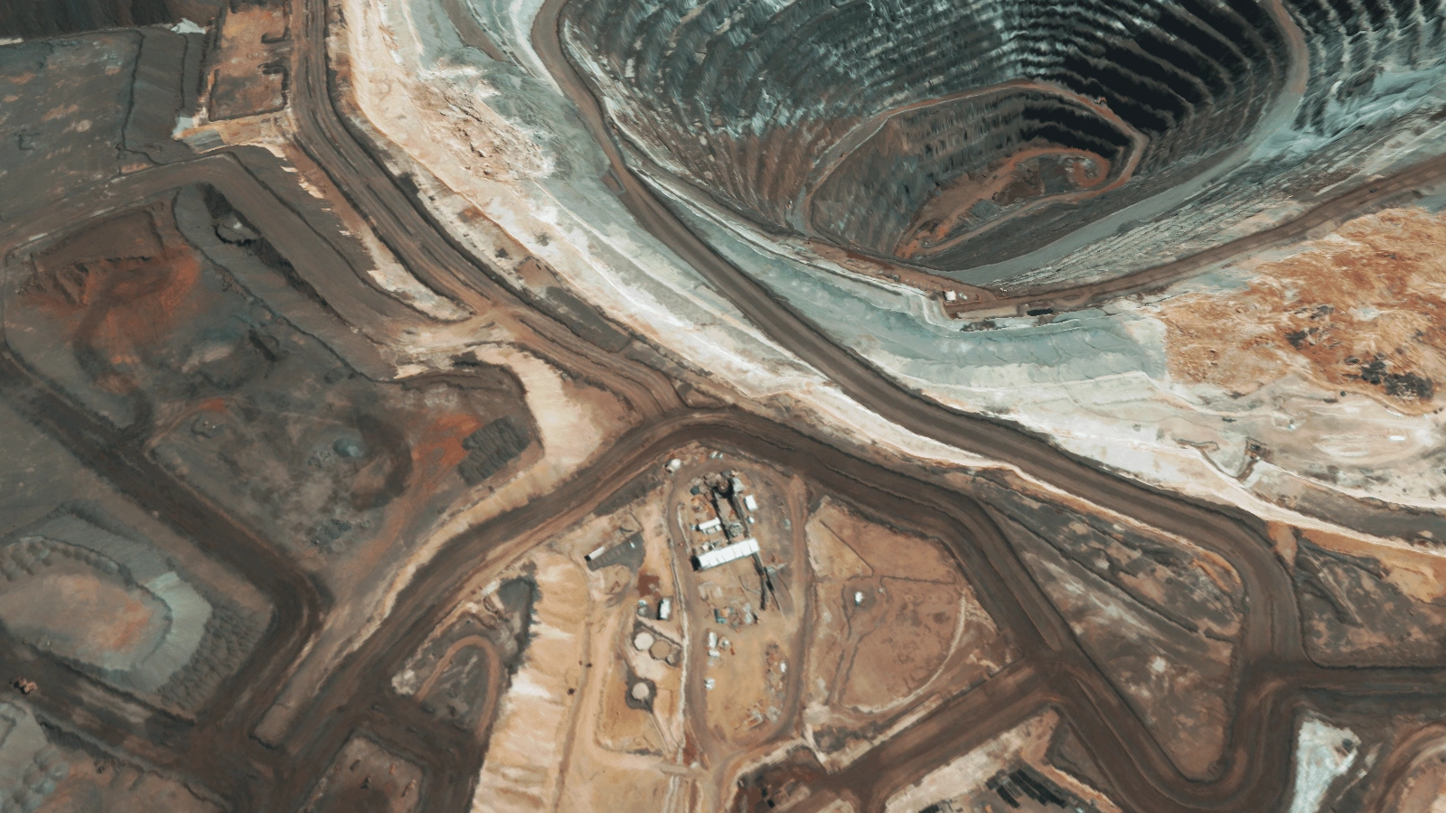
Compare Digital Surface Models, Digital Terrain Models and source RGB imagery across different terrain types and applications.
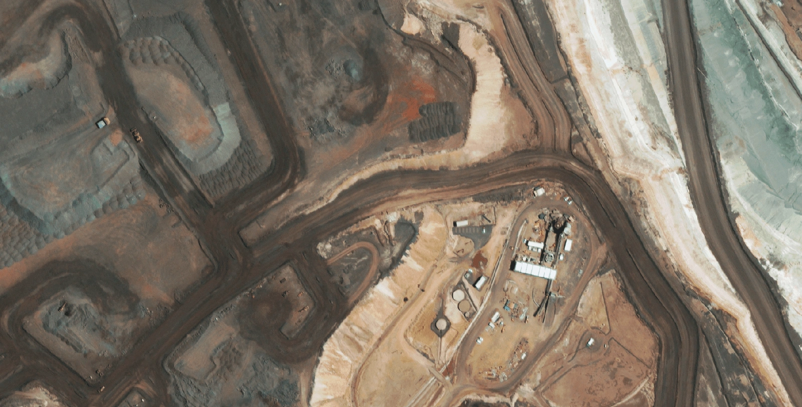
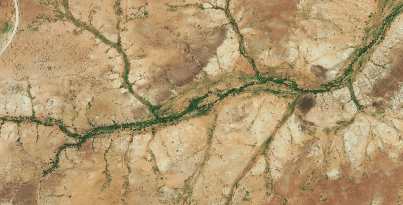
RGB Source Imagery
High-resolution optical satellite capture
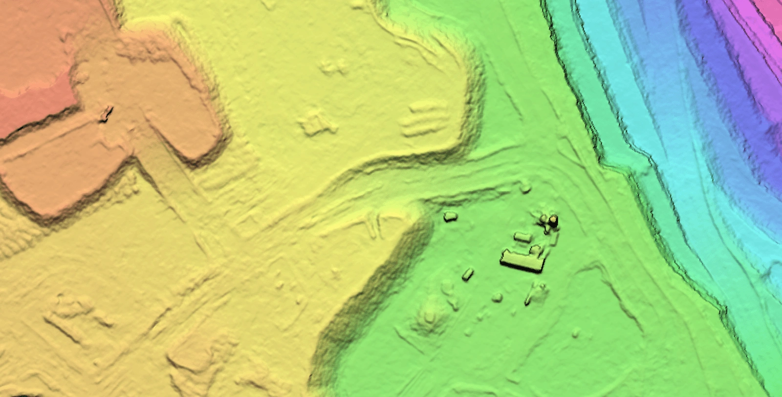
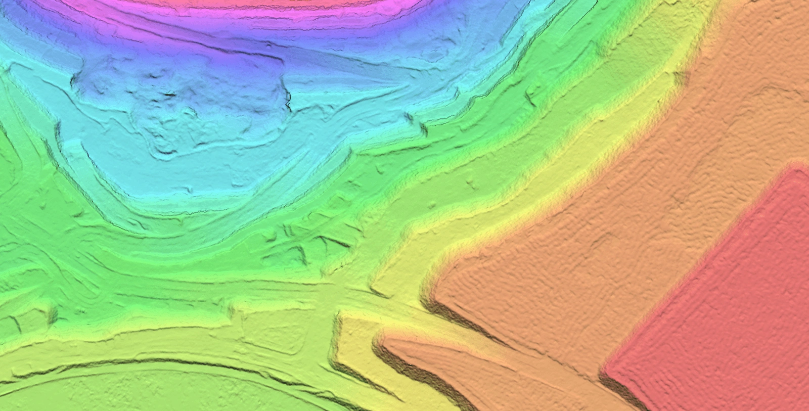
Digital Surface Model (DSM)
Surface features including buildings
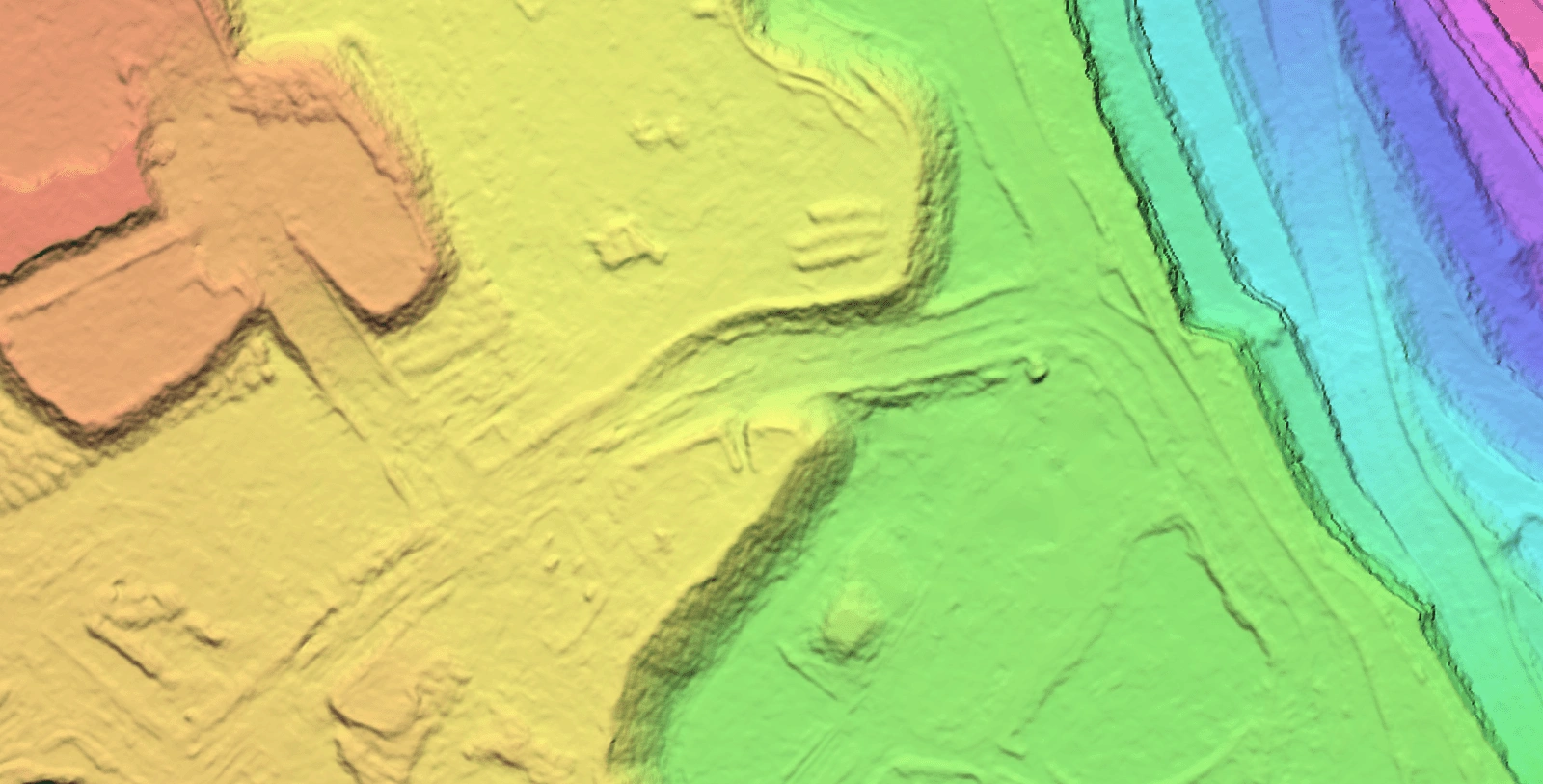
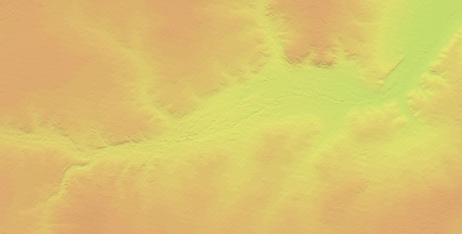
Digital Terrain Model (DTM)
Bare-earth elevation
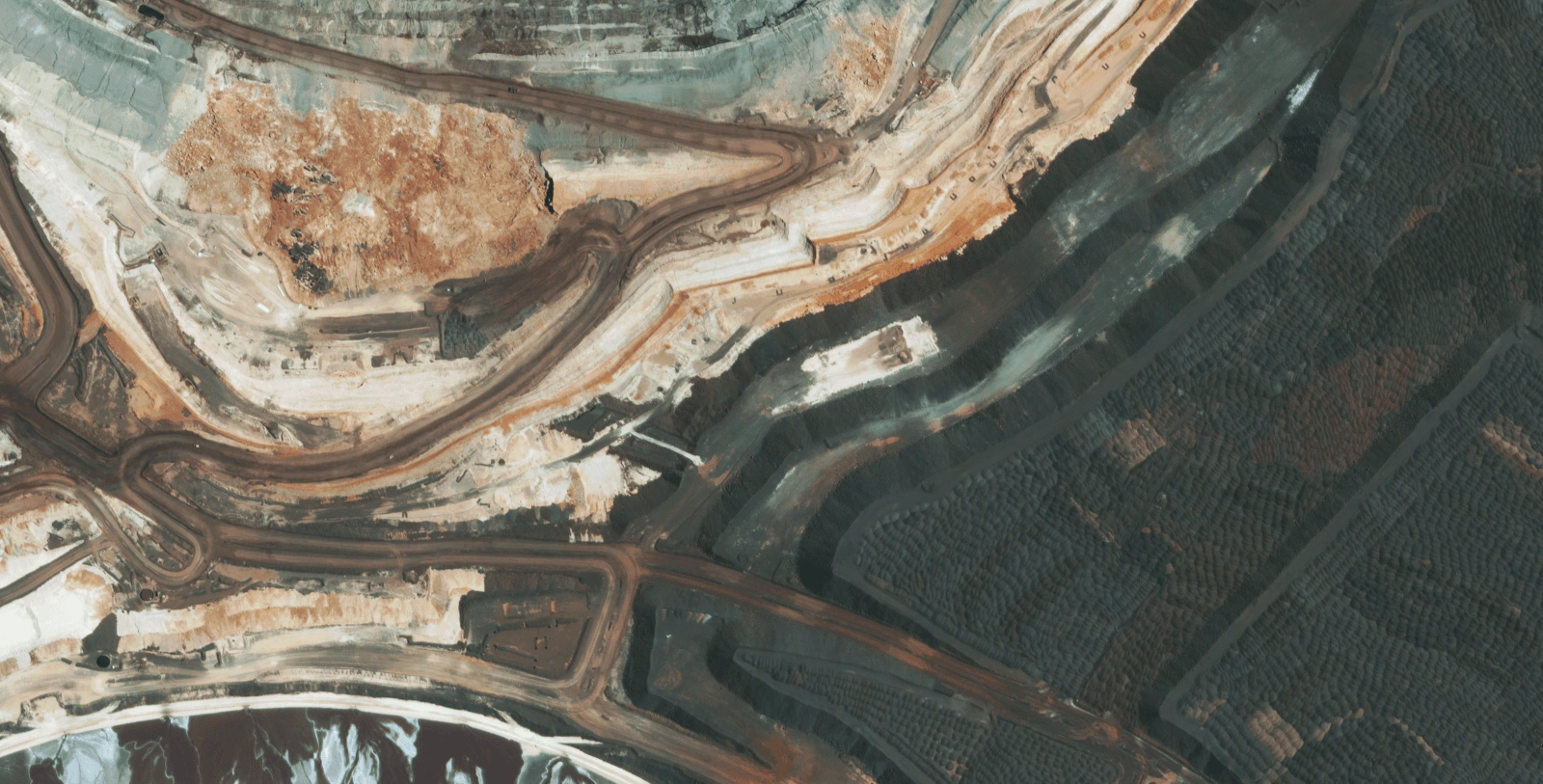
RGB Source Imagery
Optical satellite capture
Digital Terrain Model (DTM)
Terrain surface for planning
RGB Source Imagery
Optical satellite capture
Digital Terrain Model (DTM)
Elevation data for analysis
Detailed specifications for our satellite-derived Digital Elevation Model products.
Request Digital Elevation Models directly through our centralised geospatial platform.
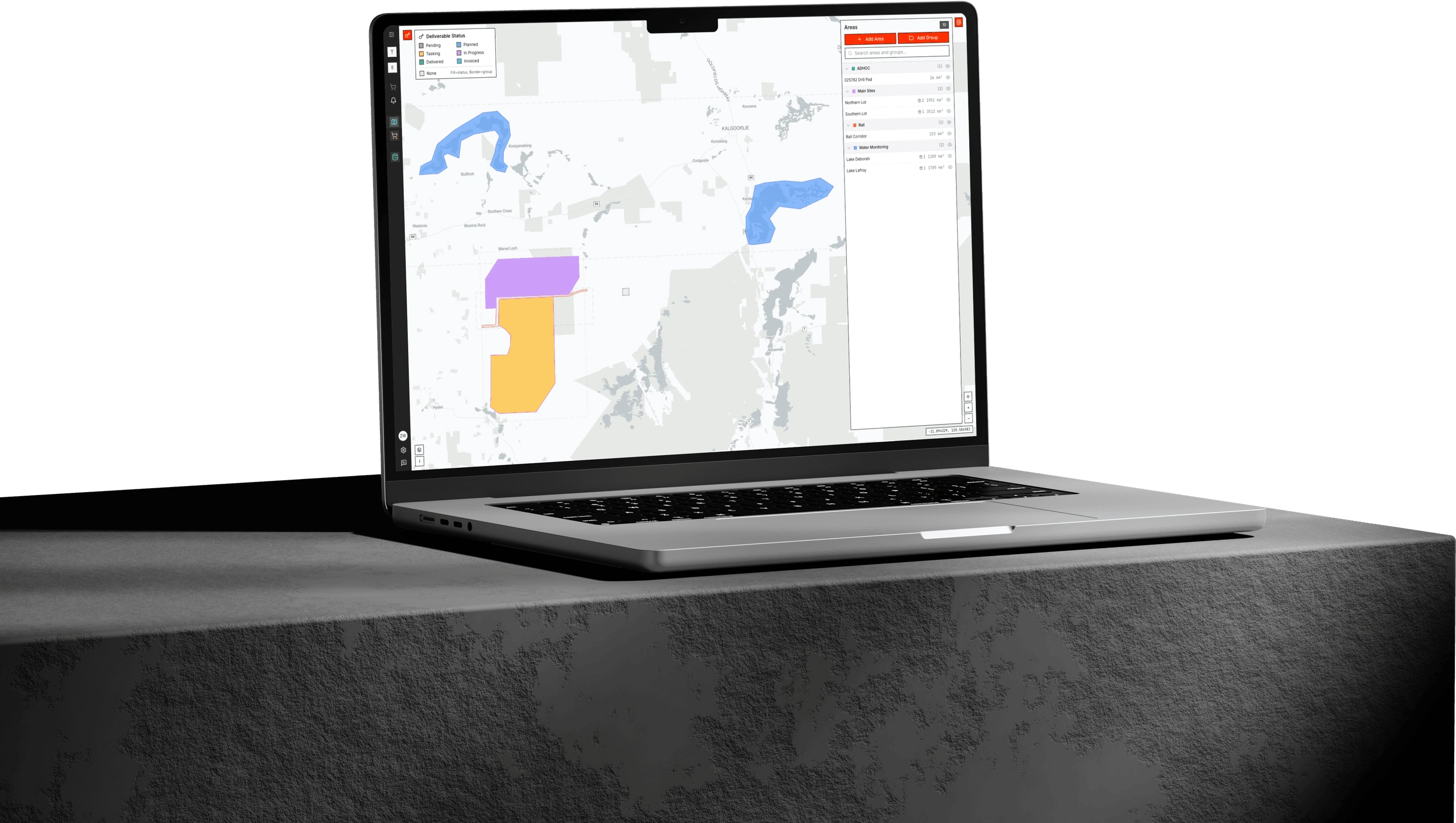
Order Digital Elevation Models, track processing status, and access delivered terrain data through Albatross. Define your area of interest, specify resolution and accuracy requirements, and receive your DSM and DTM products directly through the platform.
From stereo satellite imagery to analysis-ready elevation data, we deliver Digital Elevation Models that integrate directly with your GIS workflows. Whether you need stockpile volumes, terrain surfaces for site design, or elevation data for environmental modelling, our satellite-derived DEMs provide accurate, cost-effective terrain intelligence for any location.
Need elevation data for your project? Share your area of interest and requirements, and our team will provide a tailored quote for Digital Elevation Models, processing options, and delivery timeline.


