Buying satellite imagery in Australia can feel overwhelming. Between dozens of sensors, resolutions ranging from meters to centimetres, licensing rules and complex file formats, it’s easy to get lost in the details.
The good news? You don’t need to be a remote sensing expert to make the right choice. Whether you’re monitoring crops, planning infrastructure, exploring for minerals, or managing the environment, the right satellite data can save time, reduce costs and give you insights you can’t get any other way.
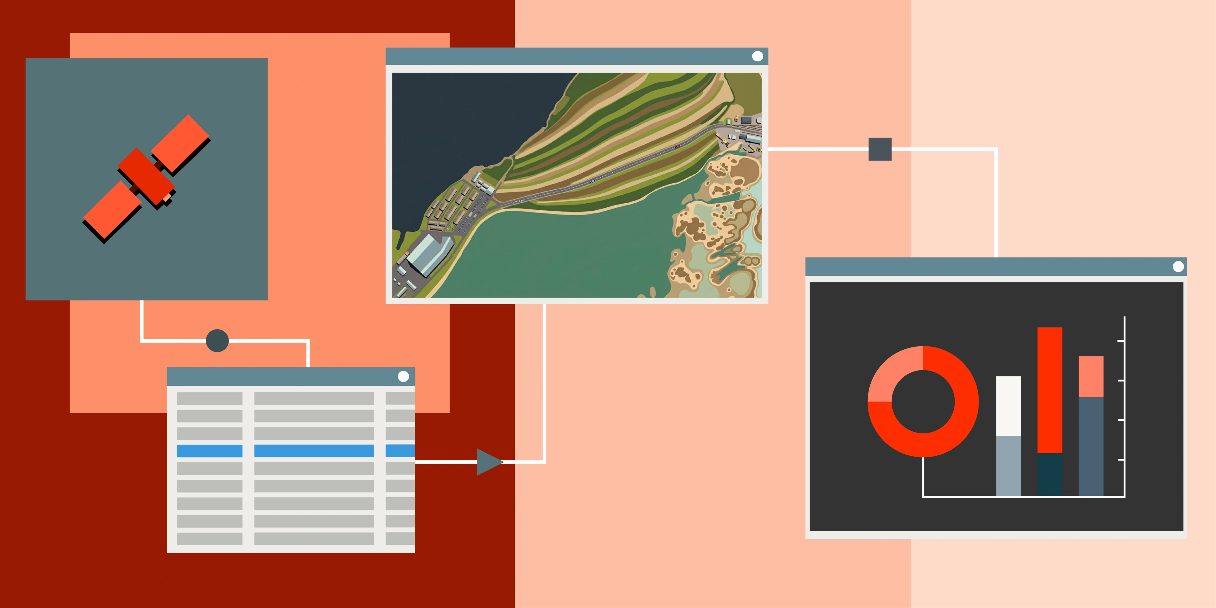
At Terrabit, we work with the world’s leading satellite operators to make the process simple. Instead of sifting through technical specs and endless data archives, we help you match the right sensor, resolution and acquisition plan to your project - so you get the data you need, when you need it, in a format that’s ready to use.
Use Cases: Why Organisations in Australia Buy Satellite Imagery
Satellite imagery isn’t just about pretty pictures from space - it’s about making faster, smarter decisions on the ground. In Australia, where vast distances and challenging terrain make fieldwork expensive, remote sensing delivers enormous value.
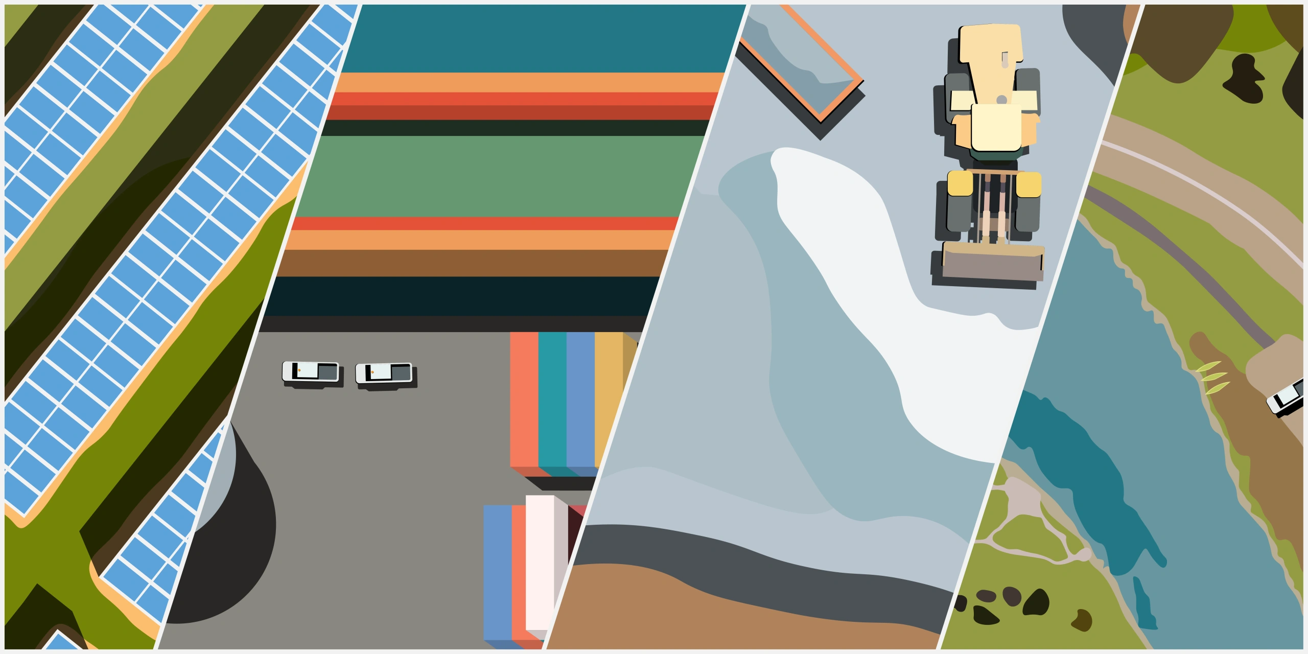
Mining & ExplorationFrom identifying surface mineral signatures to monitoring disturbance and tailings dams, satellite data is a powerful tool for the resources sector. Mining companies use very high-resolution imagery to track activity across their leases, confirm rehabilitation progress and manage environmental compliance. Hyperspectral imagery can even detect subtle mineralogical variations to guide exploration, providing insights before committing to costly ground sampling.
Environmental MonitoringGovernment agencies, consultancies and NGOs rely on satellites to track vegetation health, water quality and land use change. With archive imagery going back decades, it’s possible to measure long-term change at scale - whether it’s mangrove loss, bushfire planning/recovery, water body loss, or urban expansion.
Infrastructure & PlanningBeyond natural resource industries, infrastructure projects use imagery for corridor planning, monitoring urban growth and validating construction progress - all without costly site visits.
At Terrabit, we see clients from all these industries adopting satellite imagery not because it’s “nice to have,” but because it reduces risk, improves accuracy and often replaces weeks of on-ground work. We also support government programs and energy infrastructure initiatives requiring consistent monitoring.
Resolution: How Much Detail Do You Really Need?
One of the first questions people ask is: “What resolution should I choose?” Resolution, often called Ground Sample Distance (GSD), refers to the size of the smallest feature a satellite can detect. In simple terms, it’s about how much detail you’ll see in the image.
Here’s how the most common options compare:
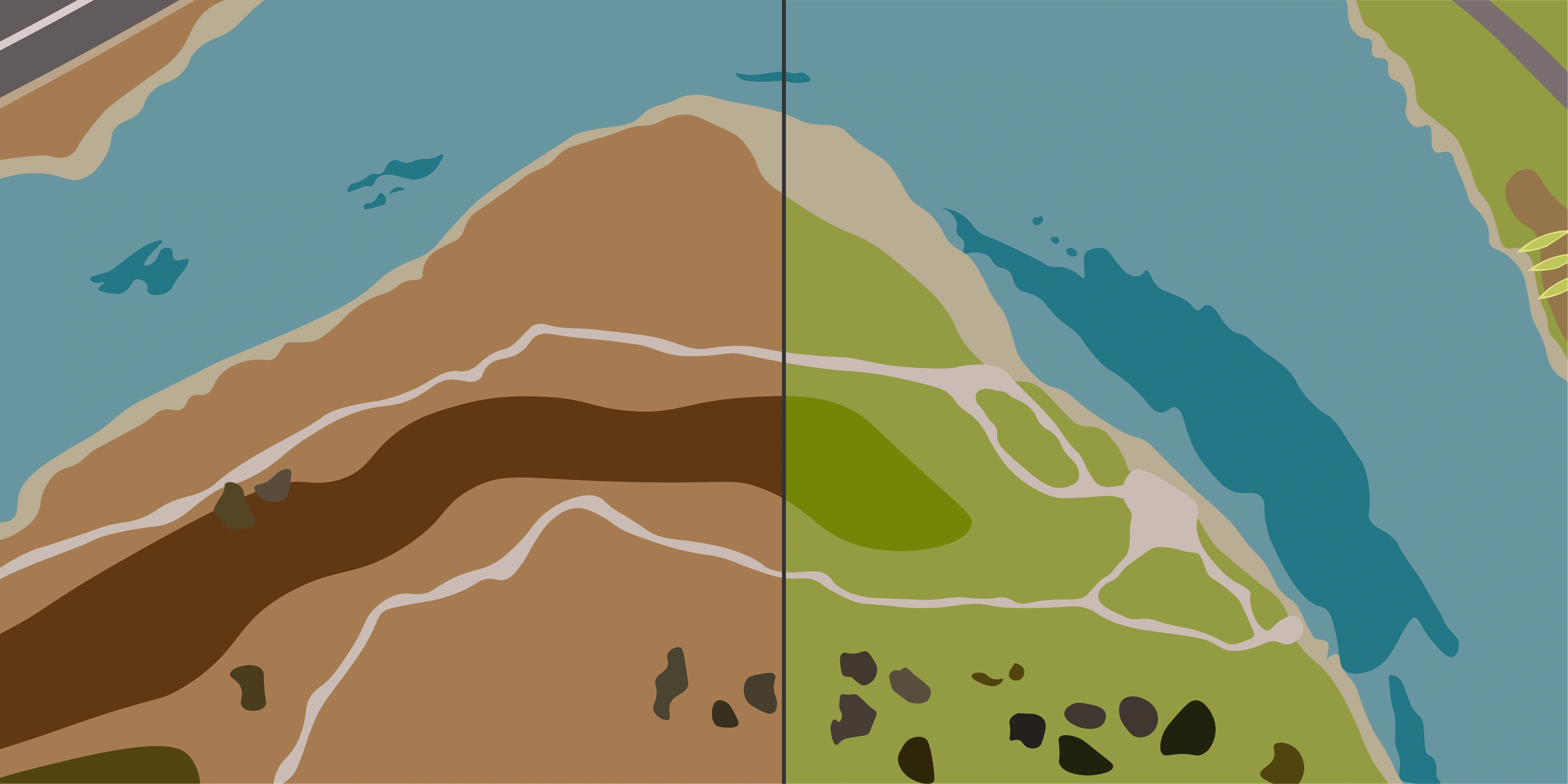
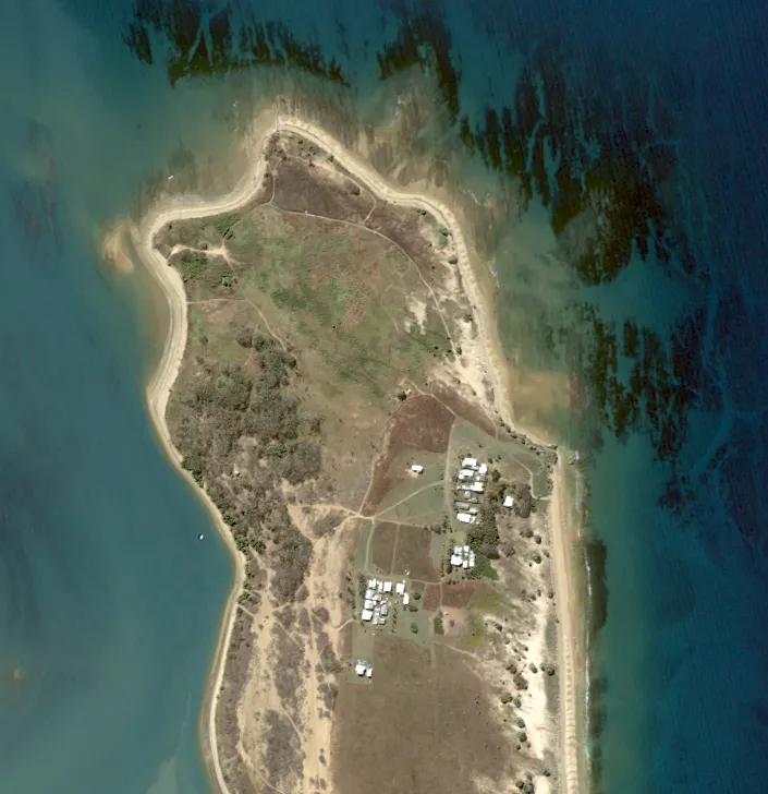
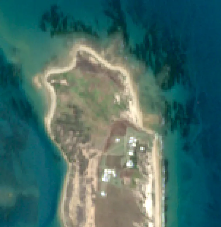
30cm resolution (very high resolution)
- You can clearly see vehicles, fences, individual trees and site infrastructure.
- Essential for mining operations where you need to track disturbance and rehabilitation, stockpiles or construction activity.
- Useful for infrastructure planning where fine details matter - e.g checking road alignments or small building footprints.
50cm resolution (high resolution)
- A cost-effective alternative to 30cm if you don’t need quite as much detail. A deeper archive and history in the remote sensing world.
- Still allows you to identify field boundaries, large vehicles and vegetation structure.
- Often used in agriculture for crop monitoring or environmental projects where broader context is more important than the finest detail.
10m resolution (medium resolution)
- Ideal for regional-scale monitoring where you’re looking for patterns, not objects.
- At 10m, you can detect changes in vegetation health, water bodies or land use over very large areas.
- Common in environmental monitoring (e.g wetland mapping, bushfire impact studies) and broadacre agriculture (e.g seasonal crop stress analysis).
The takeaway: higher resolution isn’t always better. It comes down to what you’re trying to use the data for. A mining engineer, monitoring pit development may need 30cm imagery, while an environmental scientist tracking vegetation change across a national park will get better value from 10m.
At Terrabit, we work with you to balance resolution, coverage and cost. So you're not 'over' or 'under' purchasing for your project.
Accuracy & Orthorectification: Why Aligned Images Matter
Not all satellite images are created equal. Some look great but won’t line up perfectly with your previous imagery or GPS data. That’s where orthorectification comes in.
What is orthorectification?
Think of it as “straightening” and aligning the image. Raw satellite pictures can be distorted by the angle of the satellite or the elevation of the terrain. Orthorectification corrects those distortions so the imagery lines up accurately with real-world coordinates.
When does accuracy matter most?
- Mining & infrastructure: If you’re overlaying imagery with survey data or engineering drawings, positional accuracy is critical. A misaligned road or pit boundary could throw off your planning.
- Agriculture: For broadacre farming, a small offset isn’t a big deal. But if you’re using imagery to guide precision equipment, accuracy matters.
- Environment: For long-term monitoring, consistency is key. Having imagery that lines up year after year means you can trust your change detection results.
Do you always need it?
Not necessarily. If you just want to check seasonal crop health, raw imagery might be fine. If you’re making measurements or integrating with GIS layers, orthorectified data is worth the extra step.
At Terrabit, we deliver imagery that’s fit for purpose. If your project needs high positional accuracy, we’ll make sure your imagery is orthorectified and work with your previous data or control. If it doesn’t, we won’t oversell you - you’ll get what’s best for your workflow.
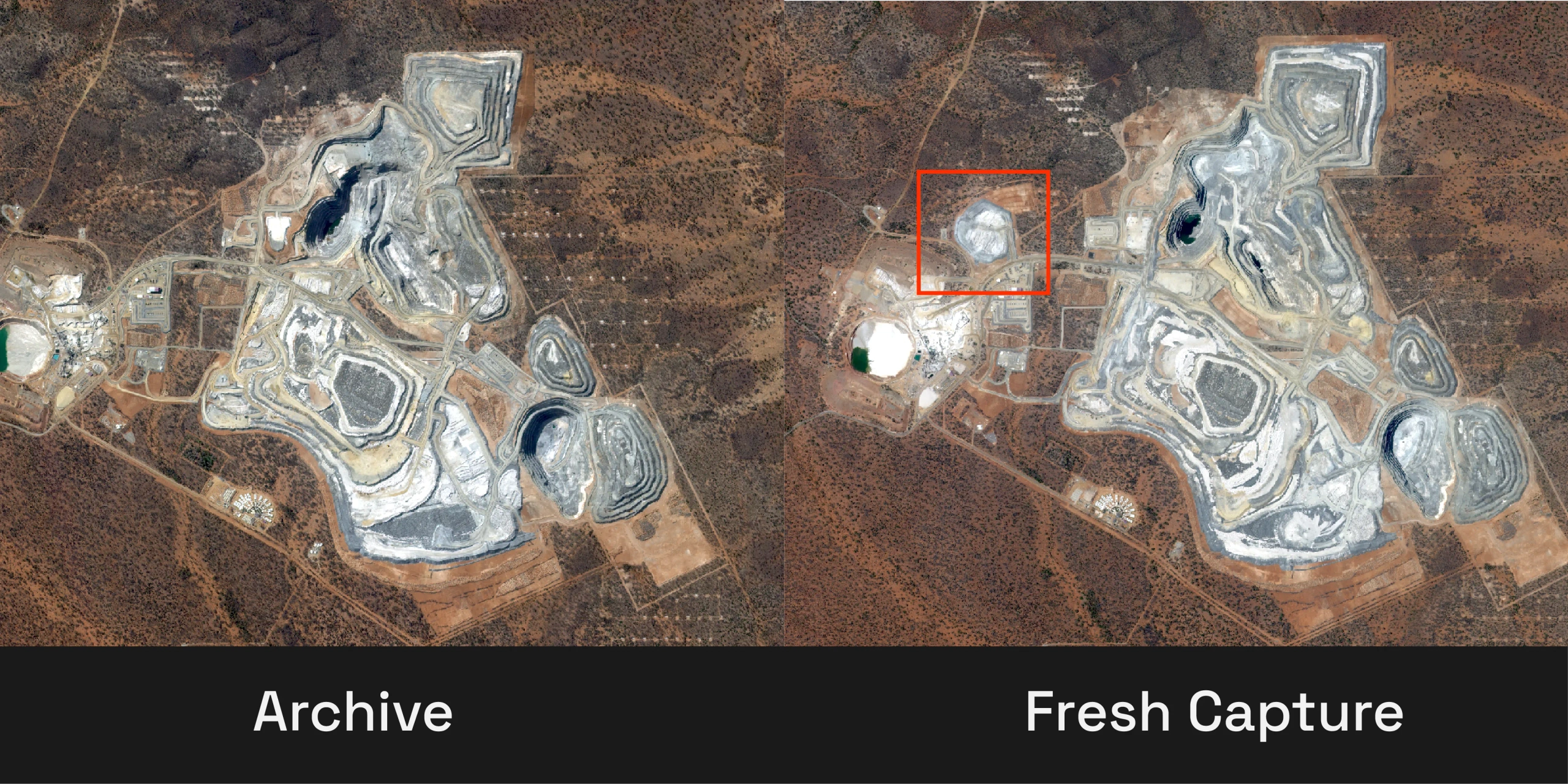
Archive vs Tasking: Historical Images or Fresh Captures?
When you buy satellite imagery, you’ve usually got two options: archive (existing imagery that’s already been captured) or tasking (asking a satellite to capture something new). Both have their place - it just depends on your project.
Quick Comparison
| Aspect | Archive Imagery | Tasking a Satellite |
|---|---|---|
| What it is | Previously collected scenes already in the provider’s catalogue | A new capture scheduled over your Area of Interest (AOI) |
| Delivery speed | Hours–days (immediate availability) | Depends on revisit + weather (days–weeks) |
| Cost | Lower (no new acquisition required) | Higher (capacity reserved, acquisition risk managed) |
| Control | Limited: you take what exists (date, cloud %, off‑nadir) | High: specify timing window, cloud %, priority, off‑nadir tolerance |
| Historical analysis | Excellent (multi‑year lookback) | Not applicable (future‑focused) |
| Recency | May be weeks–years old | Most current possible |
| Best for | Baselines, change detection, environmental history, feasibility | Monitoring programs, project milestones, time‑critical events |
Archive Imagery
Think of this as the “back catalogue.” Many satellites have years (sometimes decades) of coverage. Great for establishing baselines, building multi-year time series and validating historical change.
Benefits:
- Fast delivery – often available within hours or a couple of days.
- Cost‑effective – you’re licensing data that already exists.
- Historical insight – enables long‑term change detection (seasonal, annual, multi‑year trends).
Example: An environmental team evaluating land‑clearing trends might pull a 5‑year archive time series instead of waiting months for multiple new acquisitions.
Tasking a Satellite
This is booking acquisition capacity for a fresh capture over your AOI within a defined time window.
Benefits:
- Up‑to‑date – delivers the most recent possible view.
- Control – you can set cloud cover tolerance, timing constraints, off‑nadir / look angle limits and acquisition priority.
- Critical projects – ideal for mining, infrastructure, agriculture or emergency response where conditions change quickly.
Example: A mine operator tasks monthly very high‑resolution imagery to track construction progress against schedule and budget.
Which Should You Choose?
- Choose Archive when you need speed, historical depth or cost efficiency.
- Choose Tasking when you need guaranteed coverage, recency tied to milestones, or specific acquisition parameters.
Often the optimal (and most economical) approach is a blend: use archive imagery first to understand the past, then layer in a tasking cadence to stay current.
Tip: Start by defining the business question (baseline change? near‑real‑time progress? compliance evidence?)-the answer usually makes the archive vs tasking balance obvious.
At Terrabit, we help clients model that balance so you’re not over‑paying for recency where it isn’t needed-or missing critical updates where it is.
Cloud Cover & Revisit Rates: Why Satellites Don’t Always Get It Right First Time
One of the biggest surprises for first-time buyers is that you don’t always get a clear shot on the first try. Clouds, shadows, haze, snow - they can all get in the way.
Cloud cover
- Even the best optical satellites can’t see through clouds. If your area is in the tropics, or you’re looking during the wet season, you may need multiple attempts before you get a cloud-free image.
- For projects where clarity is critical (like construction monitoring), the best results come from setting a low cloud-cover tolerance and working with a constellation that offers high revisit rates.
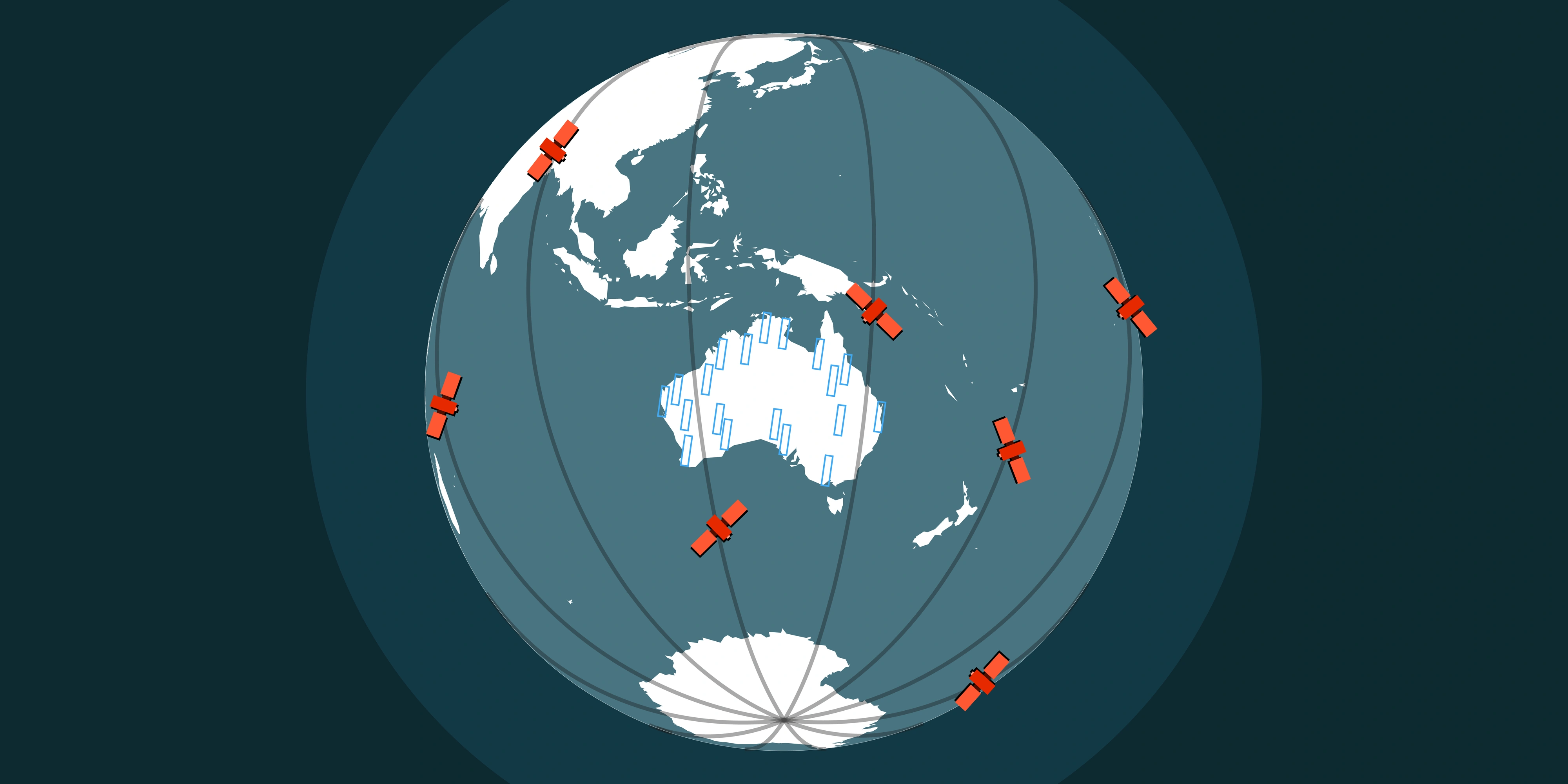
Revisit rates
- This is how often a satellite can pass over your location. Some satellites only have overpasses every few days, while big constellations can try multiple times a day.
- More satellites = more chances to capture your site without clouds.
Managing expectations
- Mining: If you need a monthly update, we’ll recommend satellites with high revisit rates so you’re not left waiting.
- Agriculture: Timing is everything. Scheduling tasking around critical growth stages means better insights - but you’ll still need to factor in cloud risk.
- Environment: For long-term monitoring, missing one capture isn’t the end of the world, because the big picture comes from many images over time.
At Terrabit, we set realistic expectations from the start. We’ll tell you upfront how often your area of interest can be captured, what the cloud risks are and build in backup options so you don’t get stuck waiting weeks for a clear image.
Licensing & Usage Rights: What You Can (and Can’t) Do with Your Imagery
When you buy satellite imagery, you’re not actually “owning” the data - you’re licensing the right to use it. For most projects, that’s all you need, but it’s important to understand the basics so there are no surprises later.
The essentials
- Standard licence: You can use the imagery inside your organisation for analysis, reporting, and decision-making.
- Sharing: Want to share it with a contractor or partner? Usually fine - but wider distribution (like publishing online or selling it) may need extra permissions.
- Time limits: Most licences don’t expire, but some providers have restrictions on how long the data can be used for commercial projects.
Why it matters
- Mining: If you’re working with external consultants, you’ll want to be sure they’re covered under your licence.
- Agriculture: If you’re supplying data to growers or agronomists, make sure usage rights extend down the chain.
- Environment: Public reports and research often need imagery cleared for publication - something to confirm before you buy.
At Terrabit, we cut through the fine print and make sure the licence matches how you actually plan to use the imagery. No nasty surprises, just clarity from the start. Explore product delivery options on our Satellite Imagery page or review active constellations on the Satellites page.
Formats & Delivery: What You Actually Get
When you buy satellite imagery, one of the first questions is: "What do you actually receive?' File types, ease of use and pre-processing can make a big difference in how quickly you can turn data into decisions.
File types & compatibility
Common formats include COG, ECW, GeoTIFF, JPEG2000 and shapefiles. These are widely supported in GIS software, so you won’t get stuck converting files before you can start working.
Analysis-ready vs raw
Some projects need imagery that’s ready to go - orthorectified, calibrated and pre-processed - so you can jump straight into measurement or modelling. Other projects may prefer raw data, giving full control over your own processing workflow.
The takeaway: the way imagery is delivered matters almost as much as the imagery itself. Providers like Terrabit focus on formats and delivery options that suit your workflow, letting you spend less time on files and more time on insights.
Pricing: What Drives the Cost of Satellite Imagery
One question we hear a lot is: “How much does high-resolution satellite imagery cost?” The answer isn’t fixed - it depends on a few practical factors.
- Resolution: Finer detail costs more. A 30cm image showing vehicles and fences will be pricier than a 50cm image of the same area and much more than a 10m regional view.
- Area & Coverage: The bigger the area you want to capture, the higher the cost.
- Archive vs Tasking: Buying existing archive imagery is usually cheaper than tasking a satellite to capture something new, especially if you need it at a specific time.
- Frequency & Satellites: If you need frequent updates, or want multiple satellites covering your site to avoid cloud delays, prices can increase.
- Processed vs Raw Data: Imagery that’s ready-to-use (orthorectified, calibrated, or analysis-ready) can cost more than raw files but it saves you time.
At Terrabit, we help you balance these factors so you get the imagery you need without paying for features you don’t. Often, a mix of archive and tasking, paired with the right resolution, gives the best value. Learn more about ordering workflows on the Satellite Imagery product page.
Bringing It All Together
Buying satellite imagery in Australia doesn’t need to be complicated. By thinking about resolution, accuracy, timing, licensing and delivery formats upfront, you can choose data that actually meets your project needs - without wasting time or money.
The right imagery can help you monitor operations, track environmental change or make informed decisions faster than traditional surveys ever could. And while there are lots of options out there, working with a partner who understands your workflow can make all the difference.
At Terrabit, we help organisations navigate the choices, balance cost and quality and get data that’s ready to use - so you spend less time researching options, managing files and more time turning insights into action. Start exploring active satellites on our Satellites page or request tailored guidance via the Satellite Imagery product portal.