Elevation data sits at the heart of countless decisions. Whether you're planning a new access road or modelling flood risk, accurate terrain information shapes the outcome.
But here's the thing: not all elevation data is the same - and choosing the wrong type can throw off your entire analysis.
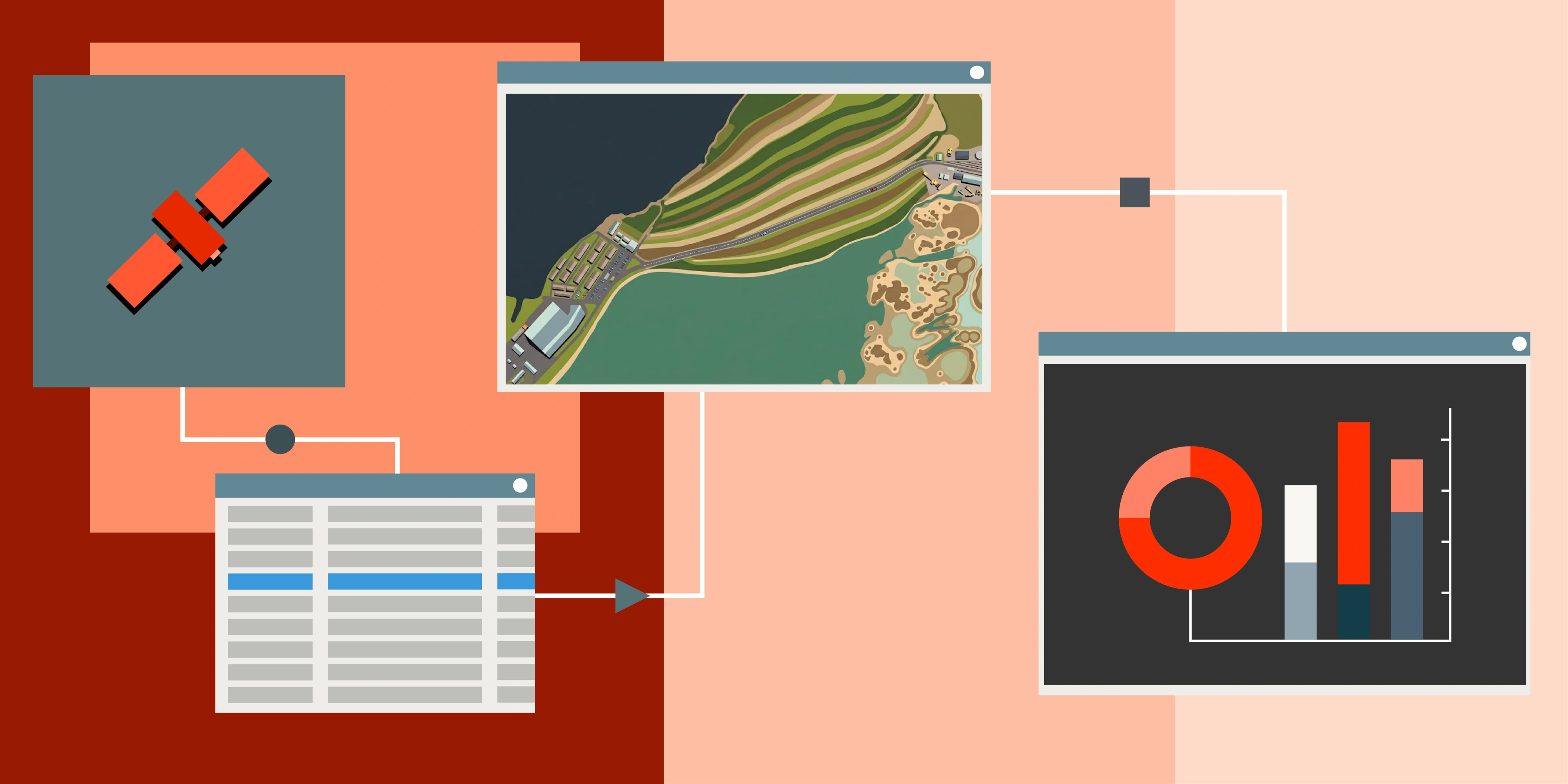
In this guide, we'll break down the different types of elevation models, explain how satellites capture them and show you exactly how industries are putting this data to work.
What is a Digital Elevation Model (DEM)?
A Digital Elevation Model (DEM) is a digital representation of the Earth's surface. It's essentially a grid of elevation values, where each pixel represents height at that location.
Under the DEM umbrella, there are two main types:
- DSM (Digital Surface Model)
- DTM (Digital Terrain Model)
They serve different purposes and allow for different insights to be gathered depending on the specific use case they are utilised for.
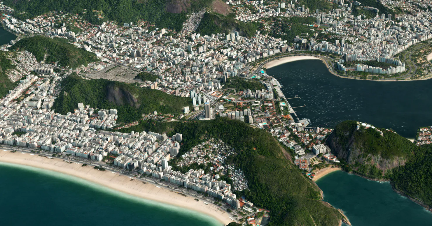
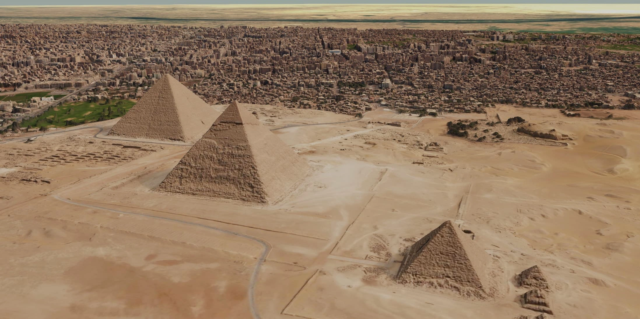
Digital Surface Model (DSM)
A DSM captures the top of everything visible from above. Trees, buildings, stockpiles, infrastructure - all of it.
Think of it as what a satellite "sees" when it looks straight down. It's the first surface that reflects the signal back.
DSM is ideal for:
- Estimating building and forest canopy height
- Digital Twins and urban planning
- Solar panel placement and shadow analysis
- Line-of-sight and telecommunications planning
Where does DSM data come from?
- With stereo satellite imagery, two images of the same area captured from different angles are compared, and software calculates elevation to generate a DSM
- With LiDAR, a sensor emits pulses of laser light and measures the return time to create a dense 3D point cloud, which is then converted into a DSM
Digital Terrain Model (DTM)
A DTM strips everything away. No trees. No buildings. No vegetation.
What's left is the bare earth - the actual terrain of the land beneath the features.
Getting a high quality DTM requires semi-automated processing and editing. The DSM elevation data needs to be filtered and classified to remove above-ground features. It's additional work but for many applications, it's essential.
DTM is ideal for:
- Flood and water modelling
- Cut and fill calculations
- Slope stability and grade assessment
- Mine pit design and planning
Where does DTM data come from?
- With stereo imagery, algorithms first generate a surface model and then semi-automatically filter out vegetation, buildings and other non-ground features to isolate the bare earth
- With LiDAR, the point cloud is classified into ground and non-ground returns and only the ground points are used to create the DTM
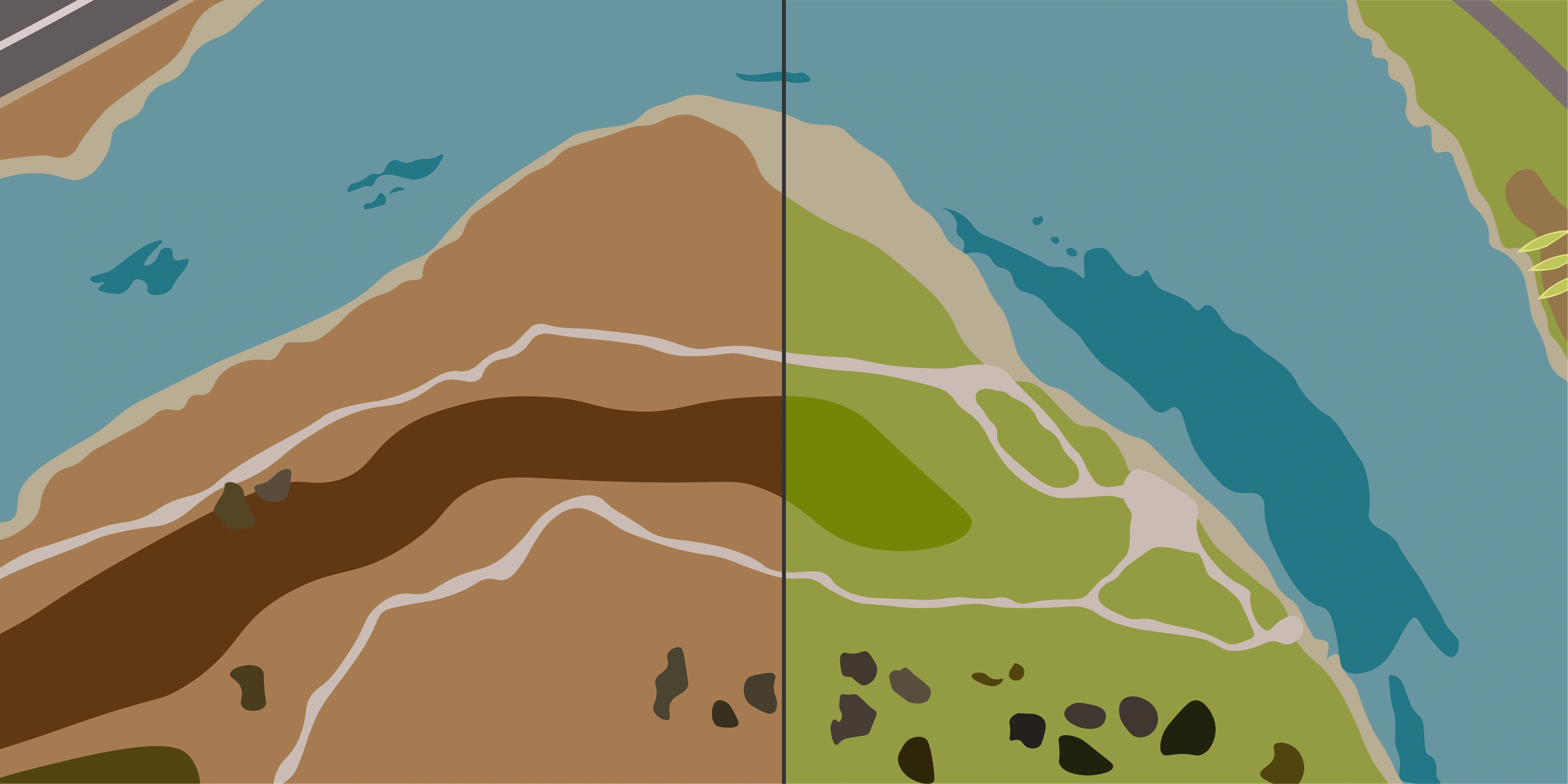
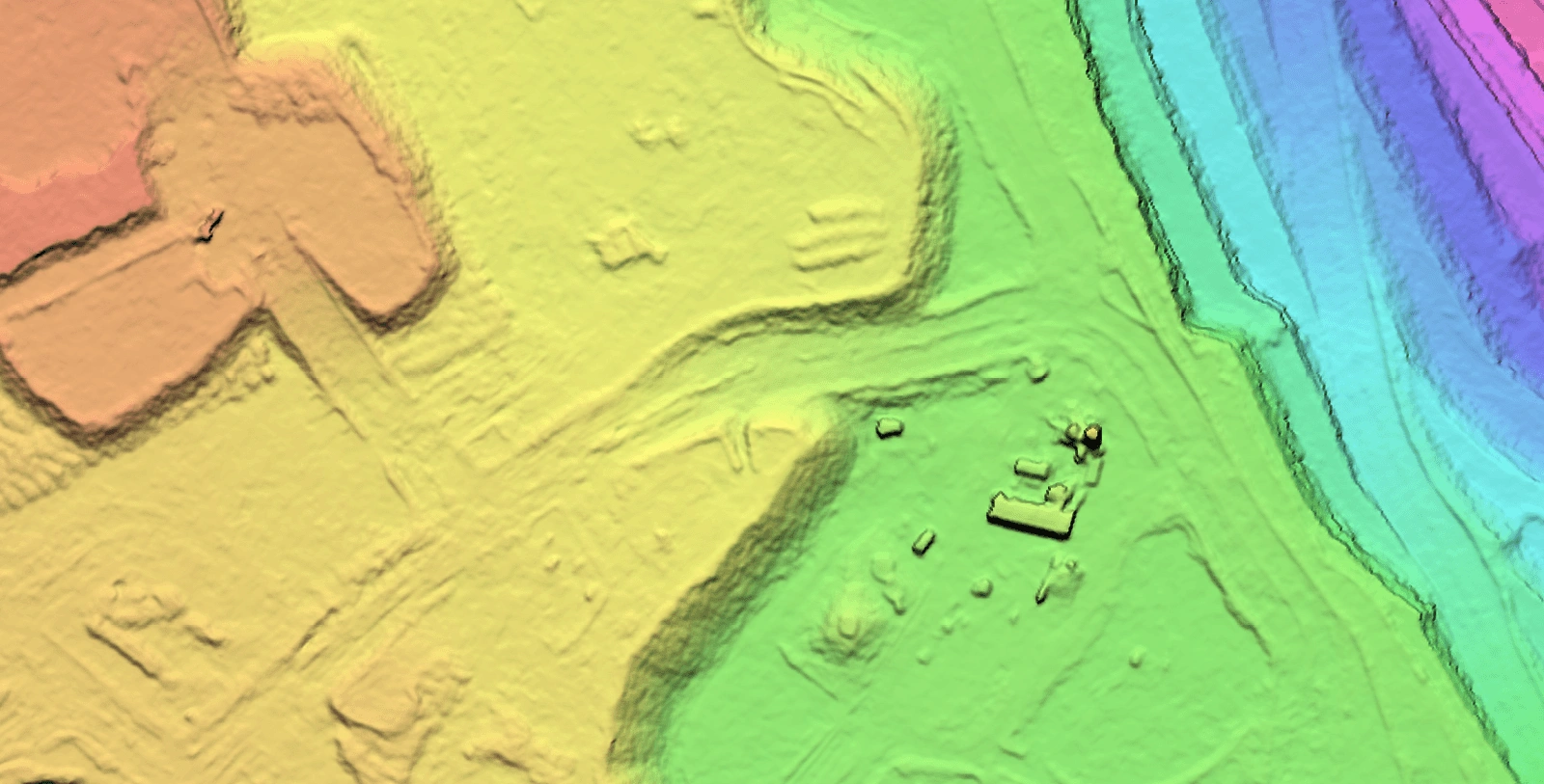
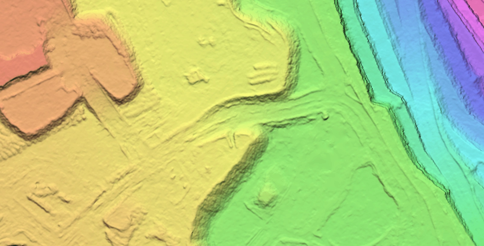
DSM vs DTM: Side by Side
The difference between DSM and DTM becomes clear when you compare them directly. In the example below, notice how the DSM captures buildings and infrastructure as elevated features, while the DTM shows only the underlying ground surface with those features removed.
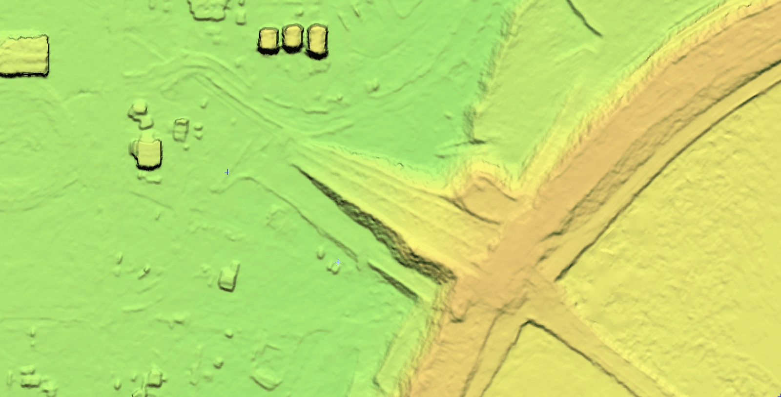
DSM (with buildings)
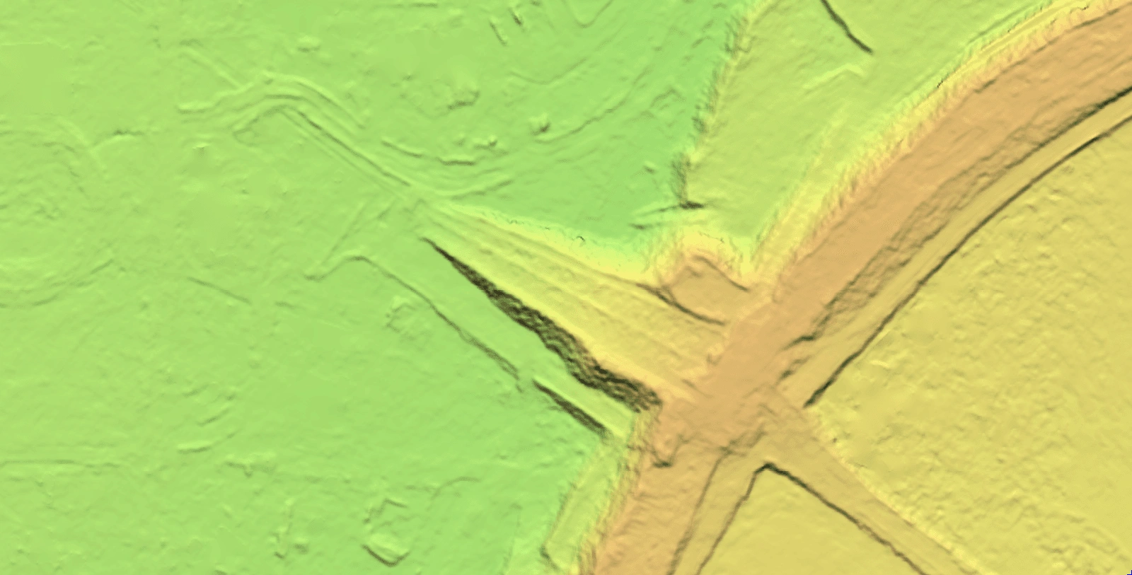
DTM (buildings removed)
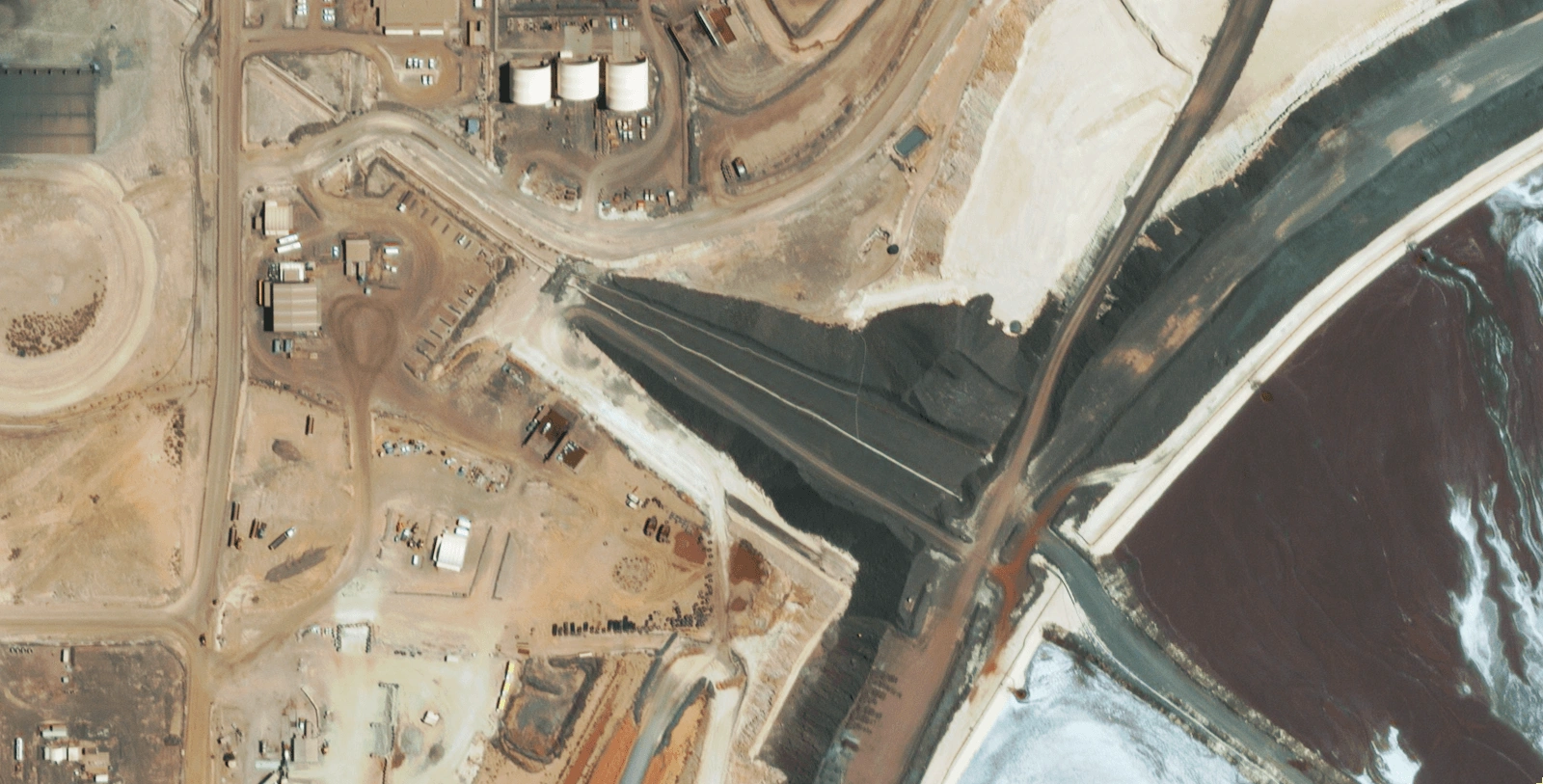
RGB Satellite Imagery
| Feature | DSM | DTM |
|---|---|---|
| Represents | Surface (ground + objects) | Bare ground only |
| Includes vegetation/buildings | Yes | No |
| Typical use cases | Urban planning, telecom, stockpiles, solar | Hydrology, earthworks, surface planning |
Why the Difference Matters
Choosing the wrong model can completely change your results.
Example 1: Flood modelling
Use a DSM and your model will show the flow of water diverting at a tree canopy or rooftop. A DTM reveals how water actually flows across the ground.
Example 2: Telecommunications planning
Here, you want the DSM. High-frequency 5G signals don't pass through walls and buildings - they bounce off them. The bare ground is irrelevant; it's the structures that matters.
The key is matching the model to the question you're trying to answer.
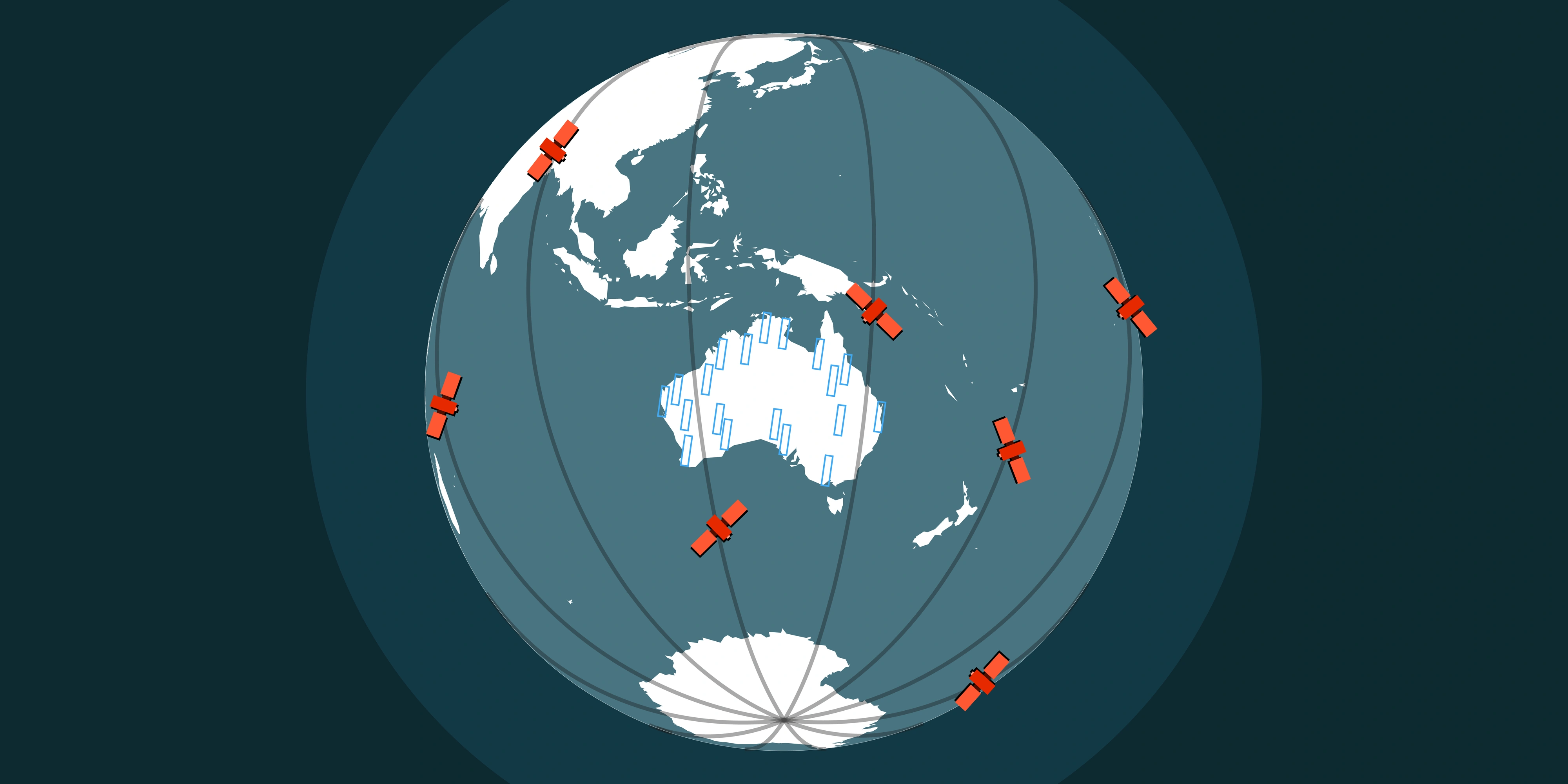
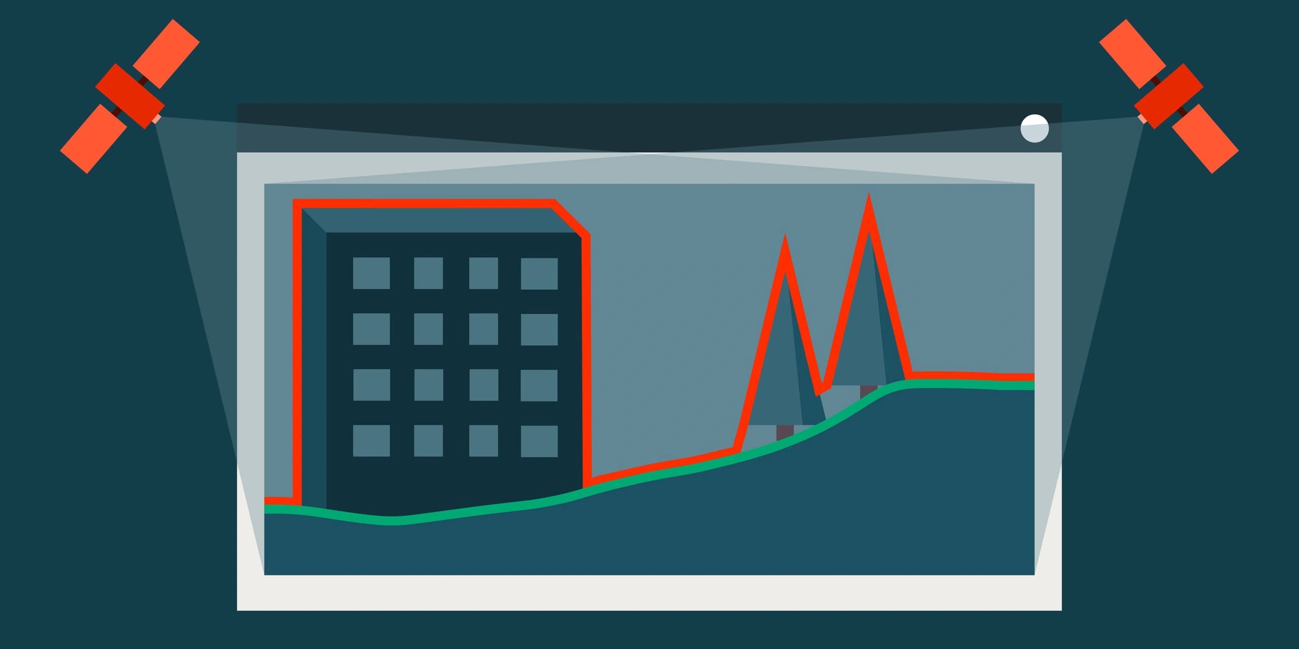
How Satellites Capture Elevation Data
Satellites don't measure elevation the same way a surveyor on the ground would. They use remote sensing techniques to extract 3D information from orbit.
Stereo Photogrammetry
This is how satellite-derived DEMs are created.
A satellite captures two images of the same area from different angles, typically in a single pass or on occasion separate orbits. Software then measures the parallax (the apparent shift of features between images) to calculate elevation.
It works the same way your eyes perceive depth. Two viewpoints, one 3D result.
High-resolution satellites like WorldView Legion can achieve 0.5–4m vertical accuracy without ground control, though accuracy improves significantly with control and can be less than 50cm. Using this method, DSMs or DTMs can be generated anywhere in the world, provided there are clear skies and reliable ground control data.
From Imagery to Elevation
The process involves several steps:
- Image acquisition - Stereo pairs are captured with sufficient overlap and appropriate base-to-height ratio for conversion to a DEM
- Ground control - Reference points tie the imagery to real-world coordinates to improve accuracy
- Matching and Elevation extraction - Photogrammetry software identifies corresponding features across both images and their heights to create a DSM
- Quality control and DEM editing - Results are checked and refined to remove erroneous data, with DTM editing if required
The quality of the final DEM depends on image resolution, terrain complexity and the skill of the team processing the data.
Resolution and Accuracy: What Do You Actually Need?
Not all elevation data is created equal. Resolution and accuracy vary widely depending on the source.
| Data Source | Resolution | Typical Vertical Accuracy | Availability |
|---|---|---|---|
| SRTM | 30m | ~10m | Free, global |
| Copernicus DEM | 30m / 90m | ~4m | Free, global |
| Commercial stereo | 0.5–2m | 0.5–4m | Tasked & Archive acquisition |
So what do you actually need? It depends on the application.
- Regional planning or feasibility studies? Freely available 30m DEM data (SRTM/AW3D30) often works well for this usecase
- Mine site access and design? You'll want sub-metre accuracy from custom acquisition
- Monitoring active operations? Recent data matters more than historical archives
The question isn't "what's the best resolution?" It's "what resolution answers my use case?"
How Industries Use Satellite-Derived Elevation Data
Here's where it gets practical. Across industries, organisations are using satellite-derived DEMs to make faster decisions, reduce costs and improve outcomes.
Mining and Resource Extraction
Elevation data helps to explain the entire process of the mining lifecycle. From exploration through to rehabilitation, terrain information drives critical decisions. Learn more about how satellite data supports each stage in our guide to leveraging satellite data across the mine lifecycle.
DSM (all surface features)
DTM (bare earth)
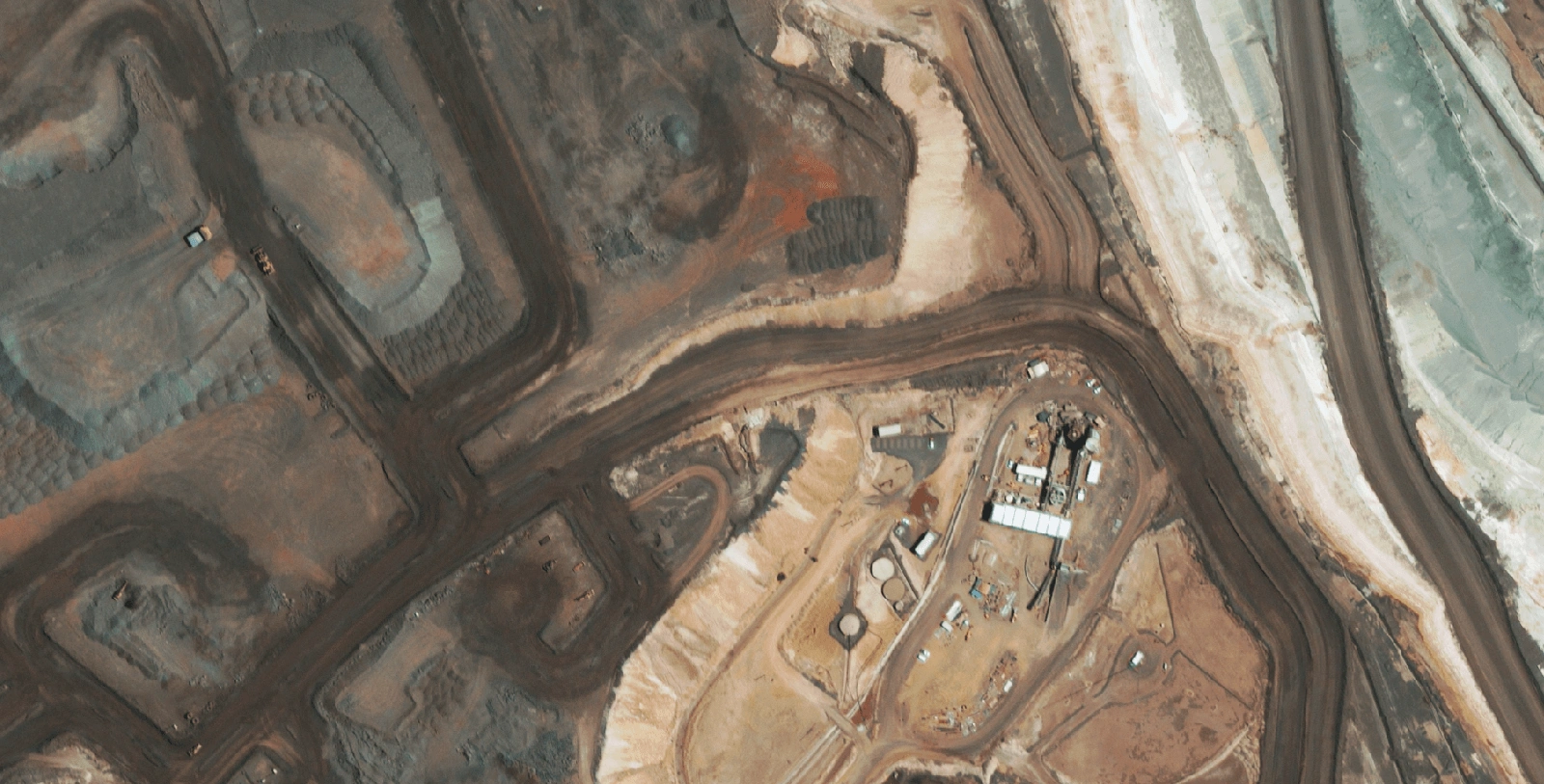
RGB Satellite Imagery
Cut and fill analysis is one of the highest-value applications. Accurate DTMs allow mining operations to calculate earthwork volumes, optimise material movement and plan extraction sequences with confidence.
Pit design and planning relies on detailed terrain models to calculate stripping ratios and design safe pit walls.

Rehabilitation planning requires understanding current conditions and target landforms. Elevation models support earthworks monitoring and track progress against rehabilitation milestones.
Geological interpretation can be enhanced with the use of a DTM to determine outcrops and geological formations visible within the elevation data.

Construction and Civil Engineering
Site selection becomes faster when you can analyse slope and access across multiple candidate locations without commissioning individual surveys. Best for determining potential sites especially when the areas of interest are both sparse and remote. Learn more about how we support infrastructure projects.
Progress monitoring tracks earthworks against schedule. Regular DEM capture gives you objective volume measurements, useful for haul road developments and remote site assessments.
Corridor planning for roads, railways, pipelines and transmission lines needs continuous elevation profiles. Satellite DEMs deliver that efficiently across long distances providing cost-effective elevation data for initial site or route planning.
Flood Risk and Water Management
Water flows downhill. That simple fact makes elevation data fundamental to hydrology. Whether supporting government agencies with regional planning or helping infrastructure teams assess drainage requirements, DEMs provide the foundation for understanding how water moves across the landscape.
High-level flood mapping relies on DEMs to identify at-risk areas across broad regions. By analysing terrain gradients and flow accumulation patterns, planners can pinpoint flood-prone zones and prioritise areas for further investigation without commissioning detailed site-specific surveys.
Watershed delineation uses elevation to define catchment boundaries automatically, helping authorities understand how water moves across the landscape and where downstream impacts are most likely.
For detailed dam design or precision drainage engineering, higher-accuracy data from ground surveys or LiDAR is typically required. But for regional risk assessment and early-stage planning, satellite-derived DEMs provide a cost-effective foundation.
Telecommunications and Network Planning
Telecommunications networks are critical infrastructure, and elevation data plays a key role in their planning and optimisation.
Line-of-sight analysis determines whether signals can travel between two points. But signals are not only affected by bare ground - they interact with trees, buildings and everything else in the way. DSMs provide a good baseline, particularly for remote regions and determining communication tower placement.
Microwave backhaul links require precise elevation profiles between towers. Fresnel zone calculations, which determine the clear area needed for reliable transmission, depend on knowing exactly what's between point A and point B.
Renewable Energy Development
Terrain influences renewable energy development. Satellite-derived elevation data supports energy projects from feasibility through to construction.
- Solar farms need slope and aspect analysis - optimal sites are relatively flat with the right orientation. Elevation models let you screen large areas quickly
- Wind resource assessment benefits from terrain analysis that identifies ridges, elevated areas, and locations where topography accelerates airflow
- Hydropower feasibility depends on head (elevation difference) and catchment size. Satellite DEMs support preliminary screening across broad areas
Environmental Monitoring
Elevation data supports a wide range of environmental applications.
- Habitat modelling uses terrain variables like slope, aspect and elevation to predict species distributions
- Glacier monitoring tracks ice volume changes over time using repeat elevation measurements
- Coastal vulnerability assessment combines DEMs with sea level rise projections to map areas at risk of inundation
Choosing the Right Elevation Data for Your Project
With so many options, how do you decide? Ask yourself these questions. For more guidance on selecting the right satellite data source, see our guide to the best sources of satellite imagery.
What accuracy do I actually need? If 5–10 metre accuracy meets your requirements, there's no reason to be paying for sub-metre data. But if you're doing detailed modelling or more precise calculations, accuracy matters.
How current does the data need to be? Most of the currently available free global datasets are over a decade old. If your site has changed through construction, mining or natural events, you will likely need a fresh capture.
What area am I covering? Small sites might be more efficiently captured by drone. Satellite data makes sense for larger areas, remote locations, or places that are difficult to access.
Which model type do I need? If you need surface details like buildings, trees and infrastructure included, choose a DSM. If you need the bare ground with above-ground features removed, a DTM is the right choice.
In Summary
DEMs, DSMs and DTMs are all representations of elevation, but they answer different questions.
- DSM: "What's the height of everything on the surface?"
- DTM: "What's the shape of the land beneath it?"
- DEM: The umbrella term covering both.
Together, they form the foundation for terrain analysis across industries - from mining and construction to site planning and telecommunications.
The data is more accessible than ever. The key is knowing which type you need and matching it to your application. For a comprehensive overview of the satellite imagery acquisition process, see our complete guide to buying satellite imagery.
Get that right, and elevation data becomes one of the most powerful tools in your analysis toolkit.
Want to find out how satellite-derived elevation data can support your projects? Our team can help you select the right elevation product for your specific requirements.