Loading...
Multi-Constellation Earth Observation
High-resolution optical and radar imagery from leading commercial constellations, unified through a single point of access.
Resolution
0.3m to 10m GSD
Sensor Types
Optical, SWIR, Radar, Hyperspectral
Coverage
Global
Access global coverage with consistent quality, predictable costs and rapid delivery - without the complexity and cost of coordinating aerial or ground crews.
0.3m
Identify individual assets, vehicles, and infrastructure features with very high resolution imagery. Sufficient detail for object detection, change analysis, and visual inspection across your operations.
Global
Capture imagery of any location worldwide including remote sites, restricted areas, and international operations - without flight permits, ground crews, or local coordination.
Daily
Monitor dynamic environments with revisit frequencies from intra-day to weekly. Build time-series datasets that reveal trends, detect anomalies, and track changes over time.
Multi-constellation tasking delivers imagery directly to your workflows - processed, georeferenced and ready for analysis.
We coordinate new tasking and pull historical archive imagery across multiple commercial and public constellations – a single point of contact for multi-sensor, optimal mix of resolution, cadence of capture and cost.
Terrabit offers both optical and radar products: customising solutions to fit your use case, we recommend the most suitable satellites by resolution, spectral bands, cloud tolerance, and deliverable formats.
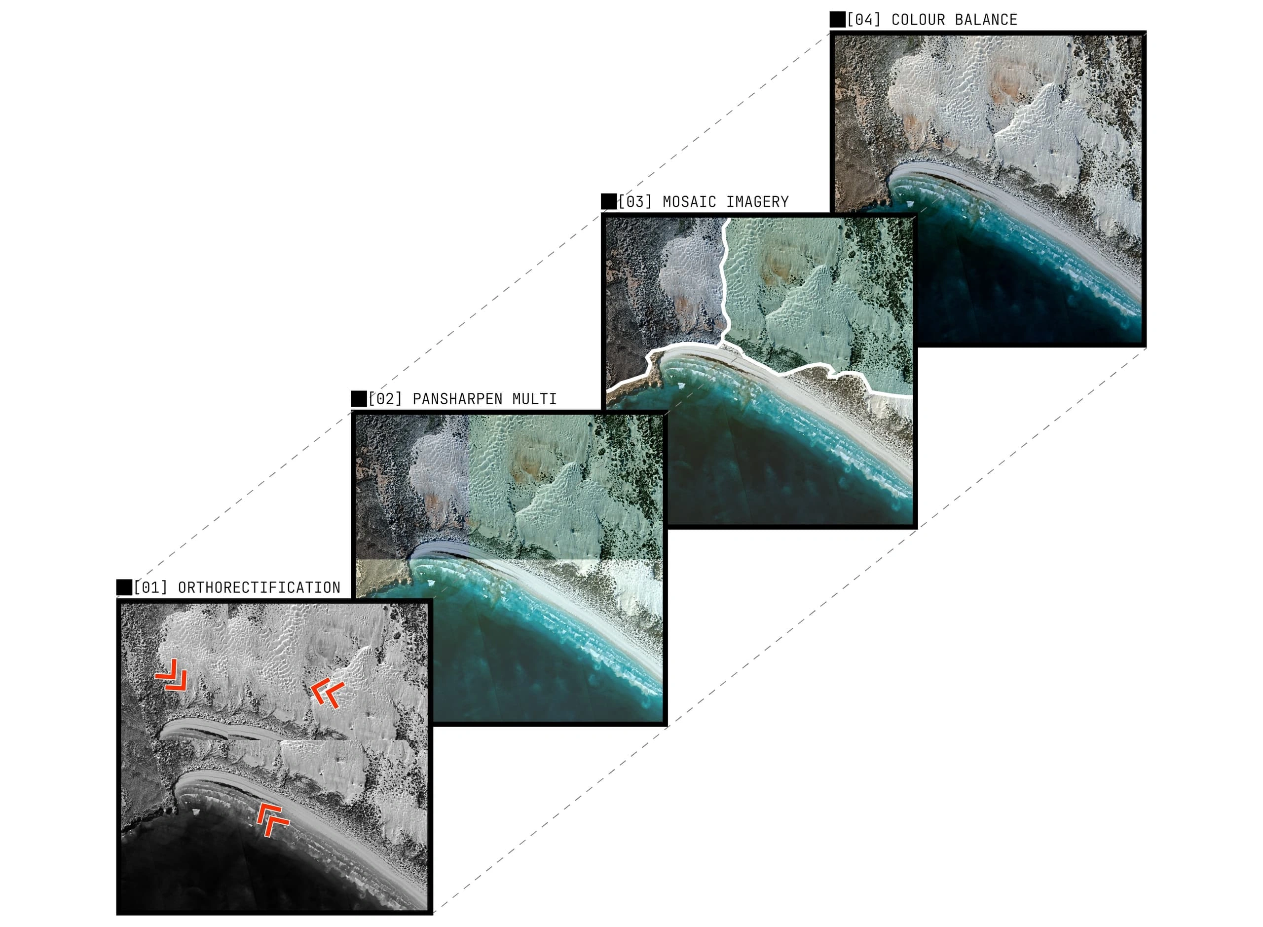
Raw pixels become analysis-ready data: orthorectification aligns data to existing layers, radiometric correction standardises multi-source inputs and mosaicking produces seamless area coverage.
Tailored deliverables for your GIS and analysis software. Our enterprise portal and image hosting allow you to quickly share purchased satellite data across your team and seamlessly integrate it into your existing operational software.
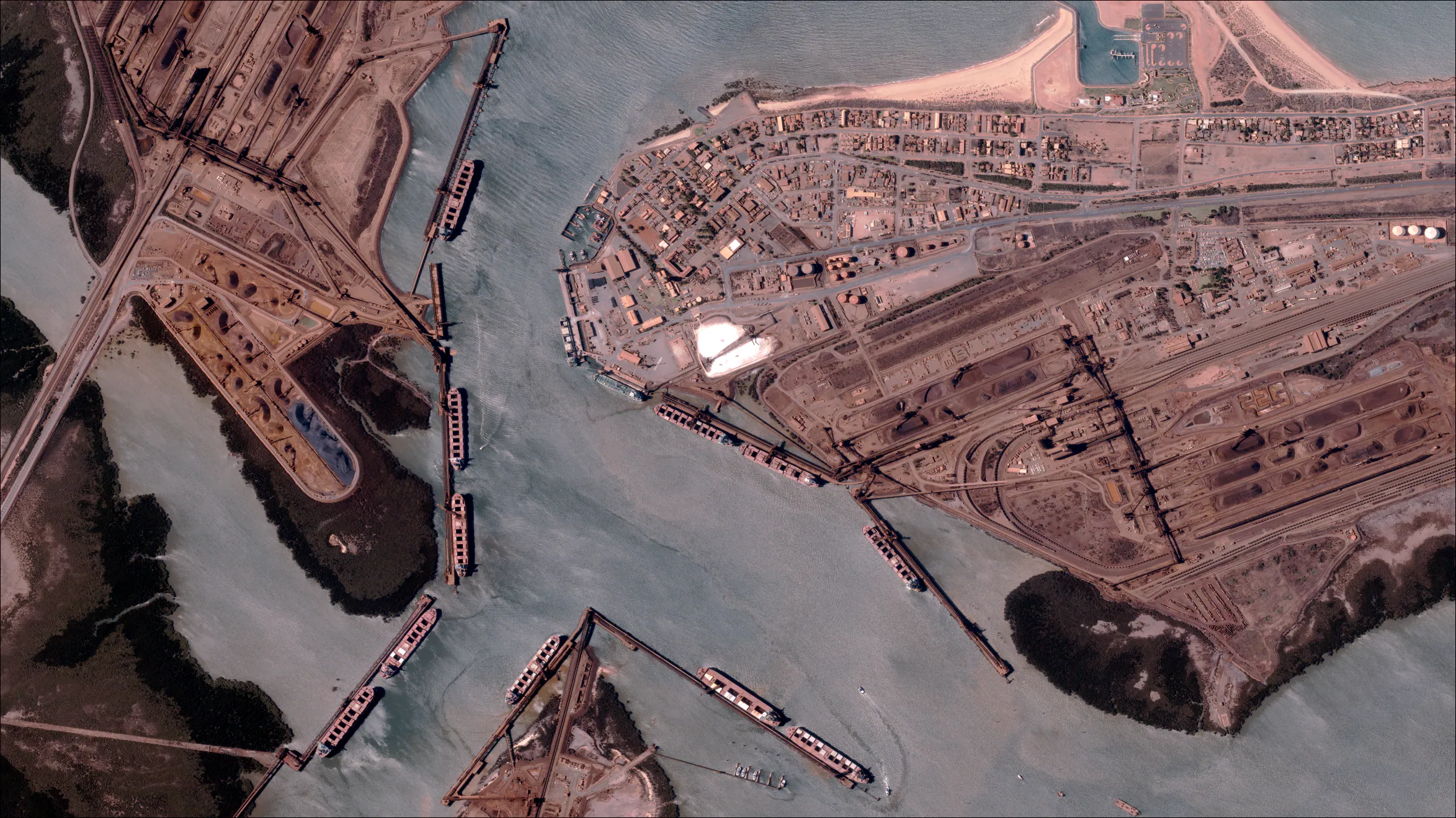
See how satellite imagery supports operational intelligence across mining, energy, infrastructure, and environmental monitoring-with examples from our commercial constellation partners.
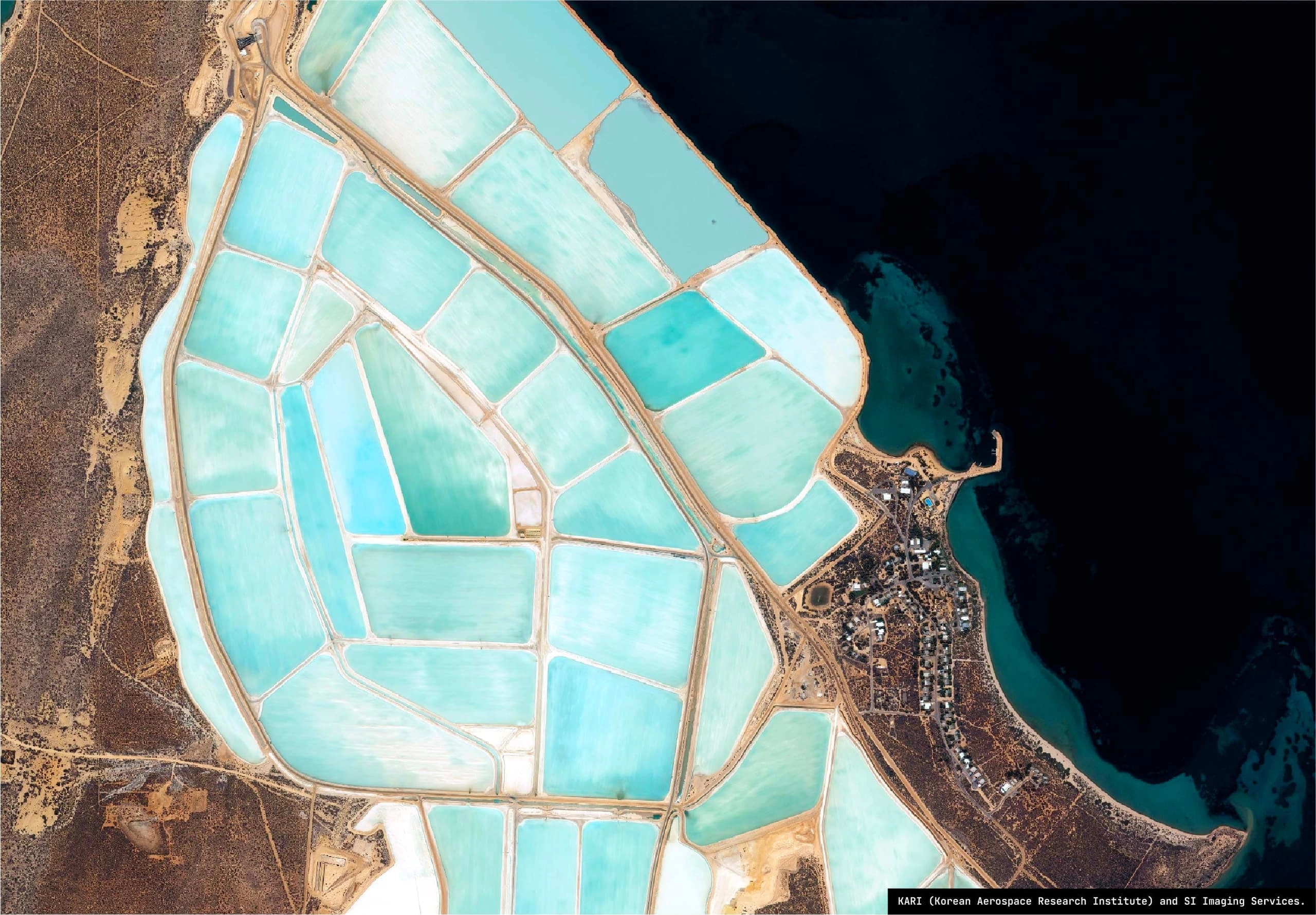
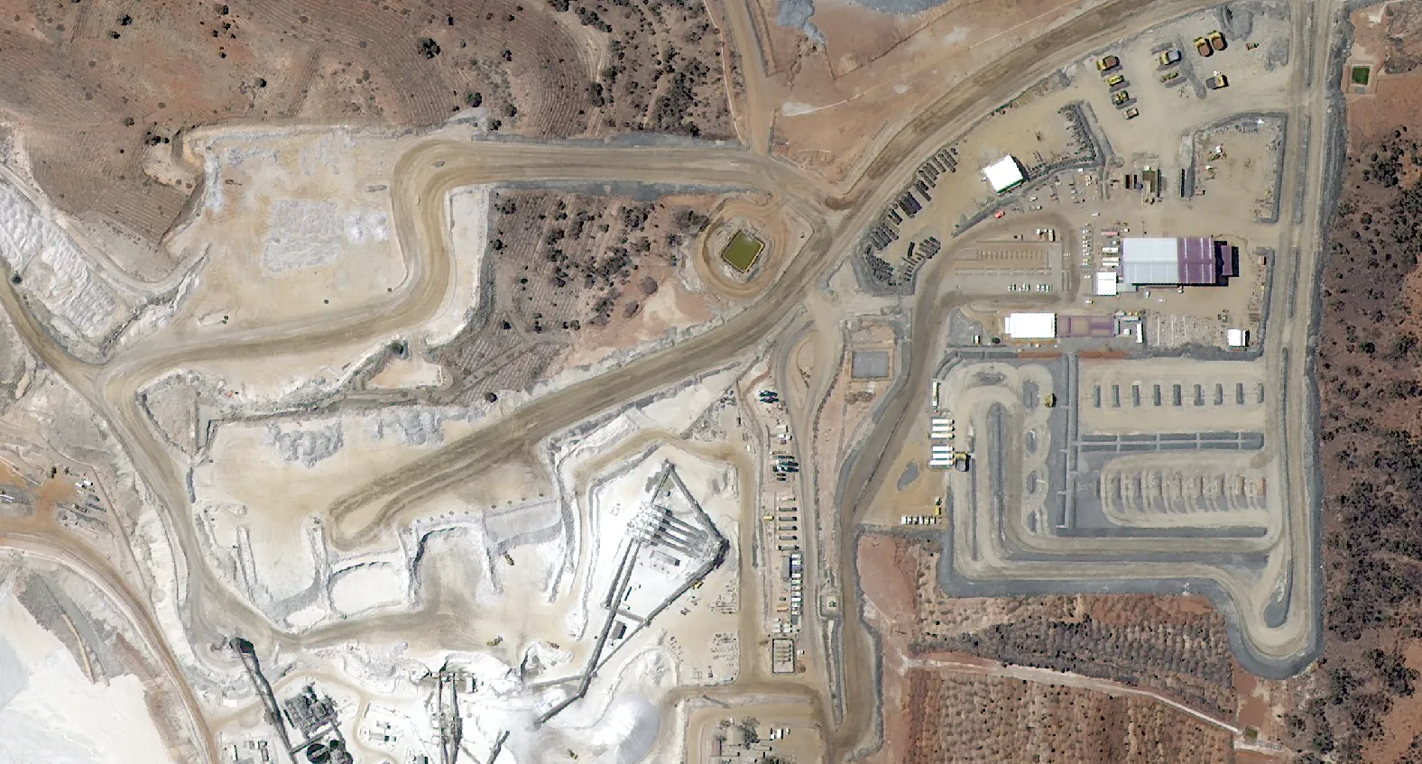
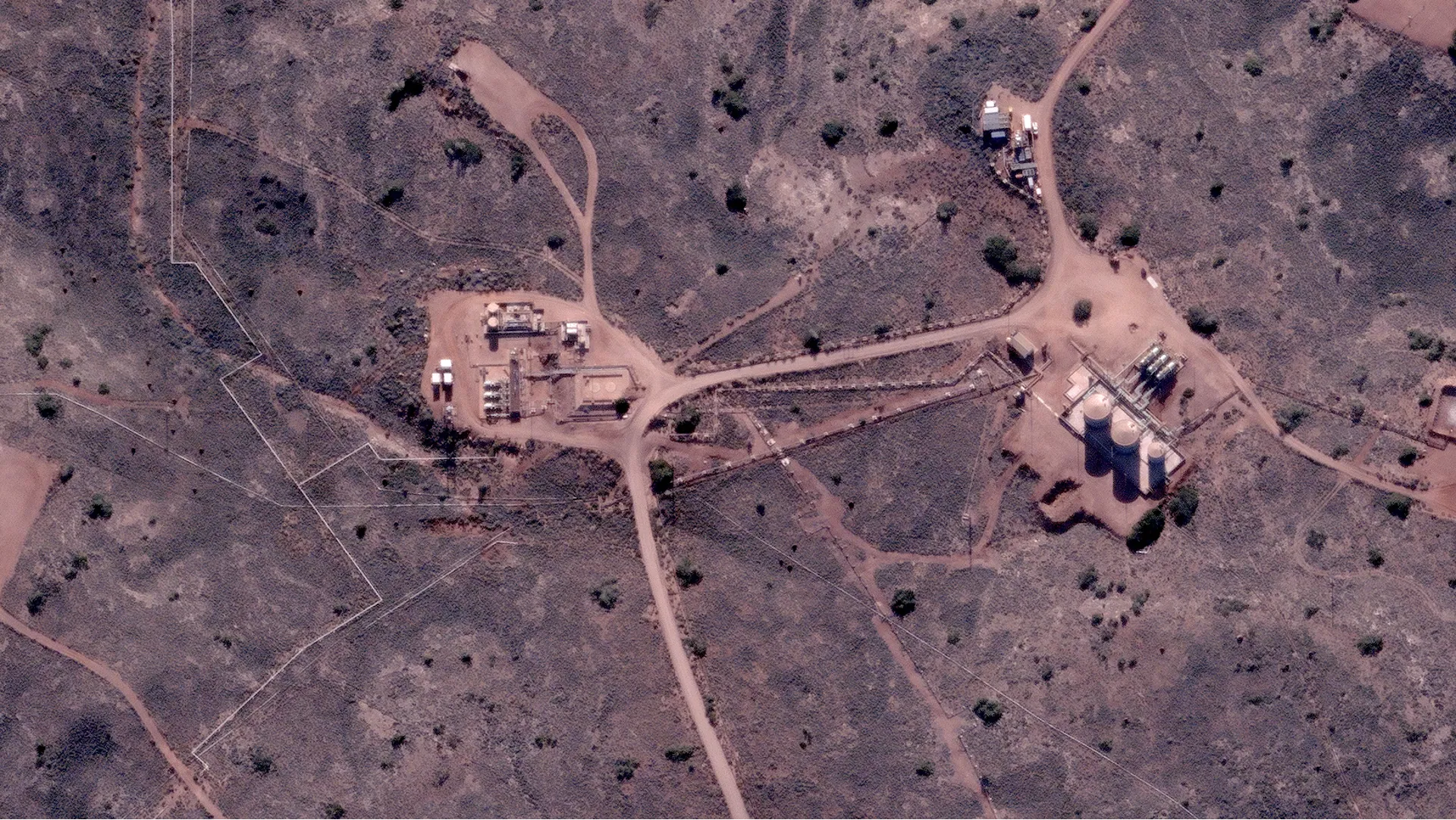
Monitor mine site operations, vegetation disturbance, assess haul road conditions and verify environmental compliance across remote locations.
Mine Site Operations
Fleet and plant level detail
Environmental Assessment
Downstream monitoring
Asset Tracking
Vehicle and equipment visibility
Inspect pipeline corridors, assess renewable energy sites, monitor offshore facilities and detect vegetation encroachment on power infrastructure.
LNG Facility Monitoring
Remote infrastructure inspection
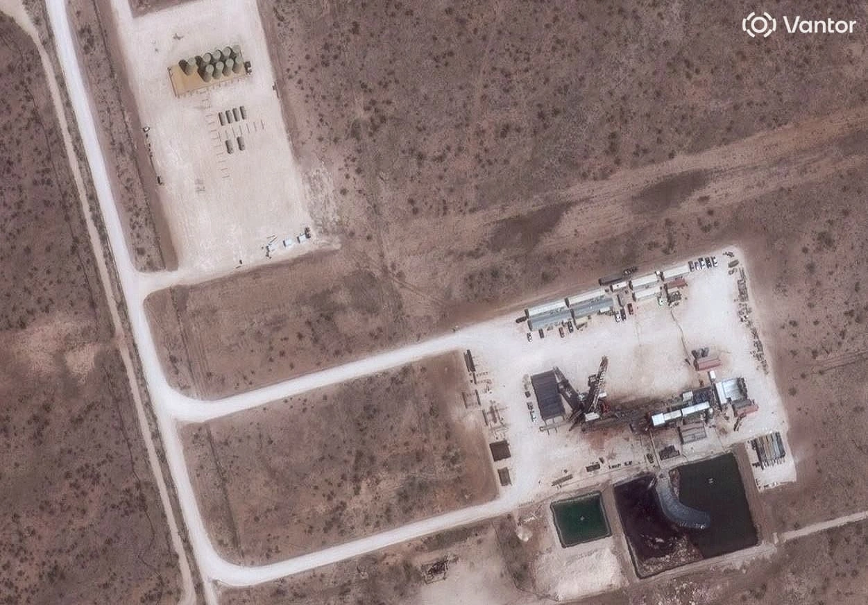
Wellpad Operations
Reduce site visits
Solar Farm Assessment
Renewable energy site planning
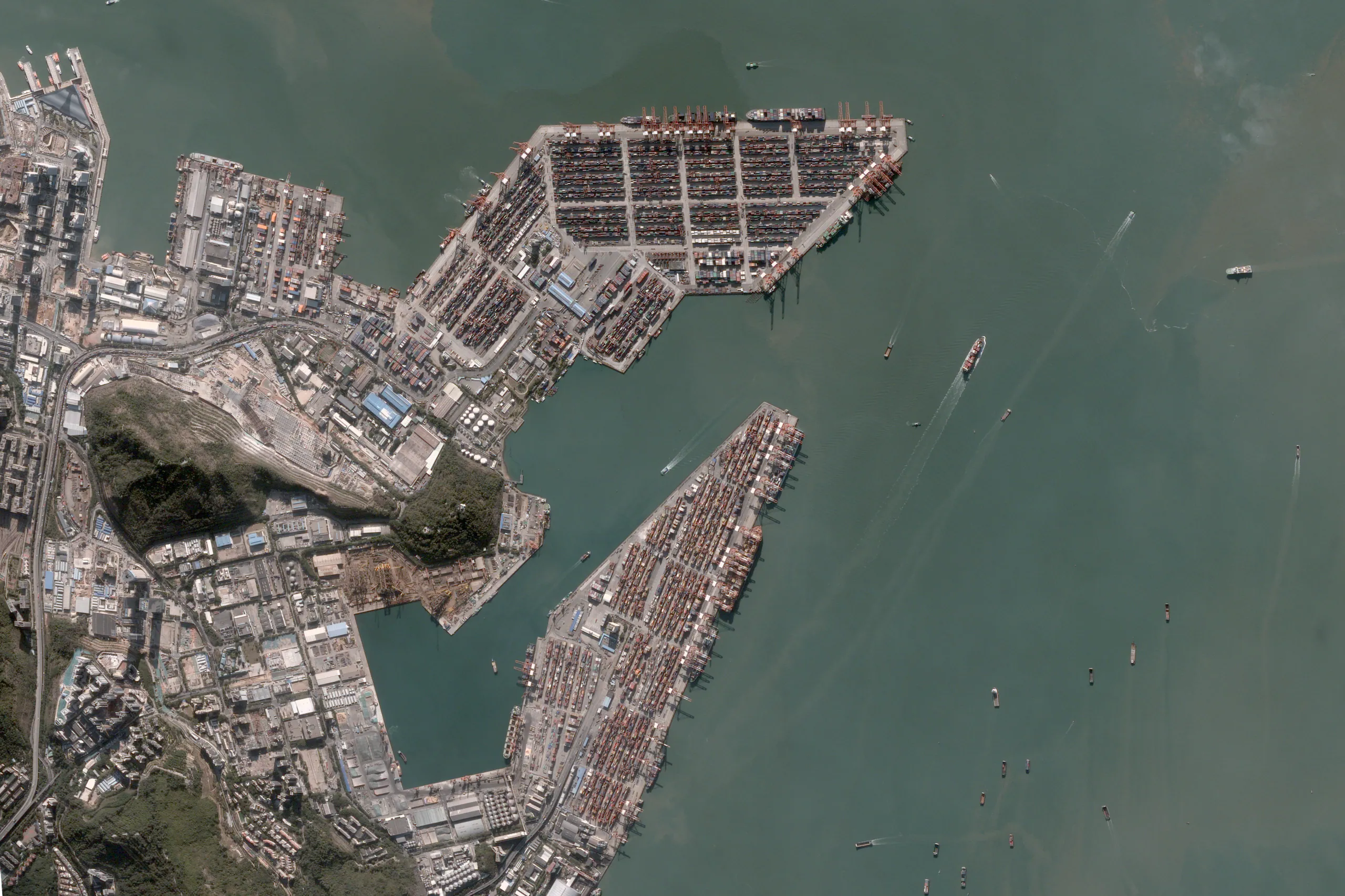
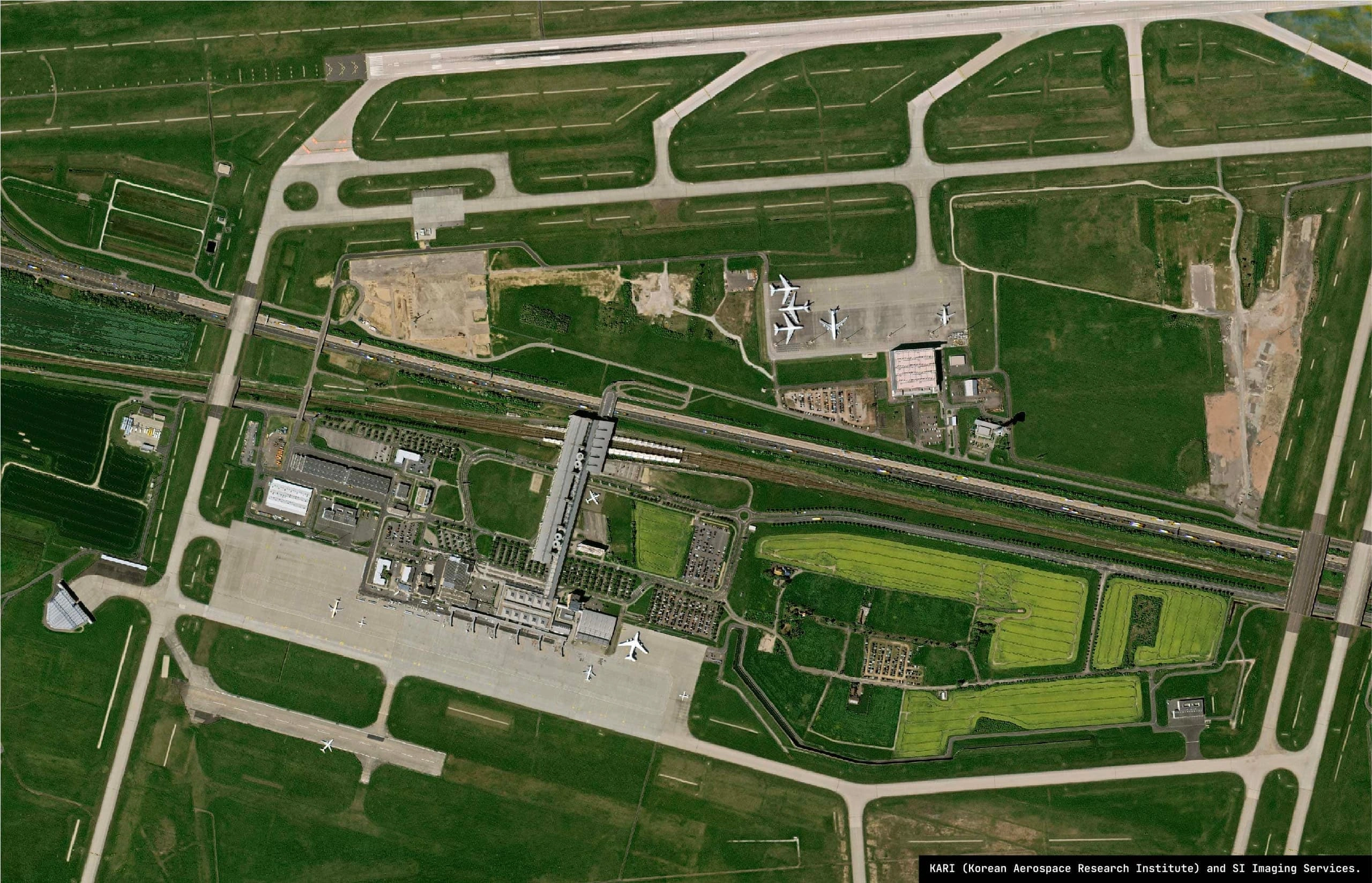
Track construction progress, monitor transport networks, assess port activity and document milestones across distributed sites.
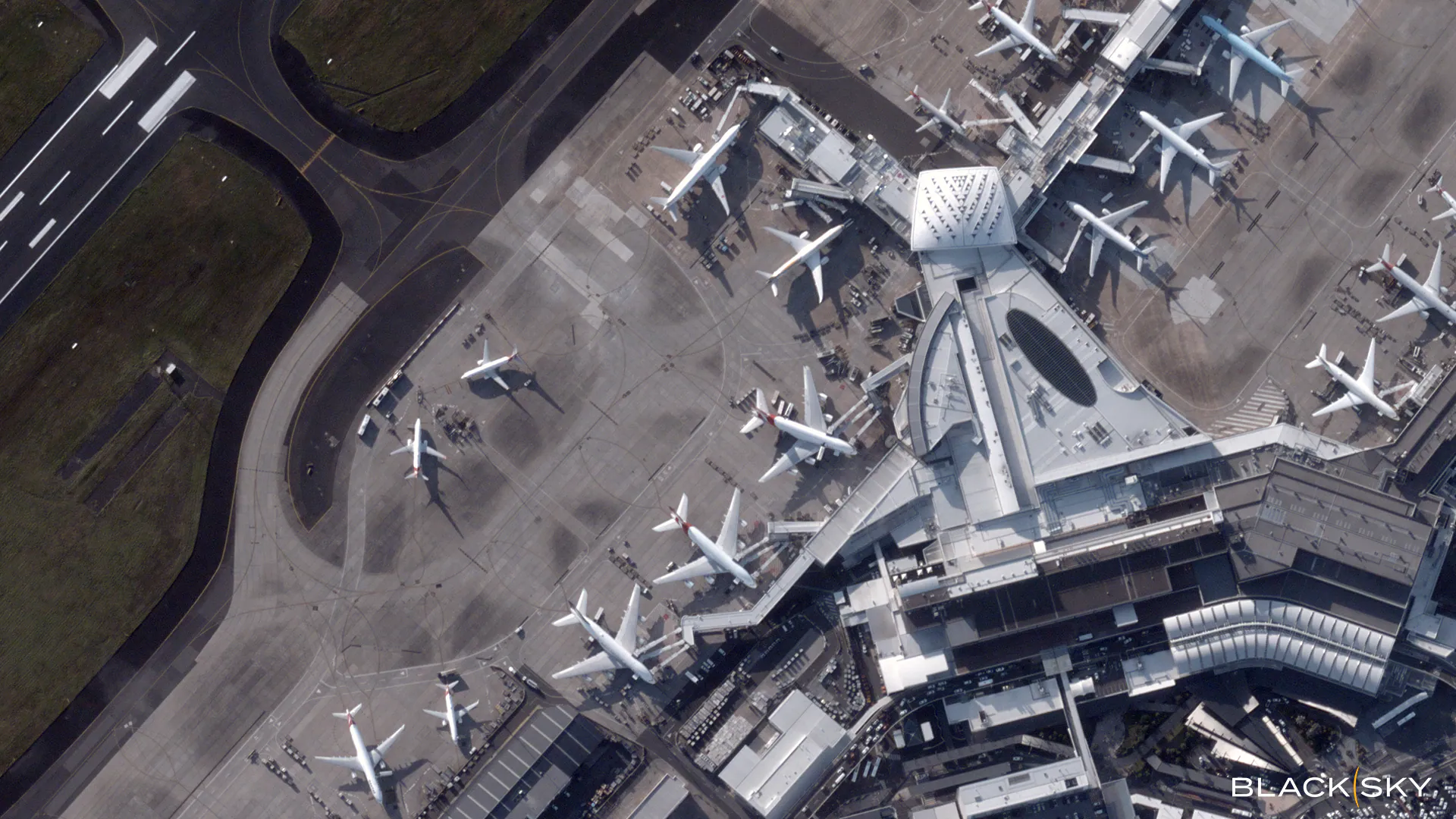
Airport Infrastructure
Transport hub monitoring
Port Activity
Supply chain visibility
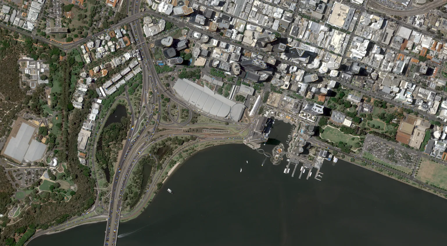
Urban Infrastructure
City and transport development
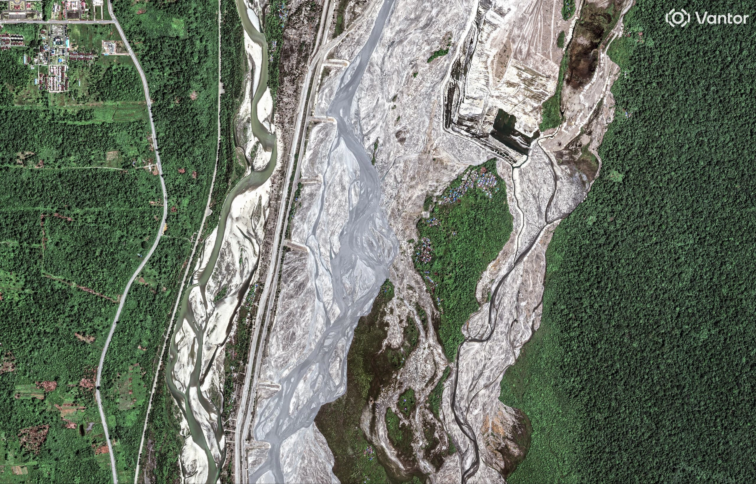
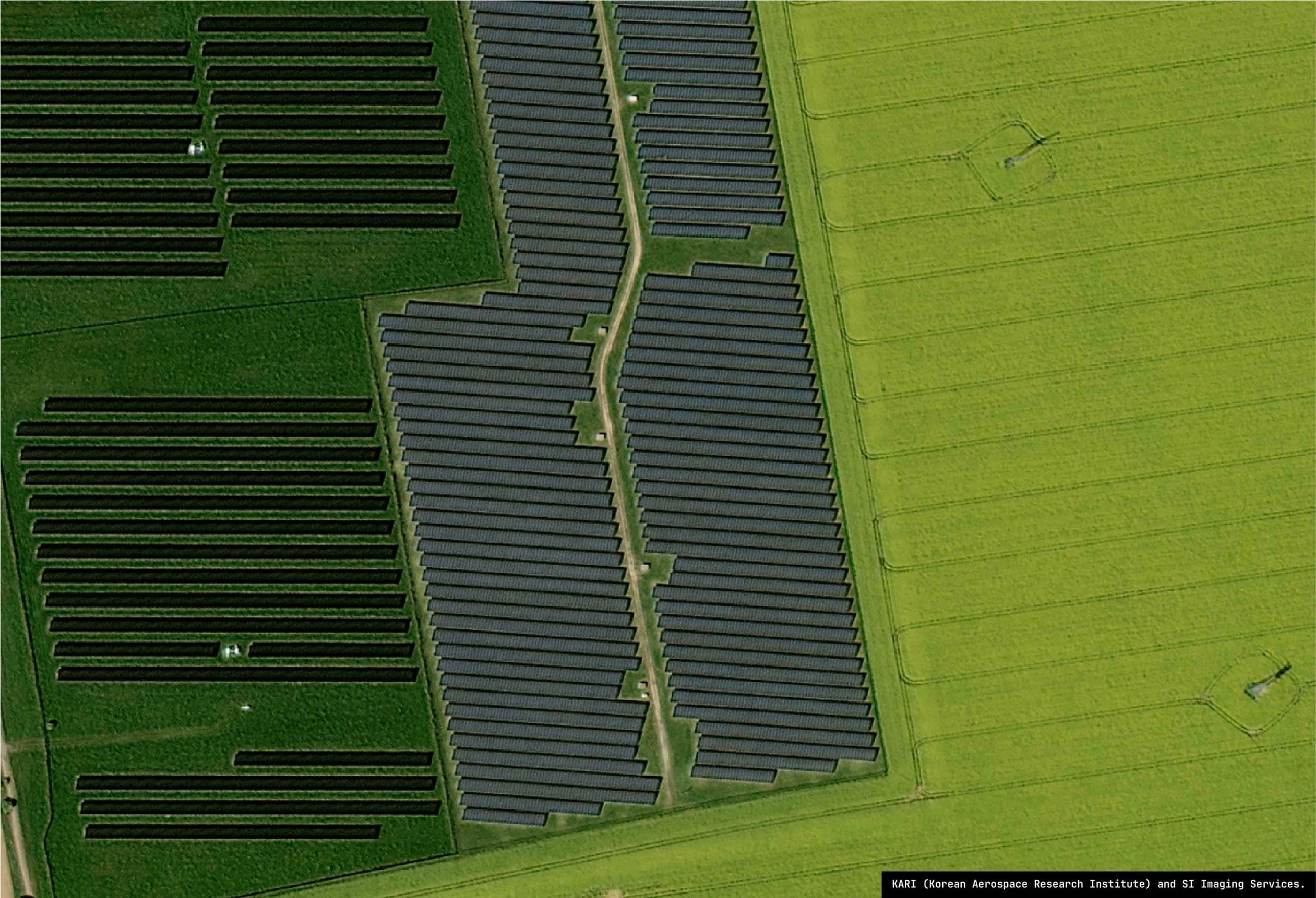
Track vegetation health, monitor land use change, assess carbon projects and support environmental compliance reporting.
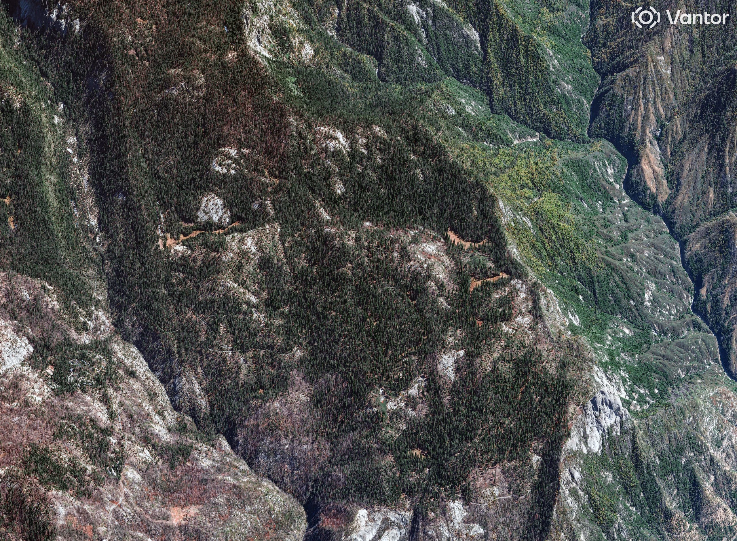
Forest Monitoring
Vegetation land use assessment
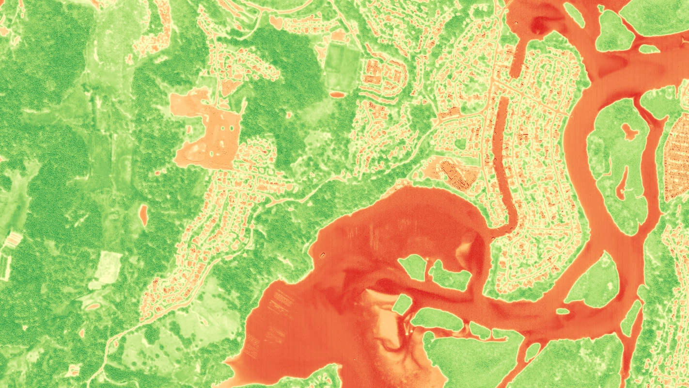
Vegetation Health
Ratios for spectral analysis
Order, manage and access satellite imagery through a single enterprise platform built for operational teams.
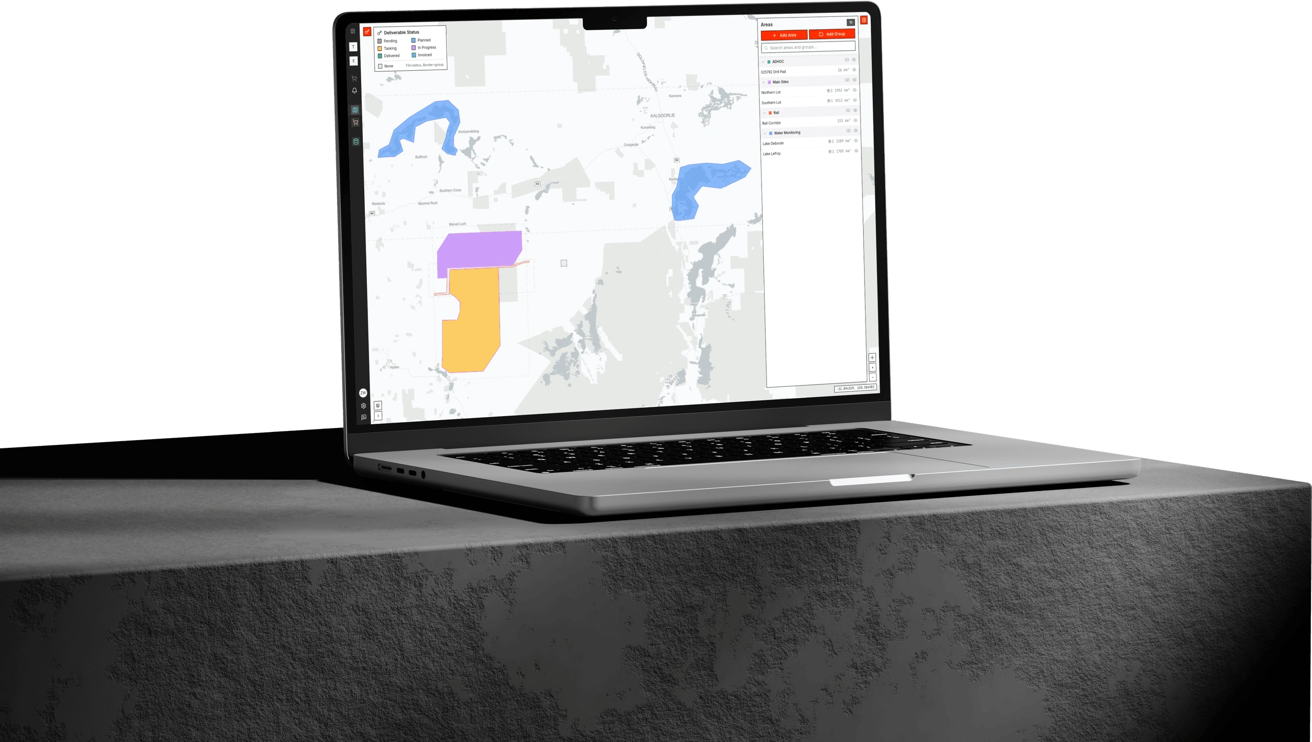
Search archives, submit tasking requests and track acquisitions from a unified dashboard. Stream imagery directly to your GIS tools, manage team access with enterprise controls and maintain full visibility over your data - from order to delivery.
Unified priority tasking, processing and delivery across leading commercial and public providers – see the live satellites we can task today.


Common questions about purchasing and using commercial satellite imagery for business applications.
Purchasing satellite imagery through Terrabit is straightforward. Define your area of interest, select your preferred resolution and spectral bands, then choose between archive imagery (historical captures) or tasking a new acquisition. Our team handles coordination across multiple satellite constellations to deliver the optimal imagery for your project. Contact us with your requirements for a tailored quote.
We offer satellite imagery ranging from 0.3m (30cm) to 10m ground sample distance (GSD). Very high resolution imagery (0.3m-0.5m) is ideal for detailed asset inspection and object identification. High resolution (1m-2m) suits monitoring and change detection. Medium resolution (5m-10m) works well for regional analysis and vegetation indices over large areas.
Satellite imagery captures Earth from orbit (400-800km altitude), offering broader coverage, consistent revisit schedules, and access to remote or restricted areas without permits. Aerial photography from aircraft or drones provides higher resolution (sub-10cm) but requires flight planning, permits, and weather windows. Satellites are better for large-area monitoring while aerial excels at detailed local surveys.
Revisit frequency depends on the constellation. Some satellites offer intra-day revisits (multiple times per day) for rapid monitoring, while others provide 2-3 day cycles. For most commercial applications, we can coordinate captures to match your monitoring requirements-from daily crisis response to monthly operational tracking.
Archive imagery refers to existing captures stored in satellite operators, ideal for when you need historical data or can accept recent imagery. Tasking means scheduling a new satellite acquisition specifically for your area of interest - essential for when you need current conditions, specific viewing angles, or precise timing. Archive is more cost-effective; tasking ensures you have up to date imagery.
Our satellite partners provide panchromatic (black and white, highest resolution), multispectral (RGB + near-infrared for vegetation analysis), SWIR (short-wave infrared for mineral and moisture detection), and SAR (radar that penetrates clouds and works at night). Hyperspectral options with 20+ bands are available for advanced material identification.
Imagery is delivered in industry-standard formats (Cloud Optimized GeoTIFF, ECW) compatible with all major GIS platforms. We provide orthorectified, georeferenced products in your preferred coordinate system. Delivery options include secure cloud hosting with streaming access or direct download links or custom delivery pipelines for automated workflows.
Mining and resources companies use it for stockpile monitoring, site progress tracking, and environmental compliance. Agriculture and forestry operations monitor crop health, land management, and carbon projects. Infrastructure and construction teams track project progress and asset conditions. Energy utilities assess pipelines, solar installations, and vegetation encroachment. Government agencies apply it across defense, disaster response, and urban planning.
Modern commercial satellite imagery achieves horizontal accuracy of 2-5 meters CE90 without ground control points. With ground control integration, accuracy improves to sub-meter levels. Vertical accuracy for stereo-derived elevation products ranges from ±1m to ±5m depending on terrain and source imagery. Accuracy specifications are provided with each delivery.
Optical satellite imagery cannot penetrate clouds-cloud cover is the primary limitation for optical sensors. However, Synthetic Aperture Radar (SAR) satellites use microwave signals that pass through clouds, smoke, and darkness, enabling all-weather, day-and-night imaging. We recommend SAR for tropical regions with persistent cloud cover or for applications requiring guaranteed capture windows.
Minimum order sizes vary by satellite operator and product type. Archive imagery typically has minimums around 25-100 km². Tasking orders usually require larger commitments due to satellite scheduling constraints. For small areas, we can often include your site within a larger collection window. Contact us with your area of interest for specific pricing.
New tasking acquisitions depend on satellite availability, weather conditions, and priority level - standard tasking takes 2-4 weeks, while priority tasking can achieve capture within days. Archive imagery delivery typically takes less than 1 business days. Processing and delivery adds 2-5 business days after acquisition.
Have a collection challenge, time to capture requirement or custom monitoring workflow in mind? Start a conversation with our team to explore tasking options, delivery integrations, and pricing tailored to your mission.


