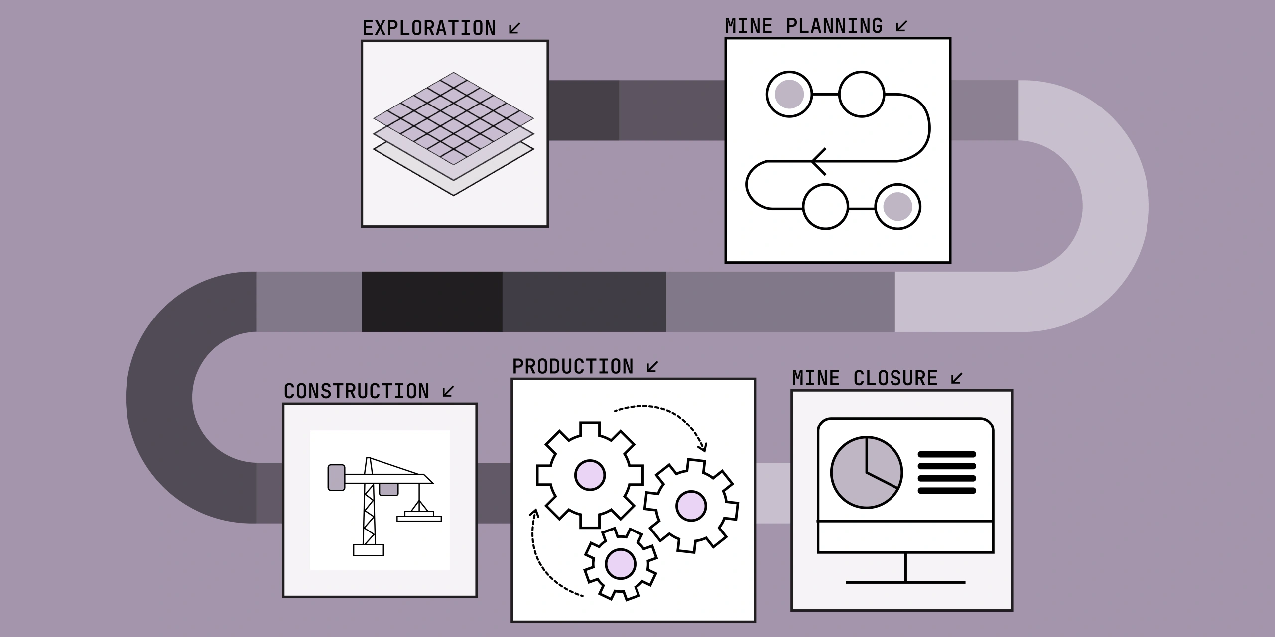
Satellite data is a core asset in the mining industry. From early exploration to post‑closure rehabilitation, satellite imagery offers a reliable, cost‑effective and scalable way to monitor and manage mining operations.
1. Exploration: Smarter Targeting with Remote Sensing
In the early stages, satellite data enables broad‑area assessment of geological conditions before committing to costly field surveys.
Key Uses:
- Multispectral and hyperspectral data to identify surface mineralogy
- High‑resolution basemaps to identify outcrops and context
- Digital Elevation Models for access planning and infrastructure design
- Historical imagery to analyse previous exploration and mining activity
Outcomes:
- Reduced field costs and on‑ground risks
- Faster site prioritisation
- Data‑driven target selection
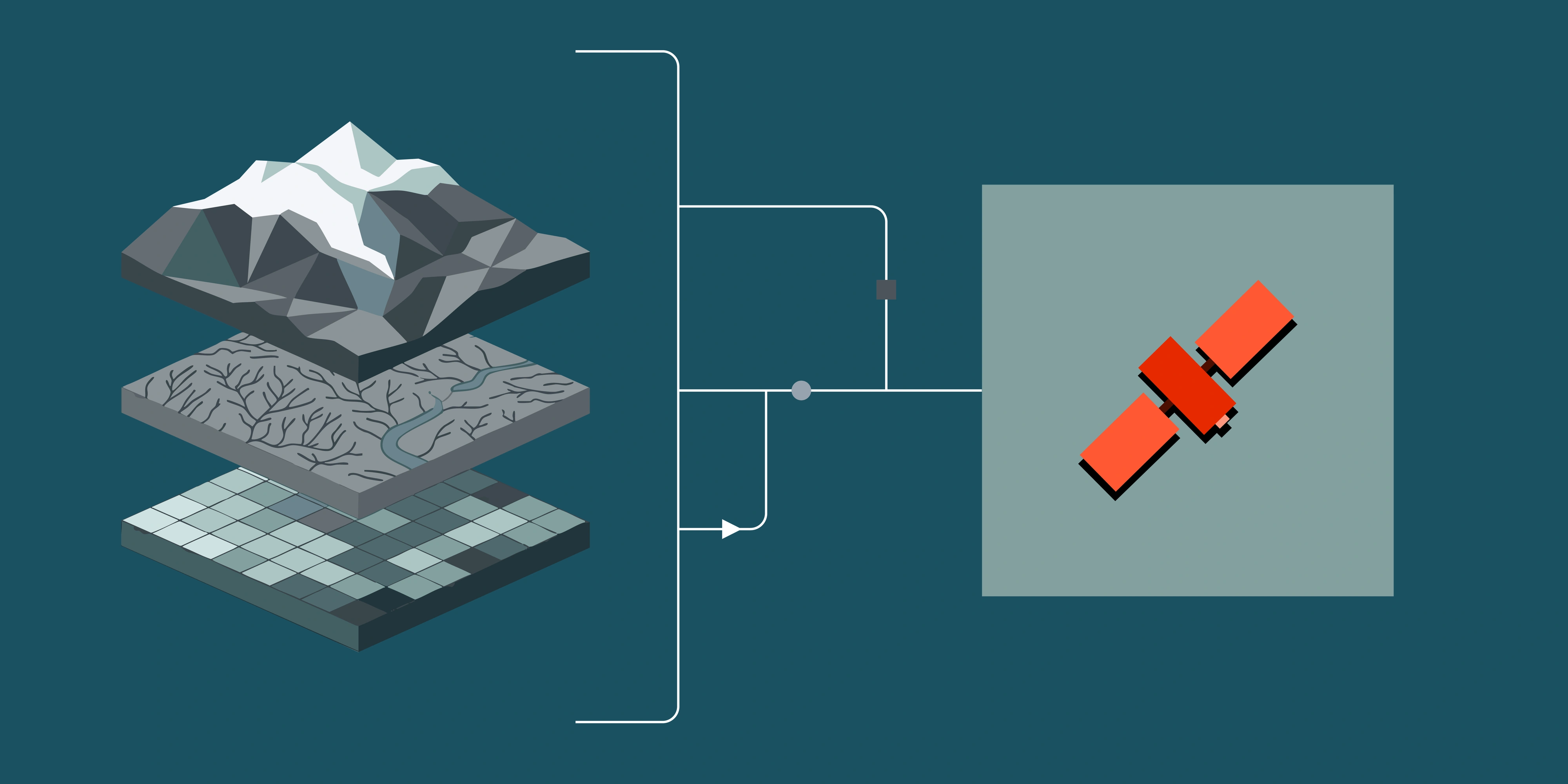
2. Site Planning: DEMs, Basemaps and Constraints for Design
Before ground is broken, satellite data reduces uncertainty and accelerates design iterations by providing consistent, current context over the full area of interest.
Key uses:
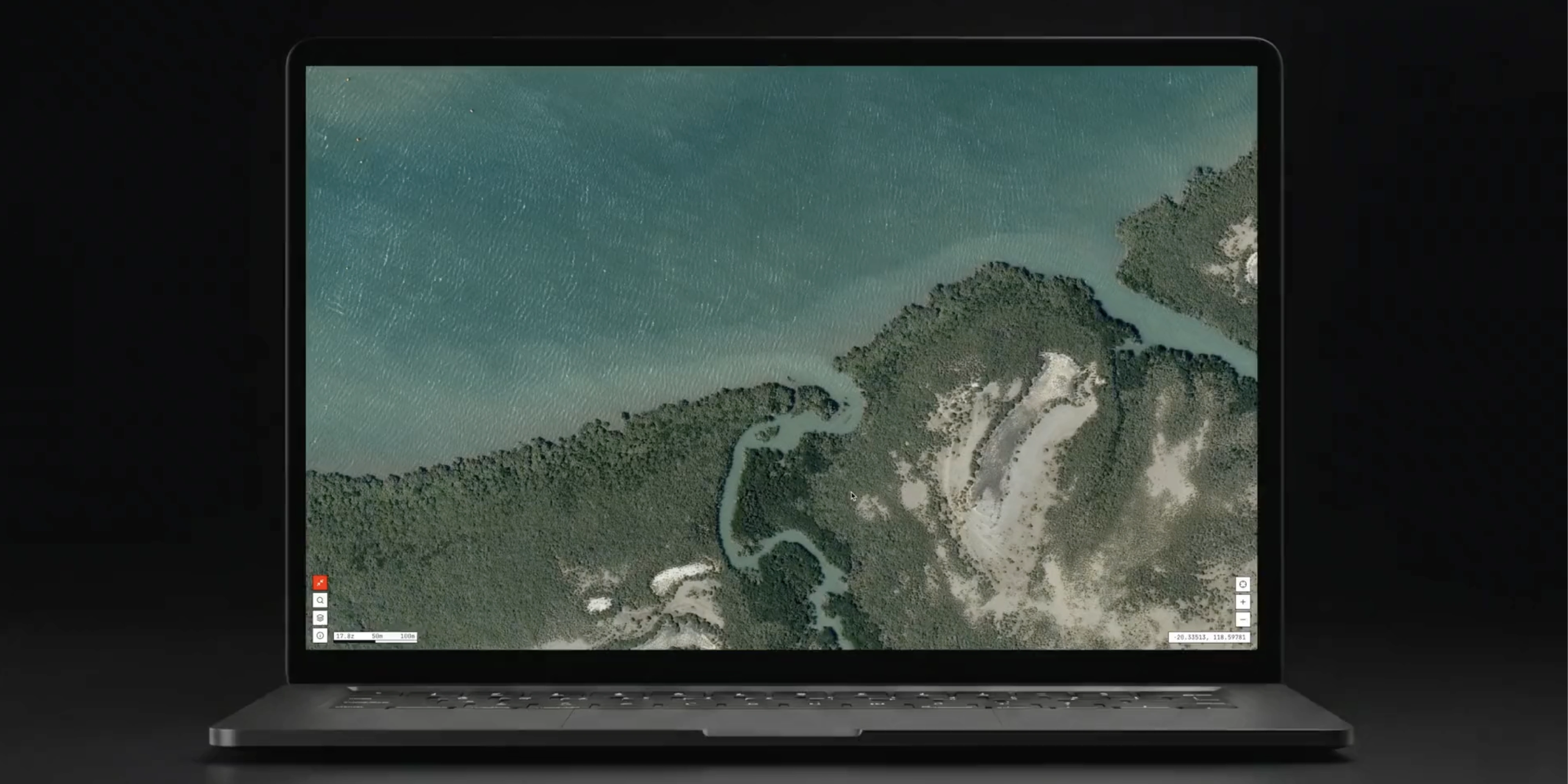
- High‑resolution basemaps (30–50cm) to plan the layout of pits, waste dumps, ROM pads, haul roads and tailings facilities with real‑world context.
- Digital Elevation Models (DEM/DSM) derived from stereo/tri‑stereo optical captures to support drainage design, slope classification, catchment analysis and tailings wall planning.
- Corridor routing and access planning for roads, pipelines and power-identify constraints early (steep slopes, wetlands, riparian buffers, land tenure and easements).
- Viewshed/line‑of‑sight and shadow analysis for communications, surveillance and blast exclusion zones.
- Hydrology and surface water mapping to locate ephemeral channels, floodplains and potential water‑logging risks for pads and roads.
- Environmental and heritage constraints using time‑series to confirm baseline vegetation extent and sensitive habitat proximity for approvals.
Recommended data: very high‑resolution optical, recent DEM/DSM, historical imagery for baselines.
Outcomes: fewer redesign loops, lower on‑ground survey time, earlier risk discovery and a clear, auditable planning baseline.
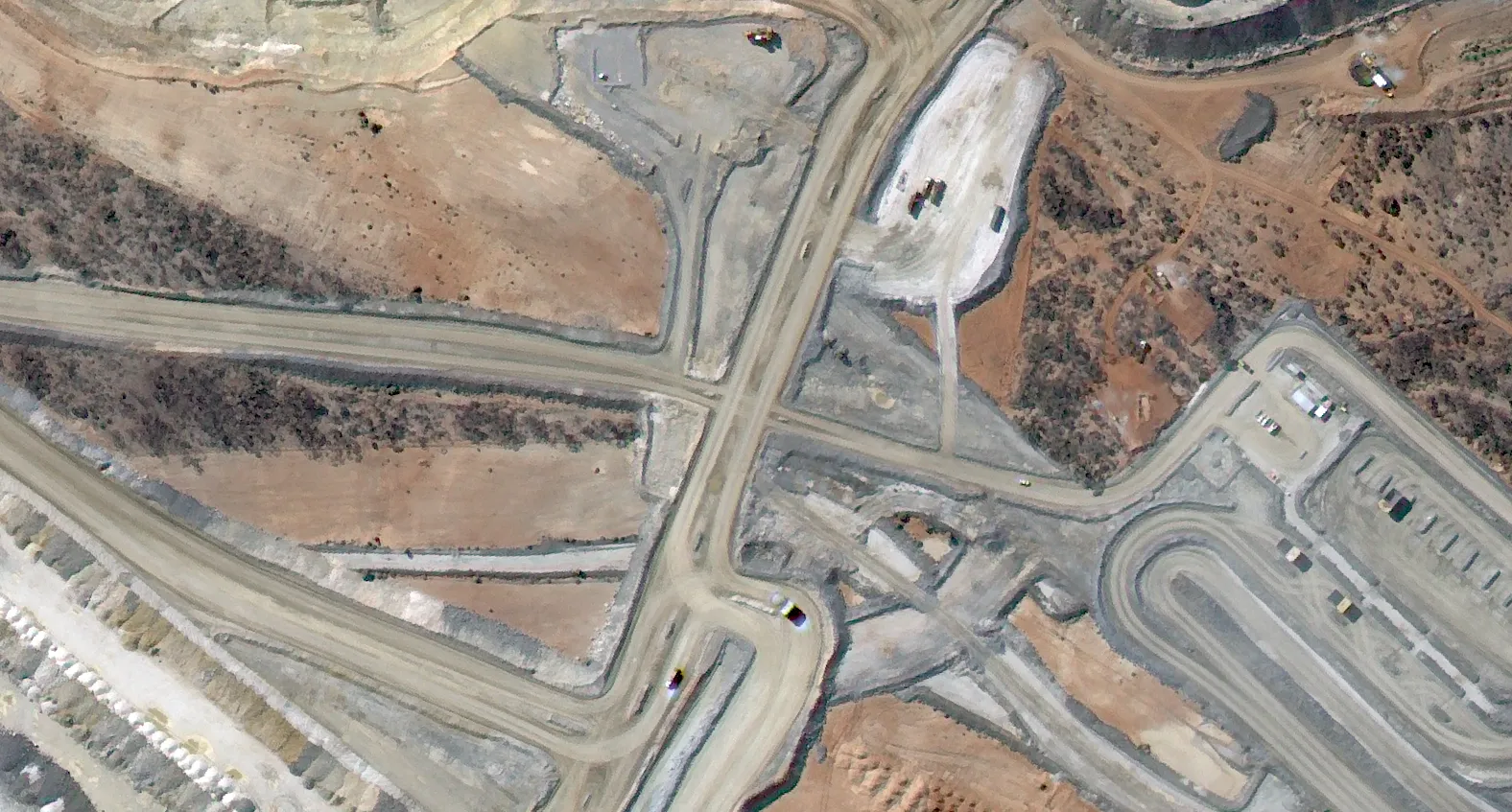
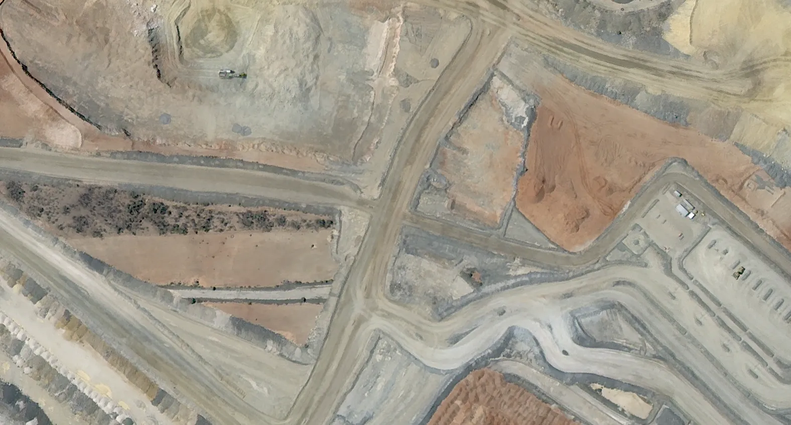
3. Construction: Progress Tracking of Major Infrastructure and Environmental Controls
Once works commence, frequent, consistent captures provide objective progress evidence and early warnings-without mobilising additional survey crews.
Construction monitoring use cases:
- Progress tracking at daily/weekly cadence; overlay planned vs actual to flag schedule variance on roads, pads and facilities.
- Earthworks and materials: monitor cut/fill extents, stockpile growth and laydown areas; optional volumetrics where suitable surface models exist.
- Mid construction quality assurance and control: validate alignments for haul roads, tailings embankments and drainage features against design.
- Environmental controls: verify sediment basins, erosion controls, turbidity risks, clearing limits and buffer compliance during works.
- Logistics and interfaces: observe construction at ports/railheads and other interfaces to coordinate sequencing and access (see example below).
Coastal infrastructure example: high‑resolution imagery supports port construction monitoring-tracking breakwater progress, dredging activity, berth construction and laydown growth-without additional site mobilisations.

Cadence & delivery: daily for critical paths, weekly for routine builds; analysis‑ready, orthorectified products to drop into GIS/BI for quick reviews.
Benefits: independent, consistent record of progress, reduced site travel, early risk detection and stronger stakeholder/compliance reporting.
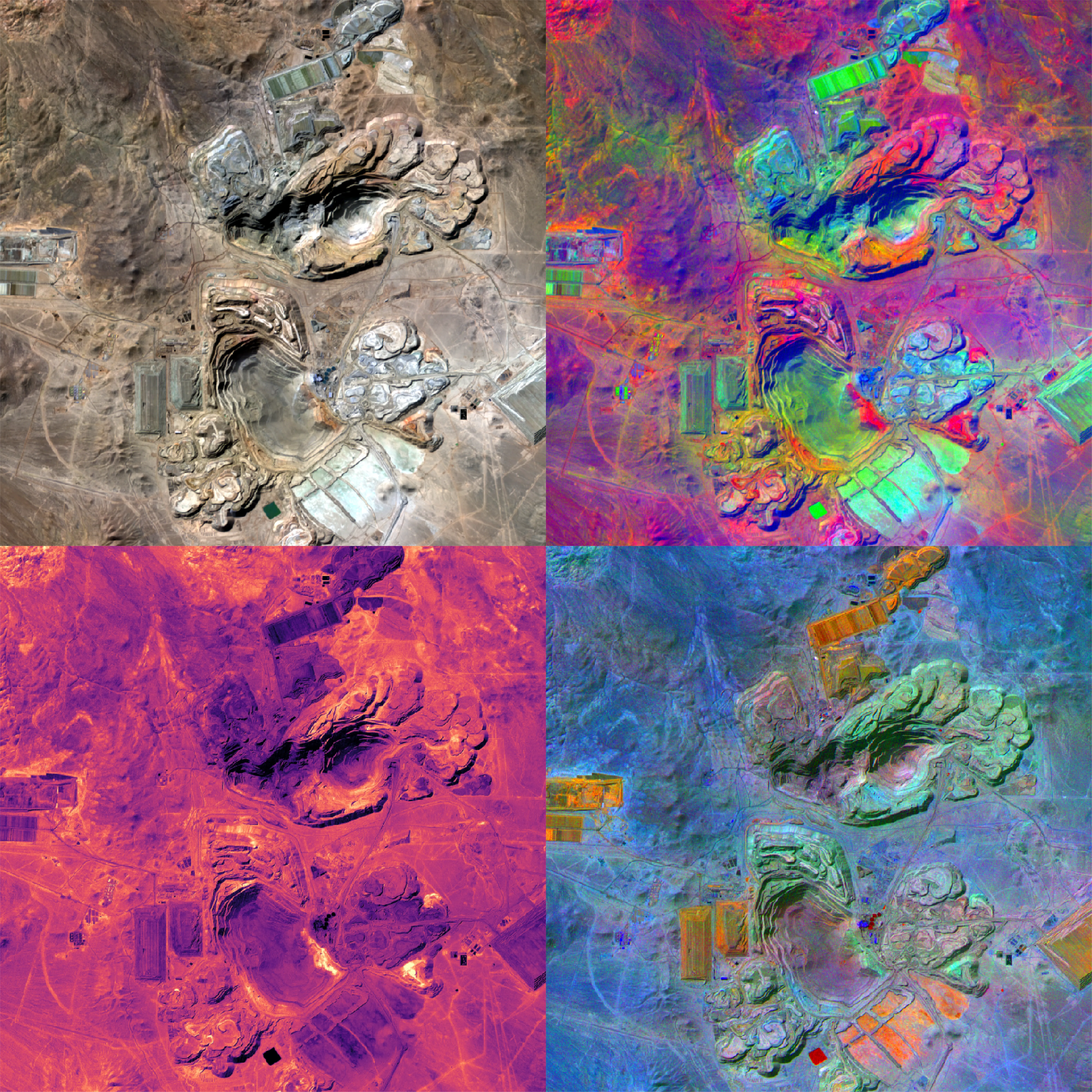
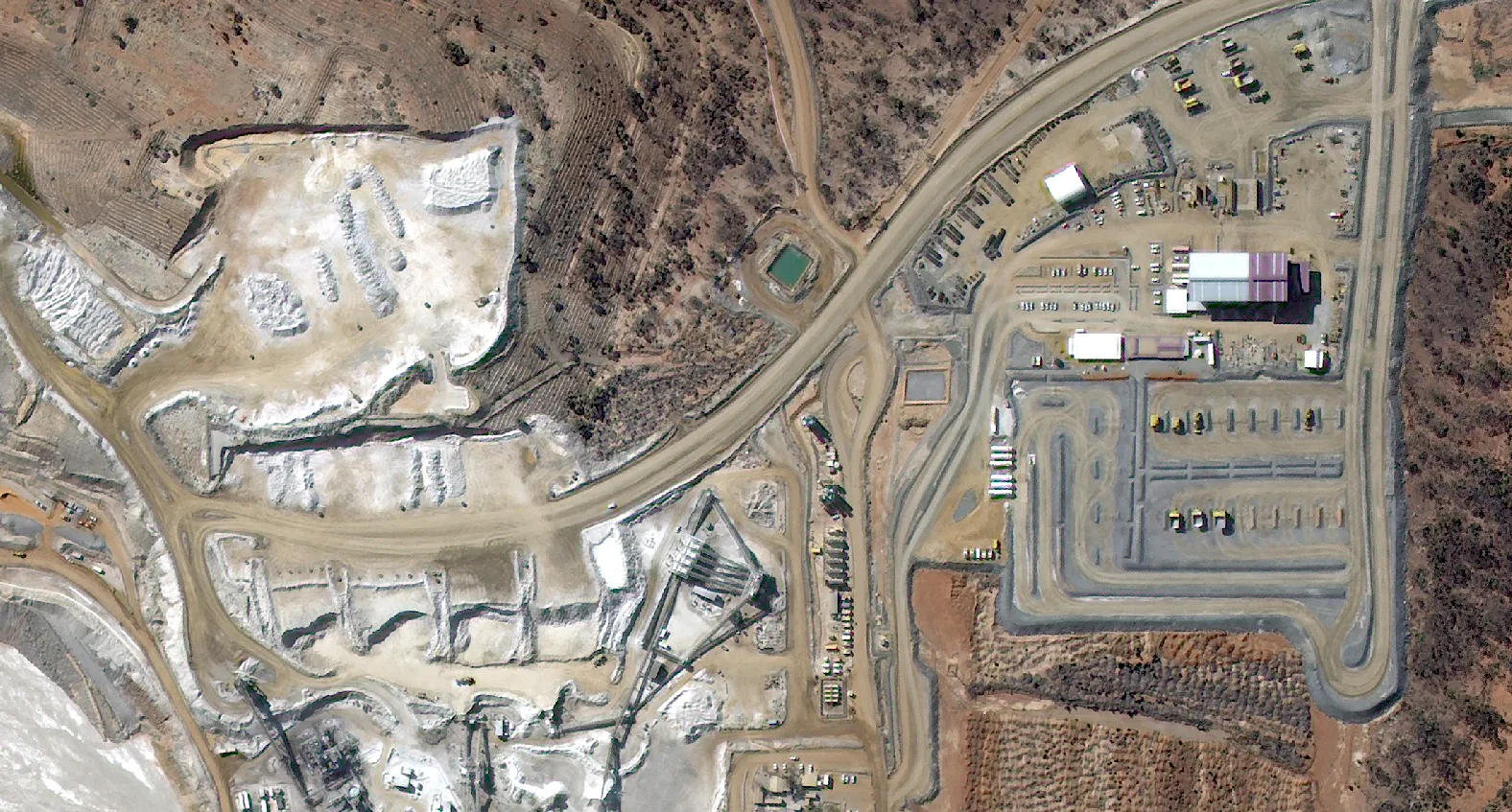
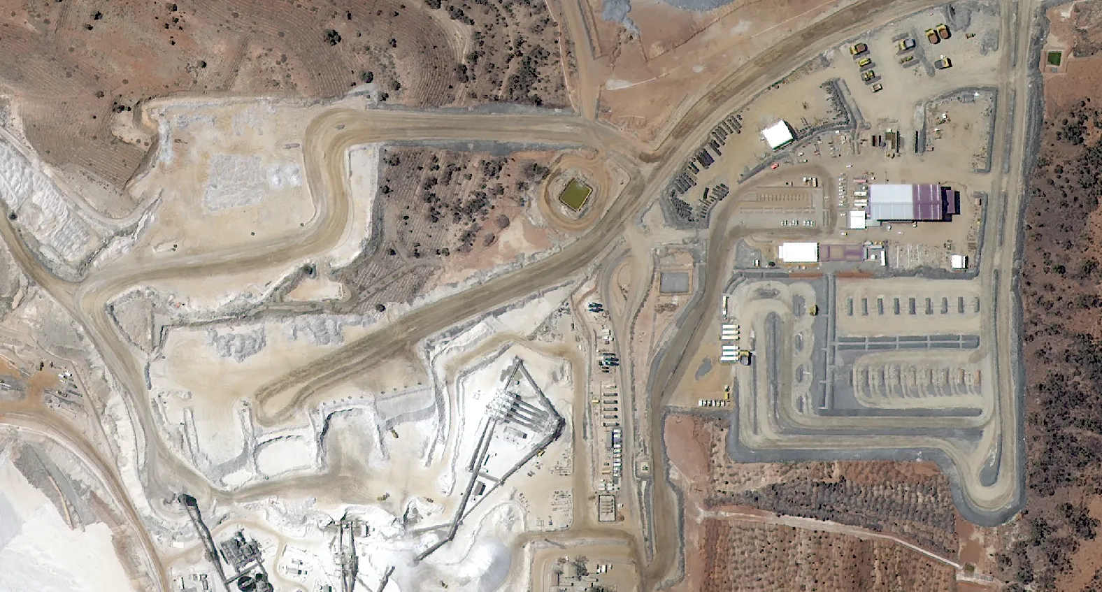
4. Operations: High‑Resolution Monitoring and Change Detection
The operational phase is where satellite imagery has become an essential part of modern mine management. With constellations now offering very high‑resolution capture and frequent revisits, operators can observe and assess changes across the site with accurate, consistent data.
Focus Areas
High‑Resolution Site Imagery
Detailed very high‑resolution optical imagery gives mine managers a current and accurate visual record of site conditions. This supports:
- Visual inspection of haul roads, pits and waste dumps
- Volume estimation of stockpiles
- Asset tracking across large areas
Change Detection
Regular image acquisition allows detection of physical changes on‑site, especially useful for identifying:
- Vegetation clearance and compliance reporting
- Unauthorized land use or encroachment
- Unplanned expansion of pits or dumps
- Shifts in water bodies or drainage patterns
Change maps and digitisation provide a clear, objective record of operational activity over time, aiding internal decision‑making, compliance records and stakeholder communication.
Did you know: Satellite data and products can be used to verify activity on an exploration or mining lease, allowing it to be counted as an expenditure.
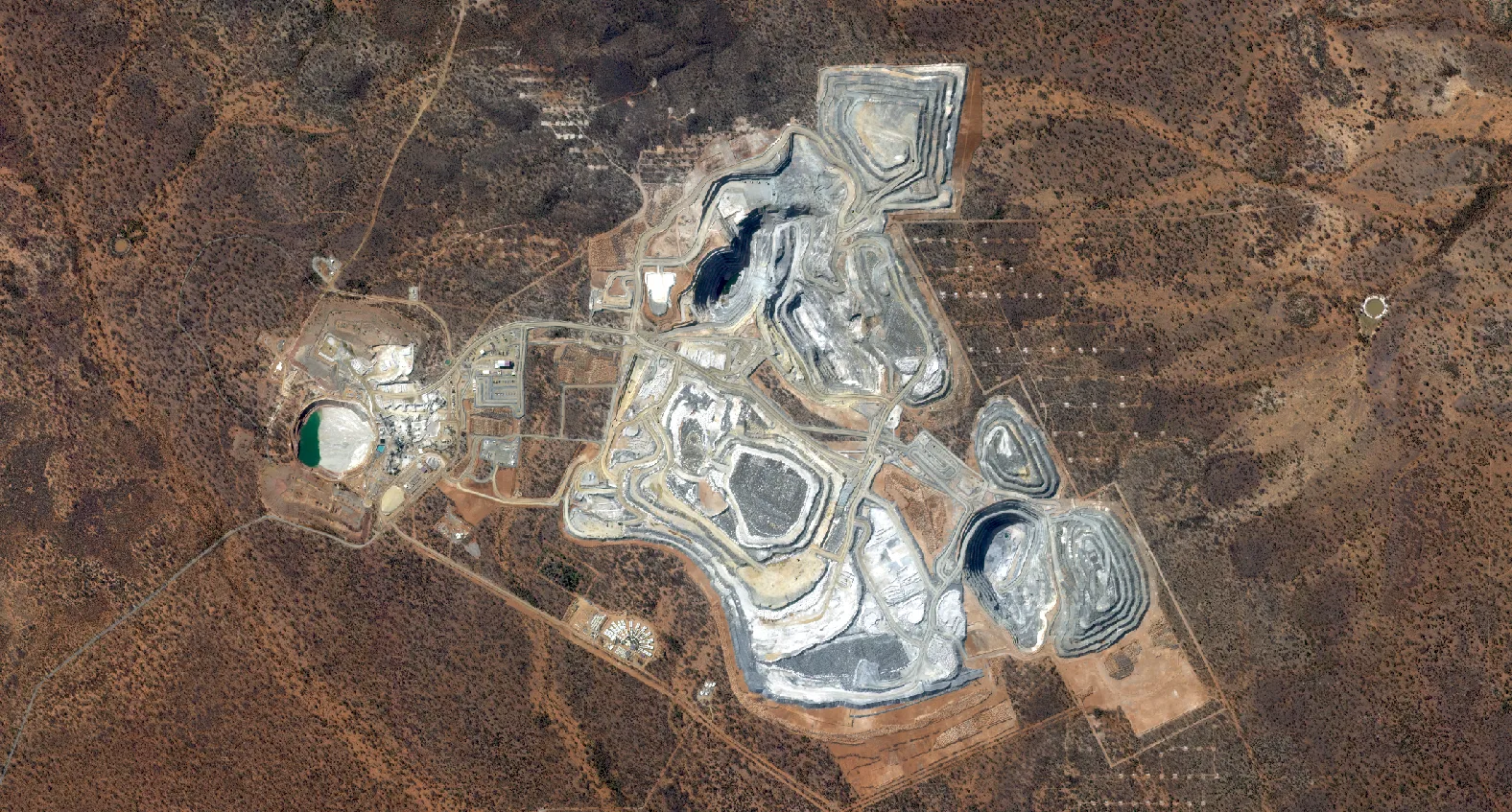
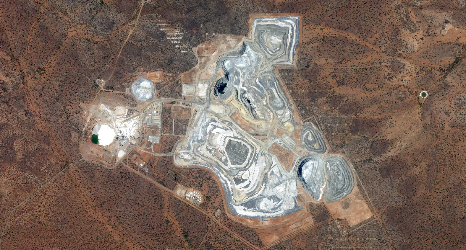
Operational Benefits:
- Independent, consistent oversight of large or remote sites
- Monitoring construction or infrastructure projects in complex environments (e.g., port development) to ensure accuracy and compliance
- Early warning of compliance risks or physical hazards
- Lower reliance on field inspections or drone deployments
- Improved reporting for ESG and regulatory frameworks
5. Rehabilitation: Remote Time‑Series Monitoring of Regrowth, Stability and Compliance
Satellite data plays a crucial role in mine closure planning and post‑closure monitoring by providing an objective, time‑stamped record of land use and recovery.
Key Uses:
- Regulatory compliance: High‑resolution monitoring tracks rehabilitation milestones under WA’s Mining Rehabilitation Fund (MRF) and QLD’s Progressive Rehabilitation and Closure Plan (PRCP), providing audit‑ready evidence.
- Vegetation regrowth monitoring using NDVI and other vegetation indices
- Species detection differentiating native and invasive species
Because satellites can capture imagery years or even decades after mine closure without a site visit, they are an ideal tool for long‑term environmental audits and stakeholder reporting.
We use analysis‑ready data, standards‑based delivery and APIs so imagery flows into your systems for both insight and efficiency.
Bringing It All Together
Satellite data is no longer a novelty in mining-it’s a practical tool for day‑to‑day operations.
With use cases across the full mining cycle from start to finish, there is a place for satellite products and solutions.
Terrabit offers high‑quality, accurate satellite data and analytics throughout the mine cycle. Talk to our team to learn more about how our service can assist.