In today's fast-paced world, knowing what's happening at your site is critical. Whether it's construction projects spanning hundreds of acres, active mining operations, agricultural fields across multiple regions, or distributed utility infrastructure, having actionable data at your fingertips can save time, reduce risk and optimise operations. Terrabit makes remote site monitoring simple, reliable and actionable through advanced geospatial intelligence.
What is Remote Site Monitoring?
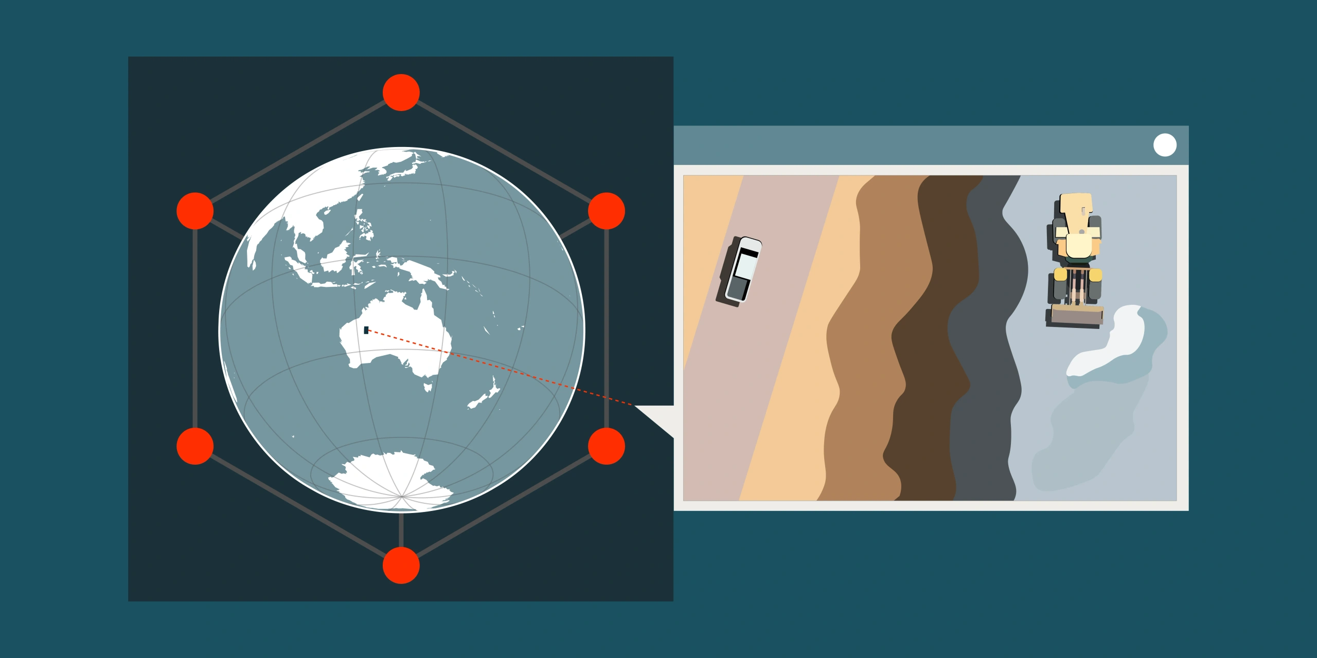
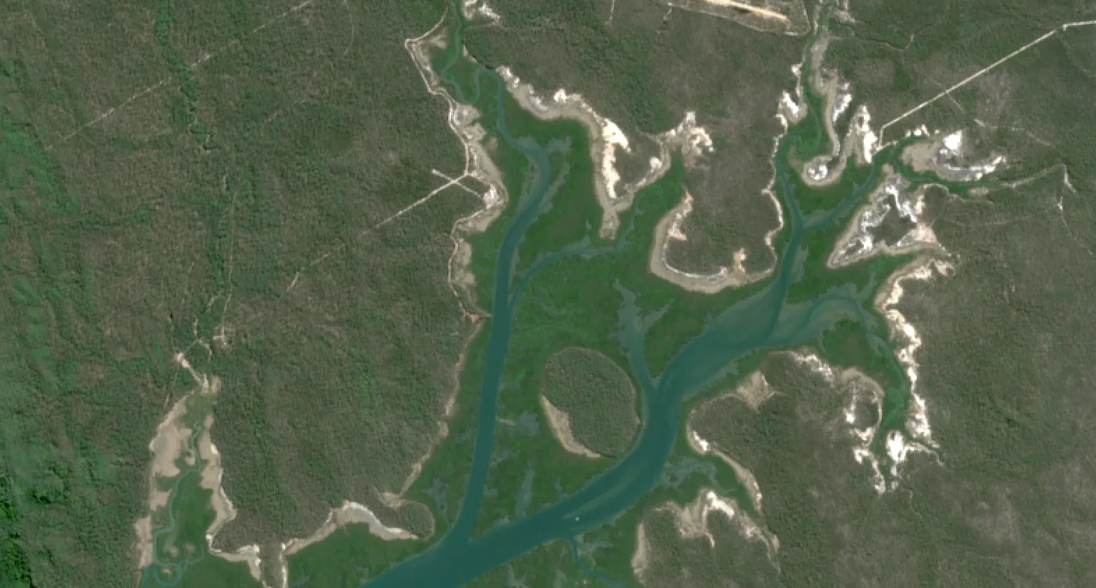
Remote site monitoring uses satellite or aerial imagery to track conditions and activities at locations that are difficult or costly to visit frequently. Instead of sending teams on-site multiple times per week, you can access geospatial data collected at intervals ranging from bi-weekly to yearly-depending on satellite availability and your operational requirements. This enables smarter, faster decision-making backed by objective, verifiable data.
Modern satellite constellations can capture imagery at resolutions from 30cm per pixel, depending on the sensor and application. This means you can detect objects as small as individual vehicles, track vegetation health at the plant level, or monitor landscape-scale changes across thousands of kilometres simultaneously.
How Terrabit Makes It Work
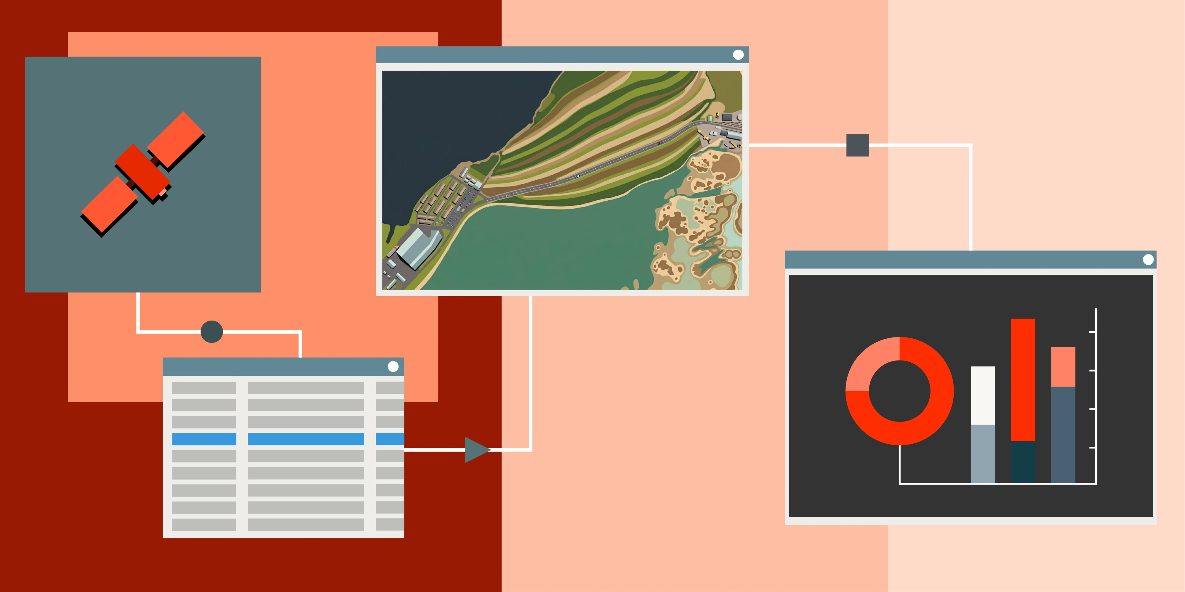
Terrabit combines advanced satellite technology, AI-driven analytics and tailored monitoring strategies to provide comprehensive visibility into your remote sites. Here's how we transform raw geospatial data into operational intelligence:
1. Define Your Monitoring Goals
Every site is different. Terrabit works with you to identify what needs monitoring-whether that's tracking equipment movement on construction sites, measuring stockpile volumes in mining operations, assessing crop health using vegetation indices like NDVI and NDRE, monitoring construction progress against project milestones, or detecting unauthorised access to restricted areas-and determining optimal data collection frequency.
We help you establish baseline conditions, define thresholds for alerts and identify the specific metrics that matter to your operations, whether that's change detection accuracy, temporal resolution, or specific spectral bands needed for your analysis.
2. Task the Right Satellite
We recommend the best satellite constellation and imaging parameters for your specific needs. Options include:
Optical Imagery: High-resolution visible and multispectral sensors (0.3m-5m resolution) ideal for visual inspections, progress tracking and standard change detection. Best for cloud-free conditions and daytime monitoring.
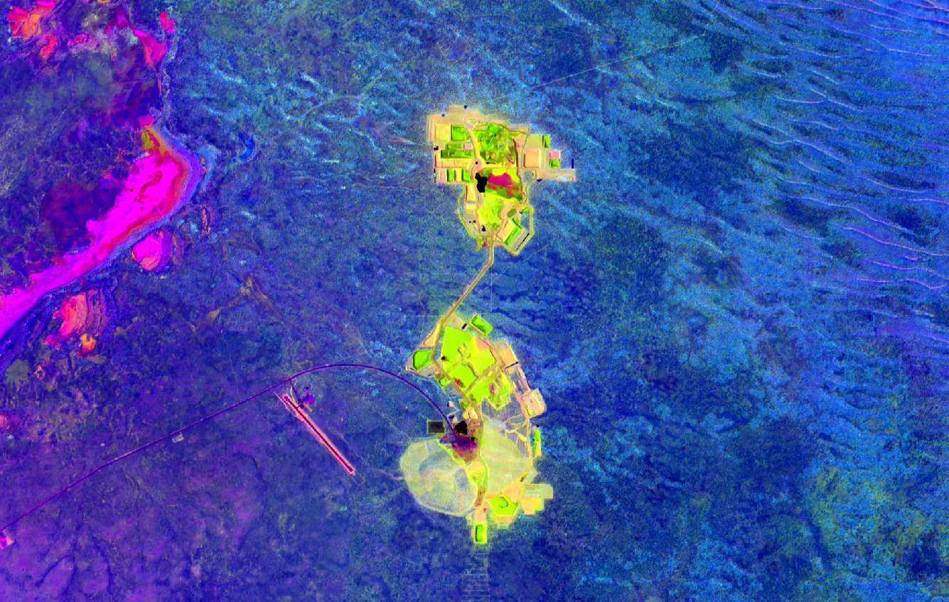
Hyperspectral Data: Captures hundreds of narrow spectral bands, enabling precise material identification, mineral mapping, vegetation stress detection beyond what's visible to the human eye and contamination monitoring.
Synthetic Aperture Radar (SAR): Penetrates clouds and operates day or night, making it essential for all-weather monitoring. Particularly valuable for detecting ground deformation, measuring soil moisture, monitoring flood extent and tracking changes in infrastructure.
The selection depends on your monitoring objectives, required revisit frequency and environmental conditions at your site location.
3. Automated Data Collection
Once satellite tasking is configured, data is collected automatically according to your schedule. For critical applications requiring near-real-time monitoring, we can leverage constellations offering multiple daily passes or hourly updates.
This automation eliminates the need for manual coordination and ensures consistent data capture regardless of your team's availability or site accessibility constraints.
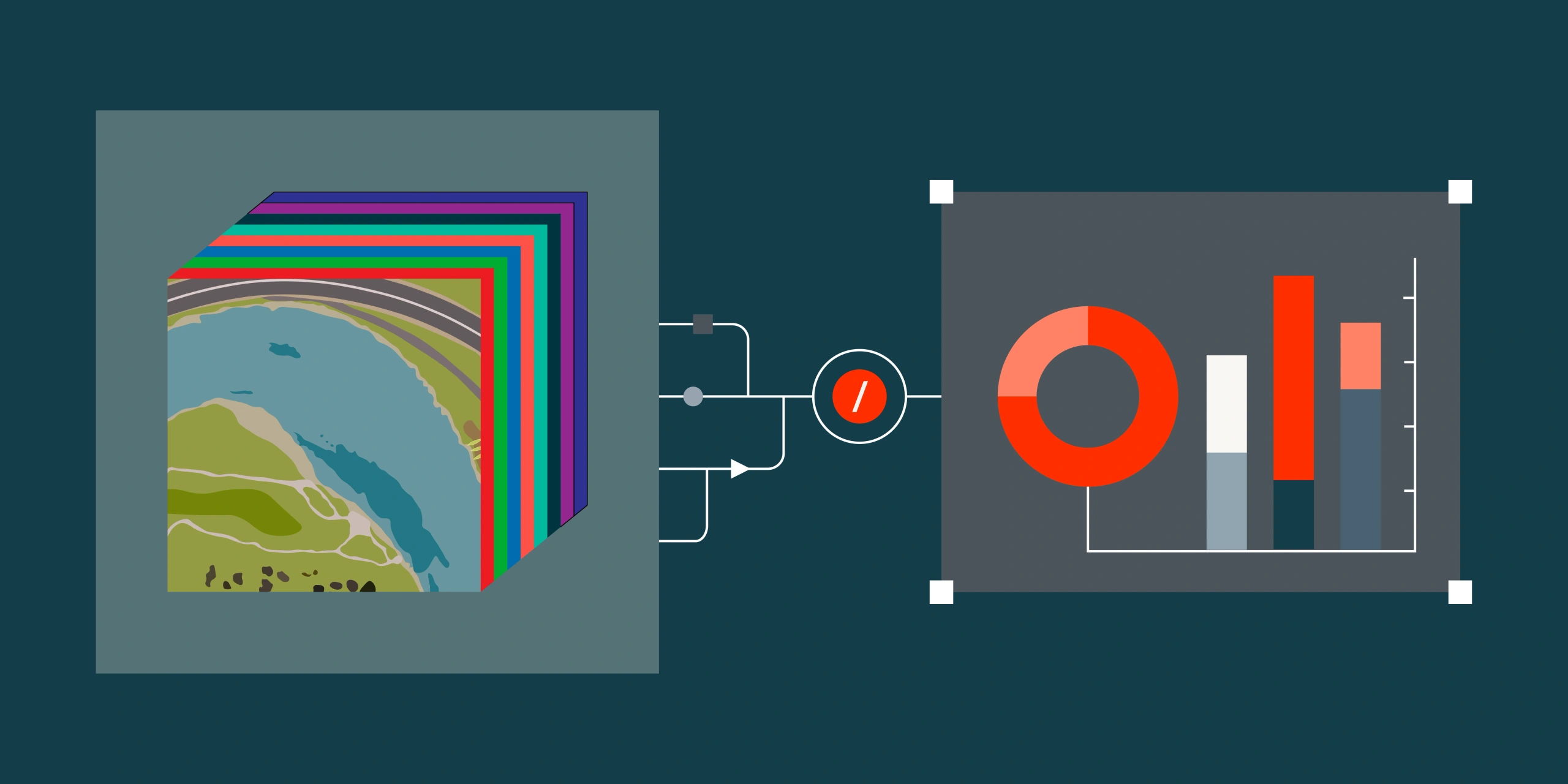
4. Data Processing & Analysis
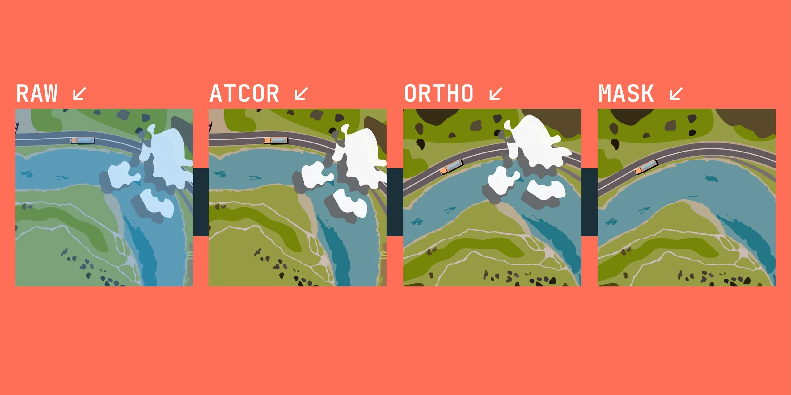
Raw satellite data undergoes several processing stages:
Radiometric Correction: Compensates for sensor variations and atmospheric interference to ensure consistent, comparable data across time series.
Geometric Correction: Orthorectifies imagery to correct distortions from terrain relief and sensor viewing angle, enabling accurate measurements and overlay with other geospatial datasets.
Atmospheric Correction: Removes atmospheric effects like haze, water vapor and aerosols to derive true surface reflectance values, critical for vegetation analysis and change detection.
Machine learning algorithms then analyse the processed data to identify patterns, anomalies, or changes relevant to your operations. This includes:
- Change detection algorithms that identify differences between time periods with sub-meter accuracy
- Object detection models trained to recognise specific equipment, vehicles, or infrastructure elements
- Spectral analysis for vegetation health assessment, mineral identification, or material classification
- Time-series analysis to identify trends, seasonal patterns, or deviations from normal conditions
- Volume calculations for stockpiles, excavations, or earthwork using digital elevation models
5. Actionable Insights Delivered
Processed insights are delivered through intuitive dashboards, automated alerts, or integrated APIs that connect directly with your existing project management or GIS systems. You can:
- Visualise multi-temporal data to track progress over weeks, months, or years
- Compare current conditions against baseline or previous periods
- Receive threshold-based alerts when specific conditions are detected (e.g., unauthorised changes, equipment absence, vegetation stress)
- Generate automated reports with quantitative metrics like area measurements, volume calculations, or index values
- Export analysis results in standard formats (GeoTIFF, Shapefile, KML) for integration with tools like ArcGIS or QGIS.
All of this happens without requiring specialised remote sensing expertise from your team.
Unfamiliar with GIS Software? Our portal allows for easy viewing and use of satellite data all from your browser, making it easy to share internally with your team without needing any specialised GIS expertise. Visit our Company page to learn more about our mission and technology.
6. Continuous Optimisation
Terrabit continuously refines your monitoring program based on evolving site conditions, seasonal factors and your operational goals. If we detect that certain areas require more frequent monitoring or different sensor types would provide better insights, we adjust the collection strategy accordingly. This adaptive approach ensures you always have the most relevant, timely and actionable information while optimising cost-effectiveness.
Benefits of Remote Site Monitoring
Reduced operational risk: Detect issues like erosion, unauthorised access, equipment displacement, or vegetation stress days or weeks before they escalate into costly problems.
Lower costs: Minimise travel expenses, reduce manual inspection frequency by up to 70% and eliminate safety risks associated with accessing hazardous or remote locations.
Faster decision-making: Receive insights within hours of satellite collection rather than waiting days for traditional site visits. Intra-daily updates enable rapid response to changing conditions.
Better resource allocation: Deploy field teams only when satellite data indicates intervention is needed, focusing human expertise where it delivers maximum value.
Objective documentation: Maintain time-stamped, georeferenced records of site conditions for regulatory compliance, dispute resolution, or progress verification.
Scalability: Monitor hundreds of sites across different regions with the same effort required for monitoring one, enabling enterprise-wide visibility at unprecedented scale.
Real-World Applications
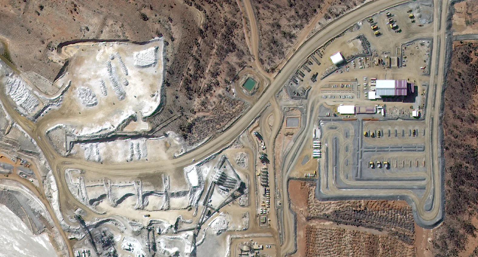
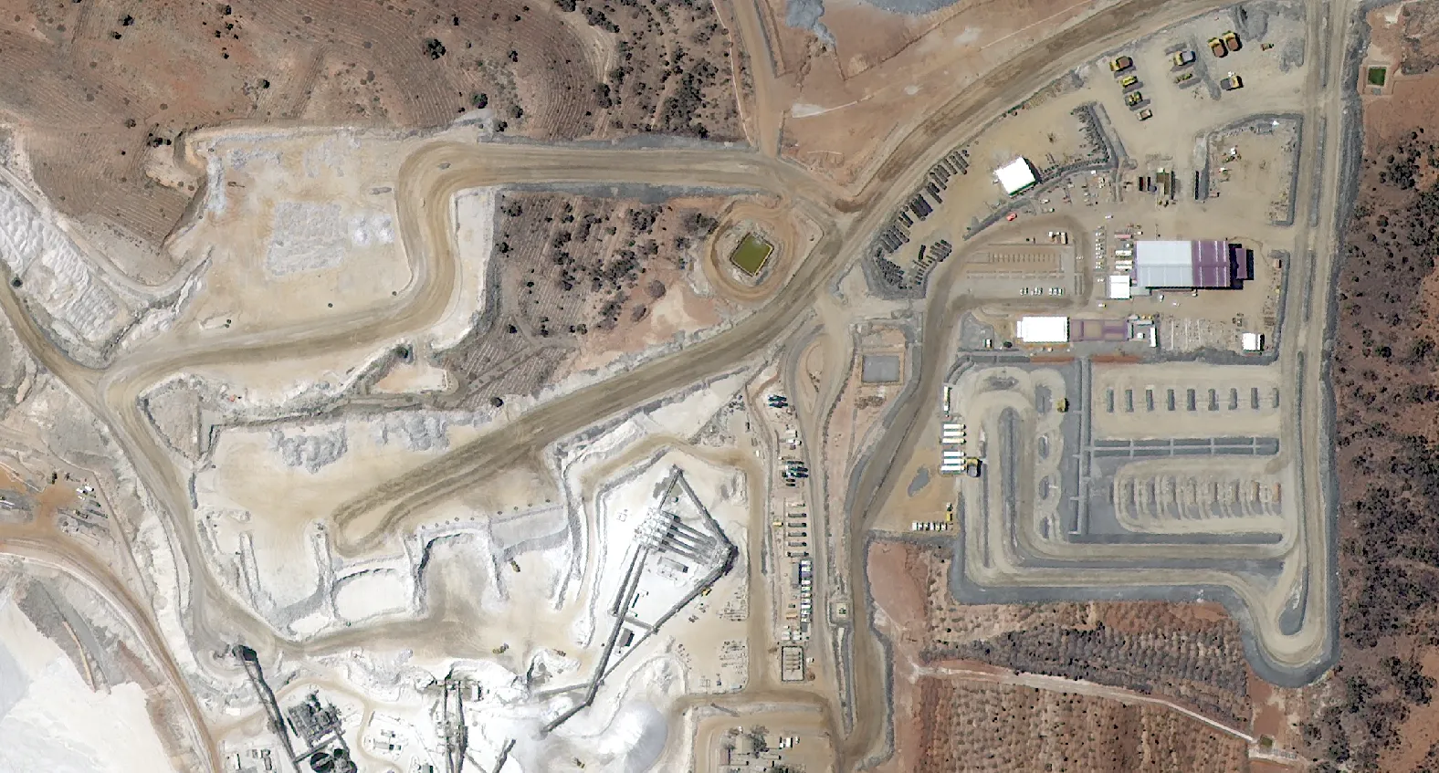
Construction: Track earthwork progress against schedules, monitor equipment positioning, verify contractor work and document site conditions for legal protection.
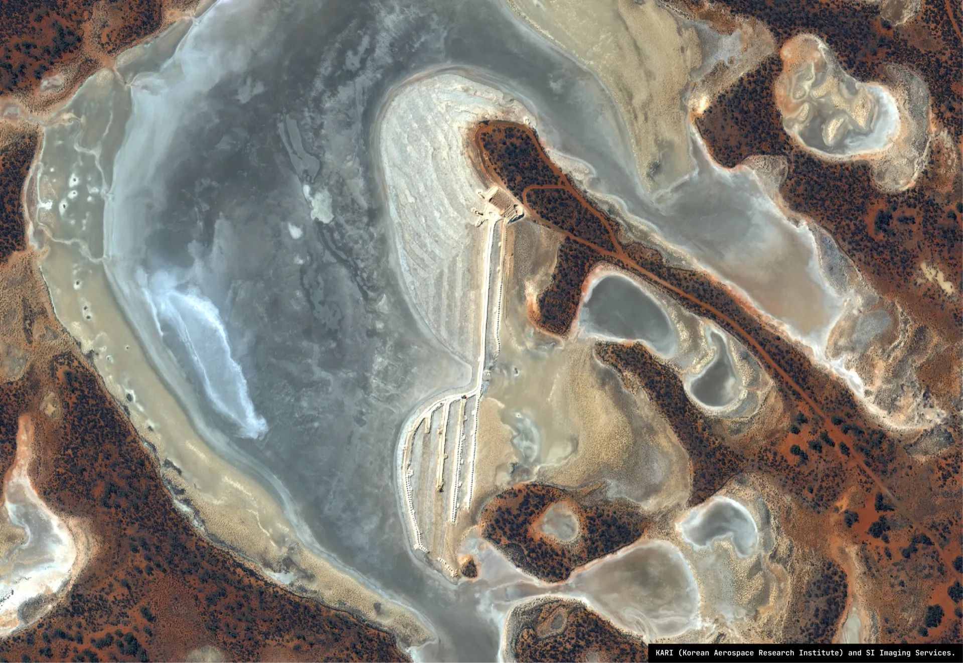
Mining: Measure stockpile volumes, monitor tailings dam stability, track haul road conditions and assess rehabilitation progress on former mine sites.
Agriculture: Calculate vegetation indices to identify underperforming areas, optimise irrigation scheduling, detect pest or disease outbreaks early and verify crop coverage for insurance purposes.
Utilities: Monitor transmission corridors for vegetation encroachment, assess damage after severe weather, track construction impacts on rights-of-way and identify potential security threats.
Unlock actionable insights for your sites with Terrabit’s advanced satellite monitoring and analytics-tailored to your operational needs. Connect with our team to see how remote site monitoring can transform your decision-making.