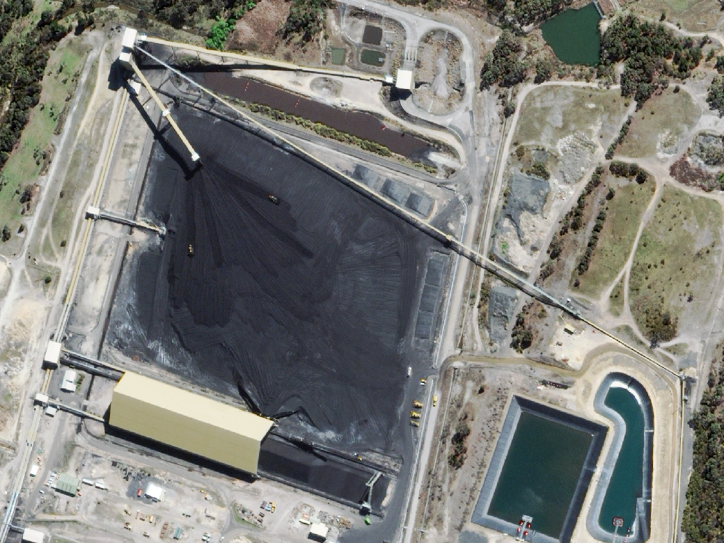
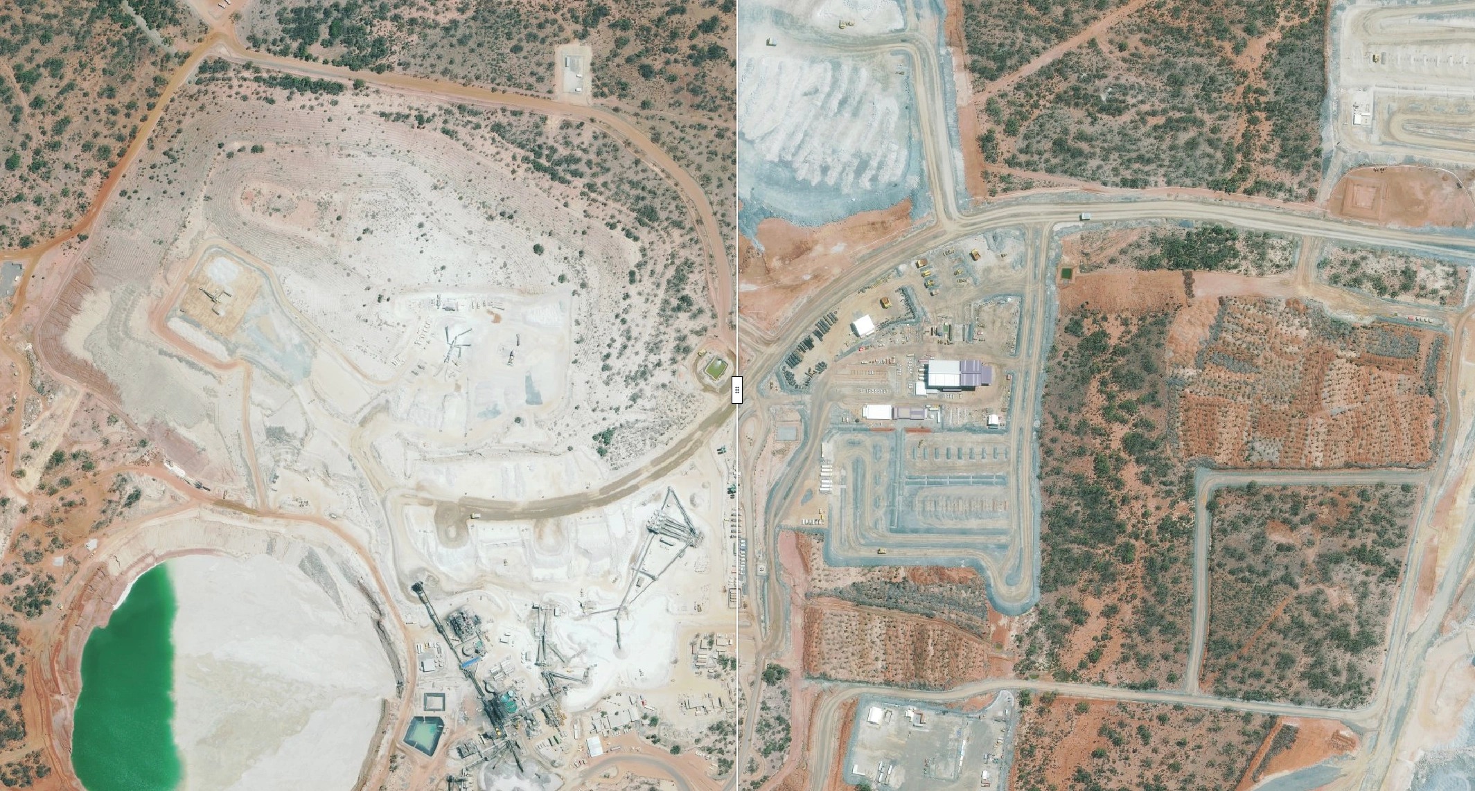
Active mines are constantly changing. Pits expand, stockpiles turn over, waste dumps advance, haul roads move and infrastructure goes up between one survey and the next. Without a consistent visual record, it's difficult to know what changed, where and when.
Terrabit delivers high-resolution satellite imagery as a single, seamless mosaic, giving the operation a consistent view of the entire site every quarter. A fresh January 2026 capture set the baseline. Each quarterly capture since shows exactly what has changed.
To preserve confidentiality, the imagery shown is sample data over a site in the Goldfields region, produced using the same methodology.
The Challenge
The operation spans a large area. Individual surveys described parts of the site, but there was no single, consistent view of the whole operation to compare over time. Without a common baseline, nobody could reliably answer the question: what has changed since last quarter, and where?
The mine needed to:
- Establish a reliable baseline across the full operational footprint
- Monitor change consistently across a large area
- Compare each quarter directly against the last
- Hold contractors to construction scope and commitments
- Keep all imagery under its own control
- Repeat the process on a fixed quarterly cycle
The Solution
Quarterly 30cm mosaics over the full site, built on a purpose-tasked baseline.
1. Set the Baseline with a Fresh Capture
In January 2026, Terrabit captured the full 2,602.2 km² monitoring area at 30cm resolution. That capture became the baseline, a complete and current record of site conditions against which every later epoch is measured.
Starting from a fresh capture means the baseline matches the extent, resolution and processing of every epoch that follows. Comparisons are like-for-like from day one.
2. Capture and Deliver a Single Mosaic Every Quarter
Throughout 2026, Terrabit is capturing the same monitoring area every quarter. Each epoch is processed into one continuous mosaic rather than a patchwork of individual scenes, so every quarter is directly comparable with the one before. Pre-existing ground control points were used to improve absolute accuracy to ±1-2 pixels.
Across epochs to date, full-site capture has averaged 10.2 days and processing 3.3 days. Imagery is in the operation's hands roughly two weeks after tasking begins.
3. Detect and Document Change
At 30cm resolution, individual features are clearly visible across the whole site. Comparing epochs identifies change to:
- Pit operations and bench progression
- Run-of-Mine (ROM) and topsoil stockpiles
- Waste rock dumps
- Haul roads and access tracks
- Processing areas and plant infrastructure
- Clearing and ground disturbance, contributing to Mining Rehabilitation Fund (MRF) vector generation and reporting
Each quarterly mosaic provides a clear snapshot across the entire operation. It supports progress reporting and disturbance mapping, and gives the operation independent evidence that contracted works were delivered as agreed.
The Monitoring Workflow
- Task a 30cm baseline capture over the full area
- Process the capture into a single, seamless mosaic
- Compare the mosaic to previous epochs to identify site change
- Document change to pits, dumps, stockpiles, roads and infrastructure
- Continue the cycle, extending the record with every quarter
The result is a growing spatial record of the operation rather than a collection of disconnected data.
How Satellite Monitoring Compares to Drone and Ground Survey
Satellite imagery doesn't replace a targeted drone flight or a surveyor on a specific feature. Covering 2,600 km² by drone every quarter within a targeted date range would be a major logistical exercise. By satellite, it's routine.
Results
The project has shown that commercial satellite imagery can deliver consistent, site-wide monitoring across a large mining operation on a reliable quarterly cycle.
Key outcomes:
- 2,602.2 km² of 30cm imagery captured and delivered as a single mosaic per epoch
- An average of 10.2 days to capture and 3.3 days to process each epoch
- A fresh January 2026 baseline matching the specification of every later epoch
- A repeatable methodology supporting ongoing quarterly monitoring through 2026
The same approach extends to exploration projects, multi-site portfolios, rehabilitation programs and any operation that needs a consistent record of change over a large area.
Keeping Control of Your Imagery
All imagery is managed through Albatross, Terrabit's geospatial data platform. Every epoch is accessible in one place and can be viewed in-browser without GIS software.
Teams can track orders from request to delivery, search their imagery archive and collaboratively plan upcoming captures, instead of chasing files across vendor portals and shared drives.
The platform also enables the client to share imagery with key stakeholders via WMTS, with appropriate access controls.
Frequently Asked Questions
How often can a mine site be monitored by satellite?
Sites can be captured weekly, monthly, quarterly or to a schedule that suits the project. Capture times depend on satellite availability and cloud cover. Western Australia generally offers optimal capture conditions, but seasonal weather such as cyclone season should be factored into any capture plan. The Terrabit solutions team can recommend the right capture frequency for your operation based on your requirements and site location.
How long does it take to capture and deliver a large site?
For this 2,602.2 km² site, capture has averaged 10.2 days per epoch and processing 3.3 days, delivering a complete mosaic in around two weeks.
What is a single mosaic and why does it matter?
A mosaic combines multiple satellite scenes into one continuous, colour-balanced image of the whole site. Delivering one mosaic per epoch means each quarter can be compared directly with the last, without having to review multiple swaths or scenes.
Why start with a fresh baseline capture?
A purpose-tasked baseline matches the extent, resolution and processing of every later epoch, so change detection is like-for-like from the first comparison.
Does satellite imagery support WA disturbance and rehabilitation reporting?
Yes. Repeat imagery documents areas disturbed and rehabilitated across a reporting period, which supports Mining Rehabilitation Fund disturbance reporting and the site plans required in Annual Environmental Reports.
Do you need site access or approvals?
No. Nothing is flown, nothing is deployed and no one enters the site.
One Site. One Mosaic per Quarter. One Consistent Record of Change.
See what changed, understand where, and report with confidence. Whether you need a one-off baseline or an ongoing monitoring program, our team can scope the right capture schedule for your operation.