Stockpile volume measurement is fundamental to mining operations, driving production reporting, inventory reconciliation, financial forecasting and mine planning. But traditional stockpile surveys demand crews, specialised equipment and site access which may not always be possible.
Terrabit demonstrated an alternative: satellite-derived stockpile volumetrics. Using high-resolution commercial satellite imagery, stockpile volumes across two operating sites were calculated remotely, with no field mobilisation and no interruption to site operations.
The Challenge
Mining operations often manage dozens of stockpiles spread across large, remote sites. Because stockpiles change continuously through mining, processing and haulage, keeping an accurate, current inventory is a constant challenge.
Conventional approaches such as ground surveys and drone (UAV) stockpile surveys are accurate but logistically demanding:
- Personnel must travel to site and mobilise equipment
- Crews need safe access to active operational areas
- Surveys are performed periodically, not whenever data is needed
The objective: demonstrate that commercial satellite imagery can rapidly generate reliable stockpile volume estimates across an entire operating mine from a single image capture.
The Solution
Satellite volumetrics built on Digital Elevation Models. Terrabit acquired recent 50cm high-resolution satellite imagery from Vantor over two operations, a copper mine and a coal-fired power station, and processed each capture into a 1m Digital Elevation Model (DEM).
From the elevation models, individual stockpiles were:
- Identified across the full site extent
- Delineated with accurate boundary digitisation
- Measured against a defined reference surface to calculate volume
The result: a consistent, repeatable assessment of site-wide inventory from a single stereoscopic satellite acquisition for inventory management, production reconciliation and operational planning.
From Volume to Tonnage
The analysis measures the volume a stockpile occupies, but inventory is reported by weight. To bridge the two, each measured volume is converted to tonnage using the bulk density of the stockpiled material. As density varies by commodity, moisture content and compaction, Terrabit applies either client-supplied or industry-standard density values, ensuring reported tonnages align with how the operation already accounts for its inventory.
The Workflow
The satellite volumetrics workflow is straightforward and robust:
- Acquire recent or previously captured high-resolution satellite imagery over the mine
- Generate a high-quality Digital Elevation Model from the stereo imagery
- Calculate stockpile volumes
- Convert volumes to tonnage using material bulk densities
- Deliver imagery, elevation products and volumetric reports
Every deliverable is available in our Albatross platform, where users can also track captures in progress and see when the next acquisition is scheduled.
Because the process is built on repeatable satellite acquisitions, the same methodology can run on a monthly, quarterly or project-specific cadence to track inventory changes over time.
The figures below are indicative estimates derived from the satellite elevation models, rounded accordingly, with tonnages calculated from typical bulk densities for each material.
Coal Fired Power Station
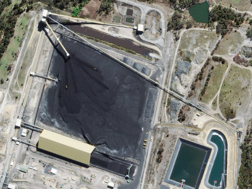
A large coal stockpile sits on a managed pad and is drawn down continuously to supply the adjacent facility. Because the pad is an near-level surface, it provides a clean reference against which its volume can be measured.
For context, this single pad holds approximately three months of feed for a facility consuming around 4 million tonnes of coal per year.
Copper Operation
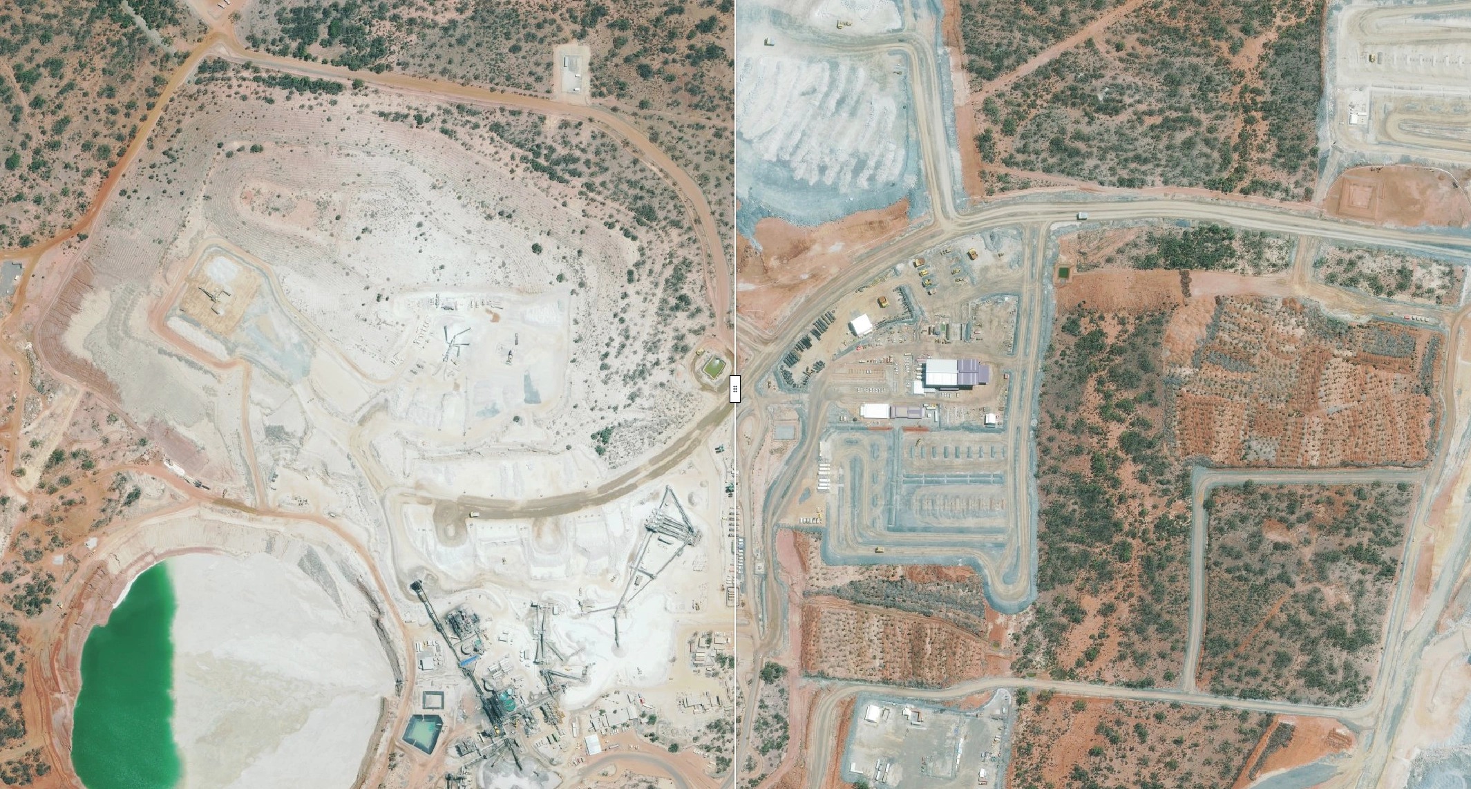
At the processing plant, crushed ore is stacked into a Run-of-Mine stockpile by an overhead conveyor.
Bulk material is distributed across a large open-pit operation, with multiple overburden piles surrounding the active pit. Two of the piles were captured, delineated and measured in the same acquisition alongside the rest of the site including the crushed ore stockpile at the processing plant, demonstrating that the same methodology applies to both valuable and waste materials.
Why Satellite Stockpile Volumetrics?
Results
The project confirmed that commercial satellite imagery can estimate stockpile measurements across large mining operations.
Key outcomes:
- High-resolution imagery captured across each mining operation
- Accurate Digital Elevation Models generated for both sites
- Per-pile volume calculations covering coal, crushed ore and waste rock
- A repeatable methodology ready for ongoing stockpile monitoring
The same approach extends to iron ore, product stockpiles and bulk commodities.
Looking Ahead
As commercial satellite constellations improve in resolution and revisit frequency, satellite-derived volumetric analysis is becoming an increasingly practical tool for inventory management and reporting.
Satellite-derived volumetrics doesn't replace traditional surveying; it adds a scalable layer of operational intelligence: rapid, repeatable, site-wide measurements with minimal operational impact.
Need Stockpile Volumes?
Terrabit delivers high-resolution commercial satellite imagery, Digital Elevation Models and remote volumetric analysis for mining operations across Australia and internationally.
Whether you need a one-off stockpile assessment or an ongoing monitoring program, our team can turn satellite imagery into actionable spatial intelligence.