Overview
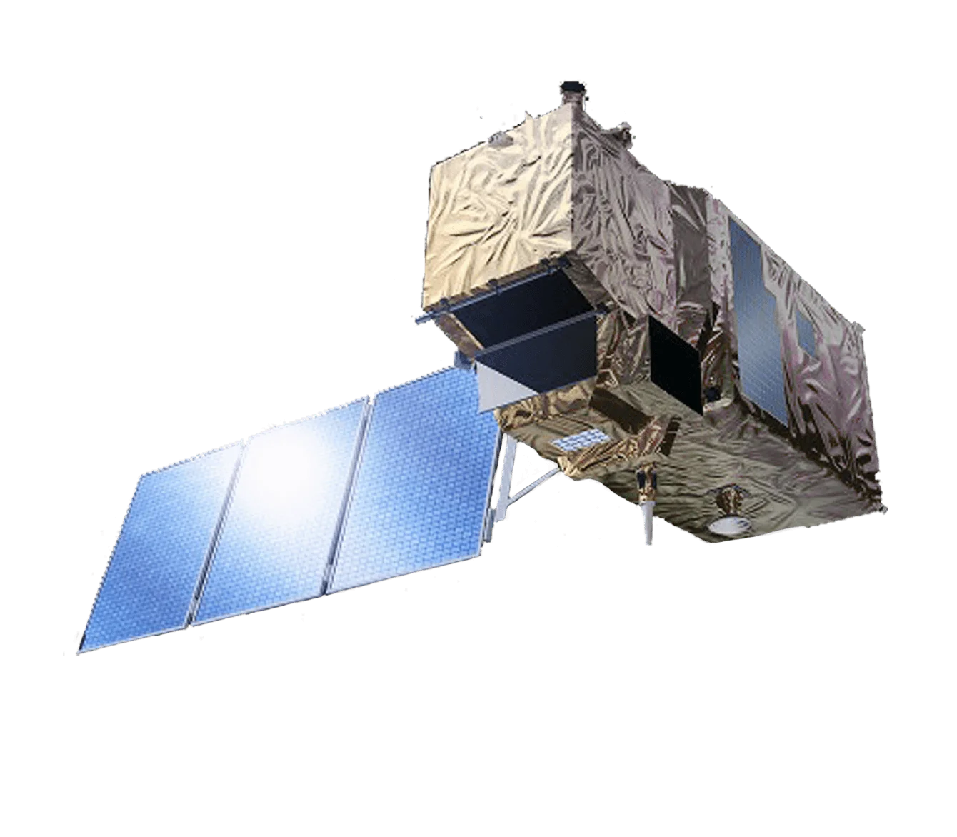
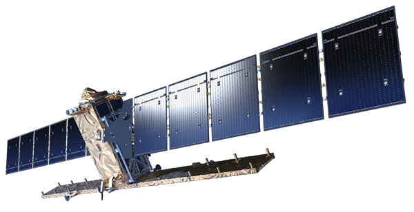
Sentinel-5 Precursor (Sentinel-5P) is the European Space Agency's atmospheric monitoring mission within the Copernicus programme, launched to fill the gap in global air-quality observations between earlier missions and the future Sentinel-5 instruments. Unlike optical imaging satellites, Sentinel-5P is dedicated to measuring the chemical composition of the atmosphere. The single satellite carries one payload, the TROPOspheric Monitoring Instrument (TROPOMI), and delivers daily global maps of pollutants and trace gases at a spatial detail not previously achieved from space.
TROPOMI Instrument
TROPOMI is a passive grating pushbroom imaging spectrometer operating in a nadir-viewing configuration. It combines measurements across four spectrometers that together span the ultraviolet, visible, near-infrared and shortwave-infrared, allowing it to detect a wide range of atmospheric constituents in a single overpass.
- Four spectrometers - Ultraviolet, visible, near-infrared and shortwave-infrared modules covering the principal absorption features of key trace gases
- High spatial resolution - Ground pixels refined to 5.5 x 3.5 km from August 2019, improved from the original 3.5 x 7 km
- Wide swath - A 2600 km swath enabling complete daily global coverage
- Heritage - Built on the experience of the OMI and SCIAMACHY instruments, developed by Airbus Defence and Space Netherlands with KNMI, SRON and TNO
Spectral Coverage
TROPOMI splits its observations across distinct spectral channels, each tuned to specific atmospheric measurements:
- UV (270 to 320 nm) - Ozone profiles, sulphur dioxide and aerosols
- UVIS (310 to 500 nm) - Nitrogen dioxide, formaldehyde and ozone total column
- NIR (675 to 775 nm) - Cloud and aerosol properties and surface pressure
- SWIR (2305 to 2385 nm) - Carbon monoxide and methane
Atmospheric Species Measured
TROPOMI retrieves concentrations and distributions of the gases and particles that drive air quality and climate:
- Nitrogen dioxide (NO2) - A key marker of traffic and combustion emissions
- Ozone (O3) - Both stratospheric ozone and harmful ground-level ozone
- Sulphur dioxide (SO2) - Emissions from volcanoes, power plants and shipping
- Carbon monoxide (CO) - A tracer of combustion and biomass burning
- Methane (CH4) - A potent greenhouse gas with natural and industrial sources
- Formaldehyde (HCHO) - An indicator of volatile organic compound emissions
- Aerosols - Absorbing aerosol index for smoke, dust and ash plumes
Air Quality and Climate Applications
Daily, high-resolution trace-gas data lets scientists and authorities connect emissions to their sources and track change over time:
- Pollution mapping - Identifying hotspots over cities, industrial zones and transport corridors
- Emission monitoring - Quantifying methane and other greenhouse-gas releases, including individual leaks
- Volcanic and wildfire response - Tracking SO2 and aerosol plumes for aviation and public-health warnings
- Climate science - Improving understanding of atmospheric chemistry and greenhouse-gas budgets
Applications
Sentinel-5P data supports a broad range of operational and research uses:
- Air quality forecasting - Feeding the Copernicus Atmosphere Monitoring Service and national models
- Policy and compliance - Informing environmental regulation and emission-reduction agreements
- Public health - Assessing population exposure to harmful pollutants
- Disaster management - Monitoring volcanic eruptions, wildfires and industrial incidents
- Open data - Freely available through the Copernicus Data Space Ecosystem for global use