Vantor (formerly Maxar)

Decommissioned

Pioneering commercial high-resolution satellite that operated from 2001 to 2015. Extensive archive available for historical analysis.

Resolution
61 cm panchromatic, 2.44 m multispectral
Bands
4
Revisit Rate
Decommissioned
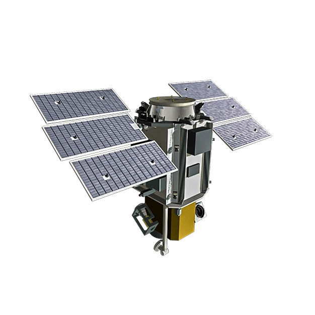
QuickBird-2

Satellite specifications

Data Availability

Archive imagery is available. Tasking is not currently offered.

Archive: Available
Tasking: Not available

Bands

Panchromatic450 to 900 nm
Blue450 to 520 nm
Green520 to 600 nm
Red630 to 690 nm
Near-Infrared (NIR)760 to 900 nm

Track satellites live

View real-time orbital positions

Satellites in Constellation1
Ground Sample Distance61 cm panchromatic, 2.44 m multispectral
Bands4
Revisit RateDecommissioned
Orbital Altitude450 km
Orbit TypeSun-synchronous orbit
Inclination97.2°
Equatorial Crossing Time10:30 AM local time (approximate)
Sensor Resolution61 cm panchromatic and 2.44 m multispectral at nadir
Dynamic Range11-bit
Swath Width16.5 km at nadir
Retargeting Ability38 seconds (time to slew 200 km)
Single Pass Collection Size4,068 sqkm
Daily Capacity200,000 sqkm
Geolocation Accuracy23 m CE90 ; 2m CE90 with GCPs
Launch DateOctober 18, 2001, 18:51 UTC
Launch SiteSpace Launch Complex-2W, Vandenberg Space Force Base, California, USA
Launch VehicleDelta II 7320-10
Mission LifeDecommissioned December 2014

Overview

QuickBird was a pioneering commercial Earth observation satellite that helped establish the market for high-resolution satellite imagery. Launched in 2001 by Vantor, it operated successfully for over 13 years before being decommissioned in 2014.

Historical Significance

QuickBird was one of the first commercial satellites to offer sub-meter resolution imagery, making high-resolution satellite data accessible to commercial and government customers worldwide.

Archive Value

With over 13 years of global collections, QuickBird's archive provides valuable historical baseline data for:

  • Long-term change analysis - Document changes over a decade-plus timeframe
  • Historical documentation - Capture conditions from the early 2000s
  • Baseline studies - Establish pre-development or pre-impact conditions
  • Legal and regulatory - Support historical compliance documentation

Applications for Archive Data

QuickBird archive imagery supports:

  • Urban growth studies - Track expansion from 2001-2014
  • Environmental monitoring - Document historical ecosystem conditions
  • Infrastructure development - Record construction timelines
  • Academic research - Support longitudinal studies and historical analysis
Order Imagery

Interested in imagery from this constellation? Contact our team to discuss your requirements.