
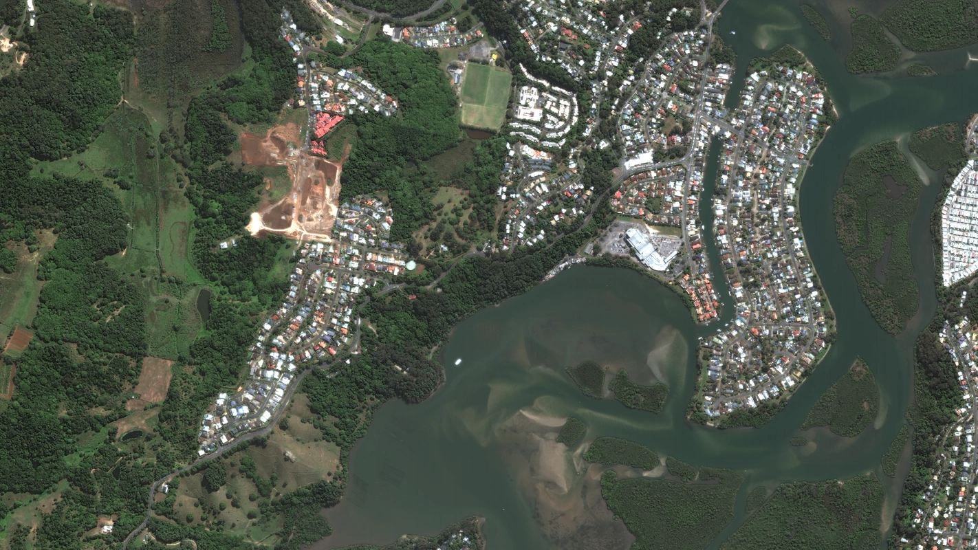
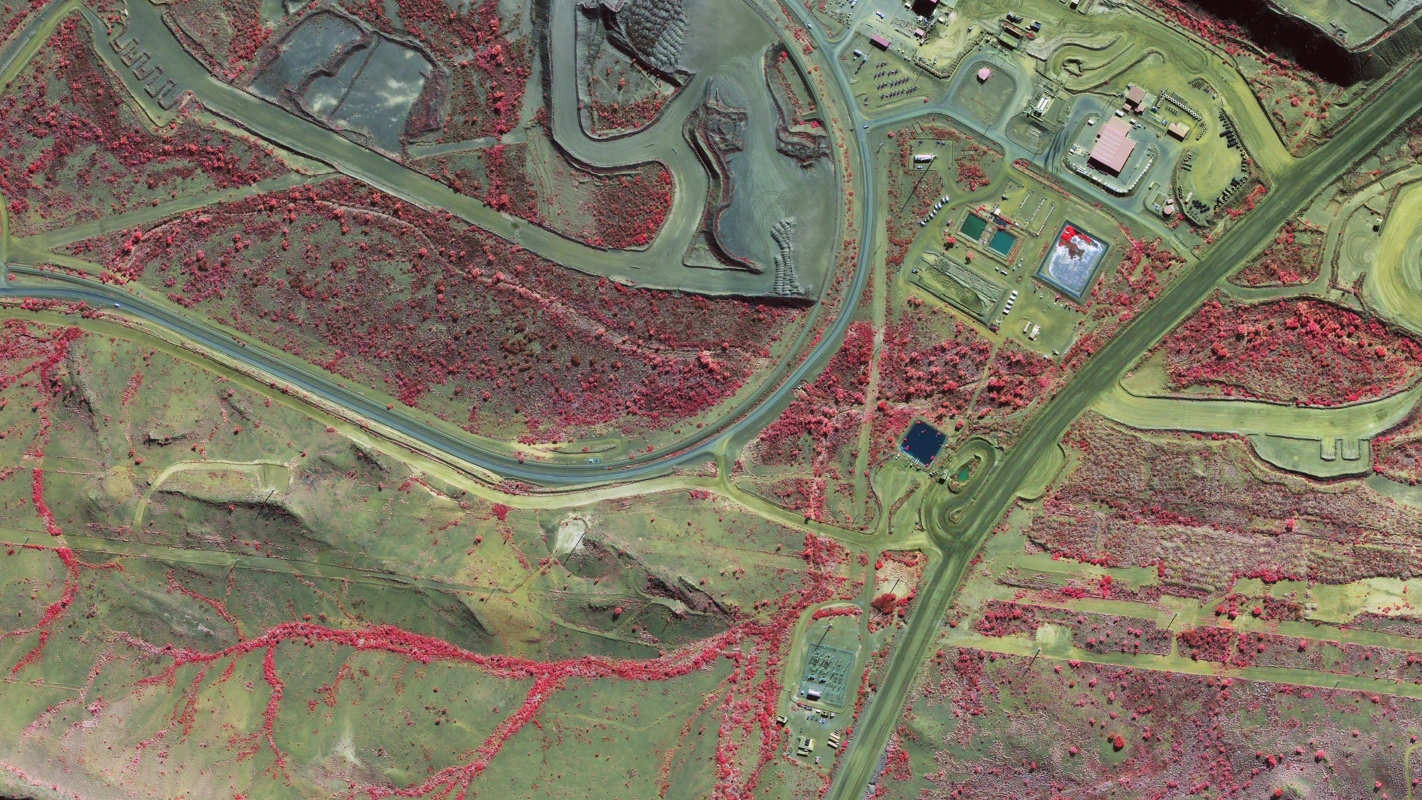
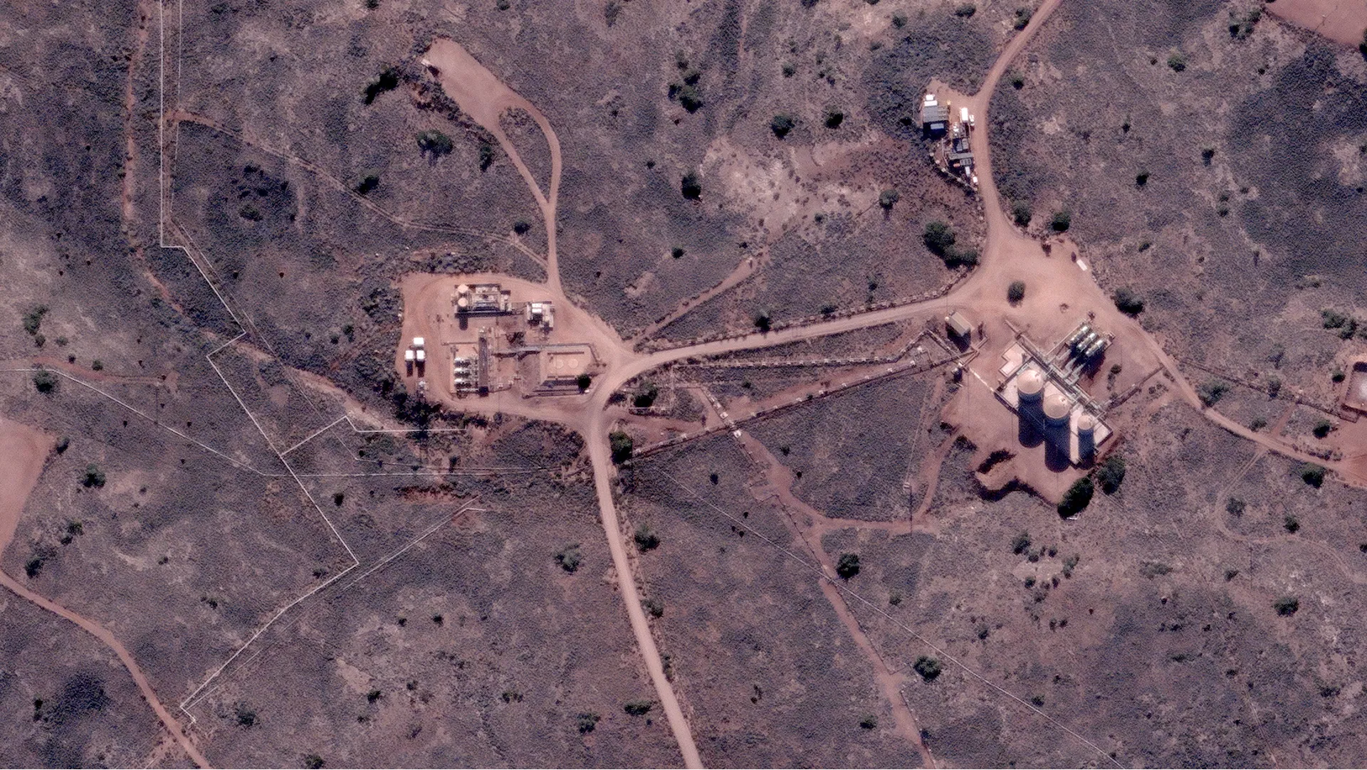
Mining
- Site monitoring and rehabilitation tracking
- Stock pile measurements
- Environmental compliance and digitisation
Sub-meter imagery from 40+ commercial satellites, analysis-ready in 3-5 working days.
Multi-constellation tasking with cloud-fallback retasking and full vendor redundancy. Used by leading mining, energy and infrastructure operators.
Tell us about your project and receive a quote, imagery options, and a delivery plan in one business day.
One contract, one invoice, one point of contact, with tasking spread across multiple commercial and public optical constellations so your project always has a fallback sensor when conditions change.


Real high res satellite images captured by our commercial constellation partners and processed analysis-ready by Terrabit.
Real high res satellite images from our commercial constellation partners across mining, energy, infrastructure and environmental sites, all processed analysis-ready by Terrabit.
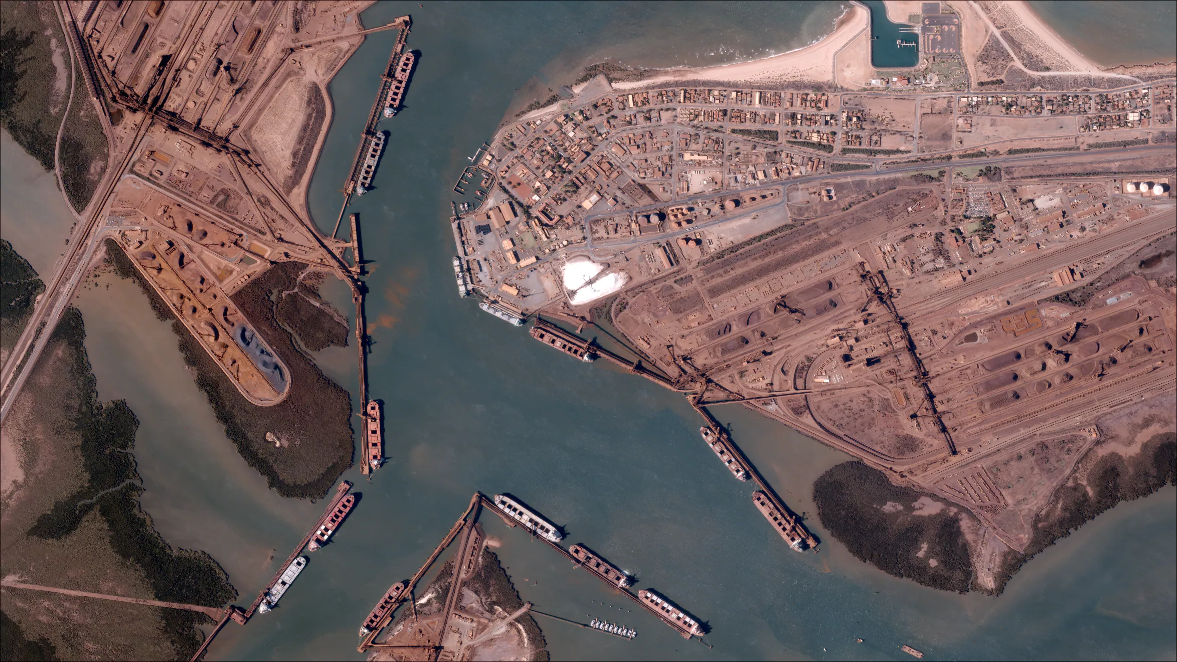
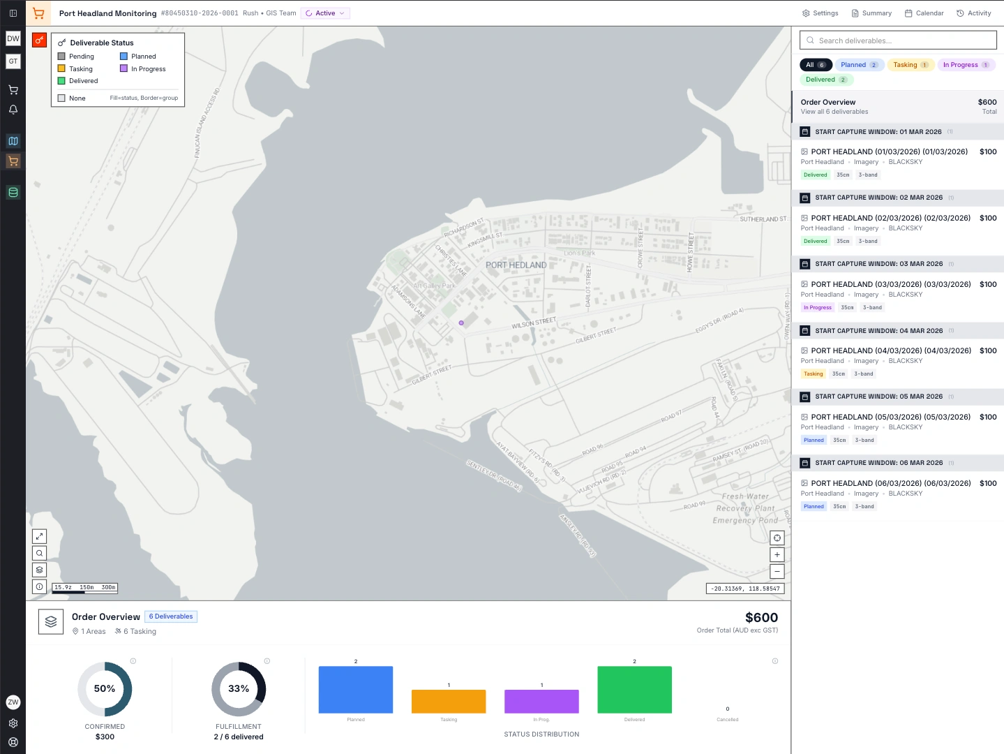
Port Activity
Port Hedland, Australia
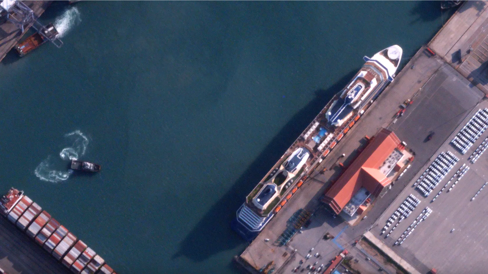
Maritime Vessels
Cruise terminal, Laem Chabang
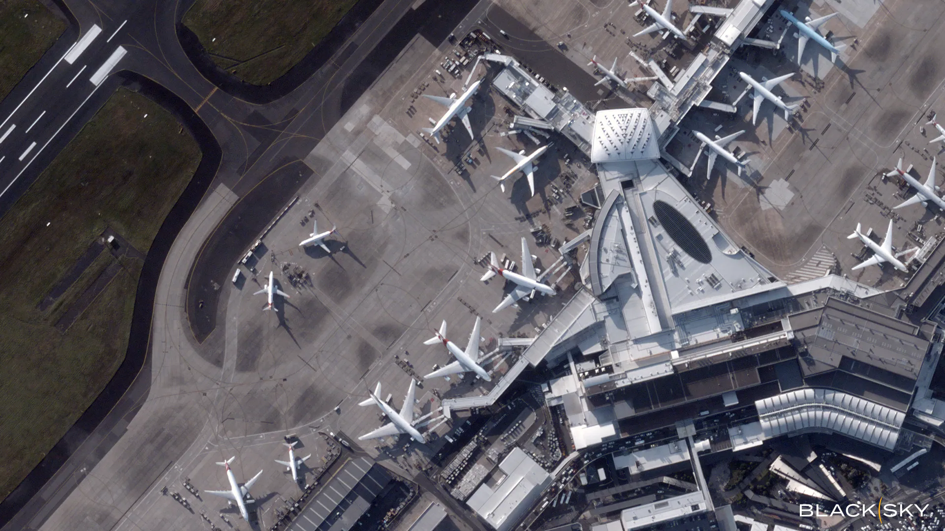
Airport Operations
Sydney Airport, Australia
3D Site Modelling
3D textured model, New Zealand
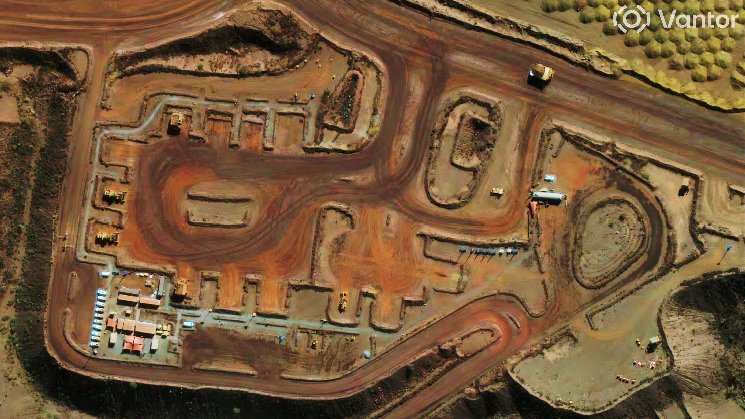
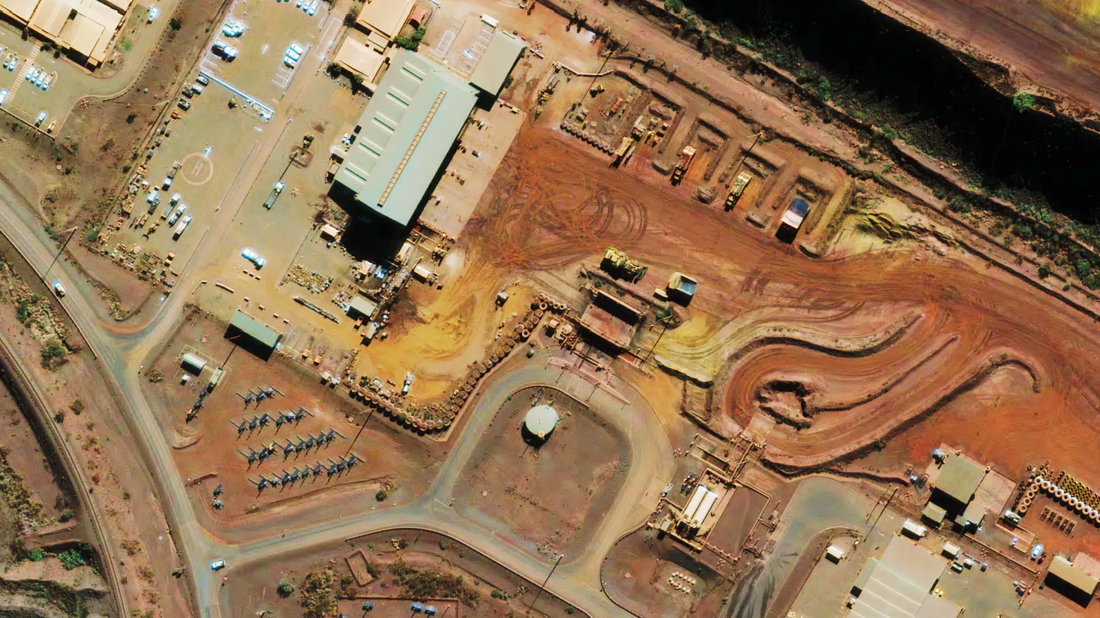
Mine Site Operations
Stockpile and pit monitoring
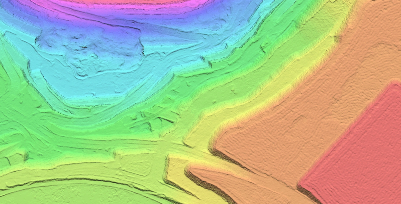
Digital Elevation Models
Bare-earth terrain model
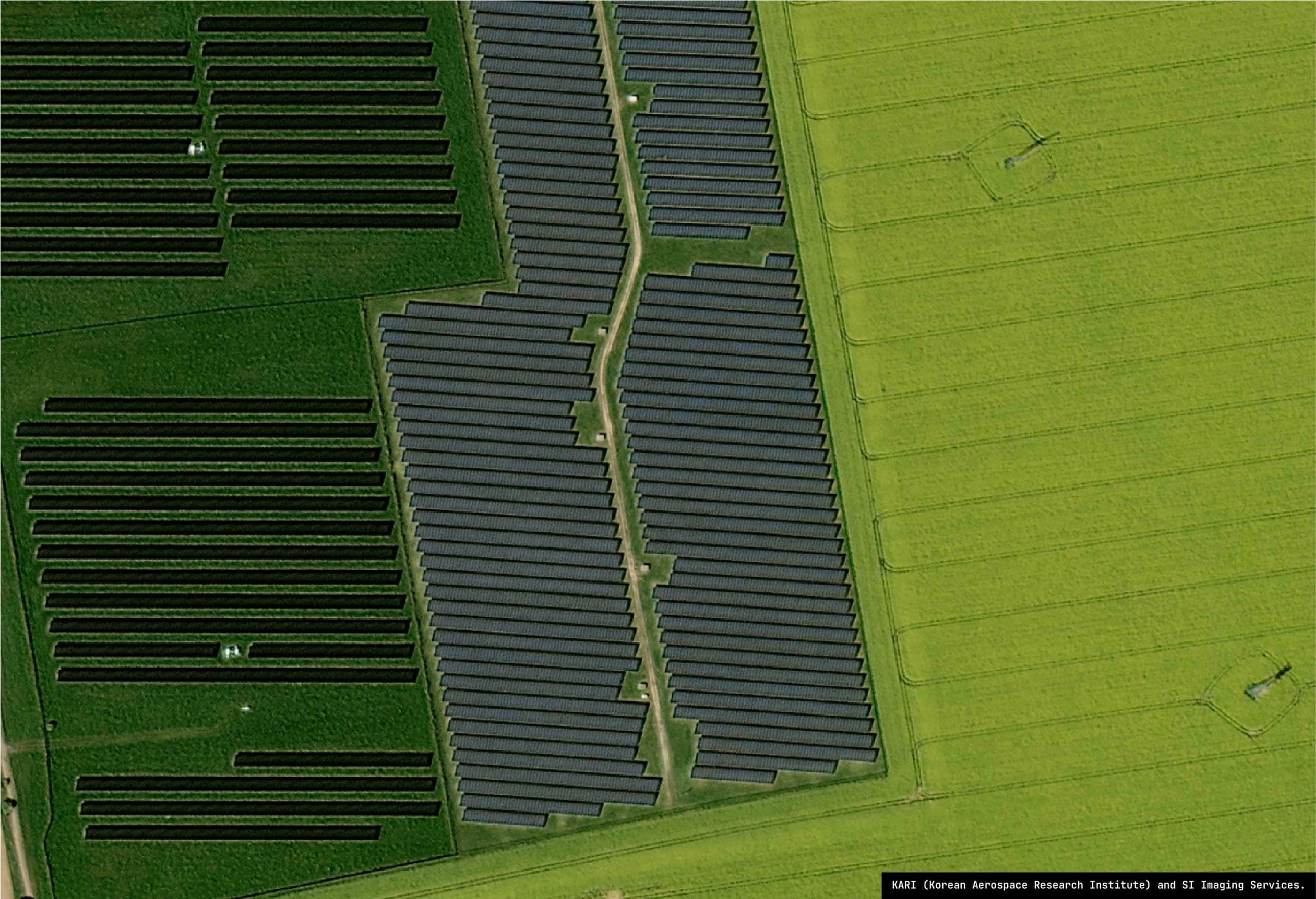
Renewable Assets
Solar farm assessment
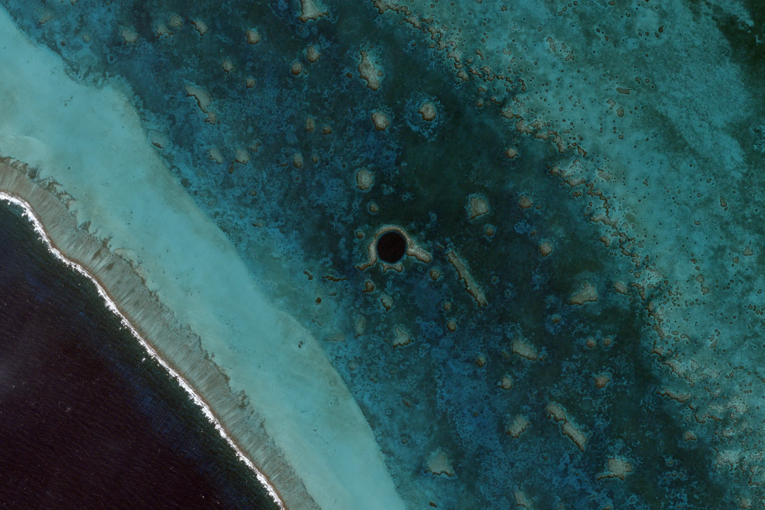
Environmental Monitoring
Color-infrared vegetation analysis
Terrabit pairs the world’s leading optical satellite constellations with a senior in-house processing team, so every program ships on time, whether it is a single site for a focused operator or a continent-scale mosaic for a global enterprise.
Proven track record
average project size, often delivered as a single mosaic
average tasking timeframe for complete coverage.
average in-house processing turnaround per delivery, from full capture
Terrabit is a multi-constellation, analysis-ready platform for high resolution satellite imagery. Order, process and deliver hi res satellite images that drop straight into your operational workflows, without managing vendor relationships, retasking logistics or processing pipelines yourself.
Tasking spreads across multiple optical constellations. We pick the right sensor for each project and fail over automatically when one is over-tasked or weather-bound.
Every delivery is orthorectified, radiometrically corrected and mosaicked in 3-5 working days, dropping straight into your GIS, BI or AI/ML pipeline.
Captures over your cloud-cover threshold are flagged and retasked within days, not weeks. You only pay for imagery you can actually use.
Our entire delivery team is based in Australia. You speak with the engineers running your project, not a global call centre, from quote to delivery.
One-off captures or long-running monitoring programs. We handle tasking windows, sensor selection, weather watching and re-collection against your timeline.
Sub-meter to multi-meter resolution across the constellation network. We match the sensor to your use case so you only pay for the detail you actually need.
A steady satellite cadence in place of irregular site visits - with every capture processed in-house by our Australian team. Pansharpening, orthorectification, mosaicking and colour balancing, delivered in the format your downstream workflow needs.
Face-value pricing as you scope. Combine archive, tasking and processing in a single order at any size - existing imagery, coverage gaps and itemised costs side by side, so you only pay for what your project actually needs.
Set the conditions every capture must meet - time of day, off-nadir angle, sun elevation, cloud cover - and we hold tasking to spec. Anything outside the bar is retasked across the constellation network, so scenes stay consistent enough to compare side by side.
Every order lands analysis-ready in 3-5 working days, with live tracking along the way - attempted captures, estimated delivery and order status across your entire team. Custom deliverables and direct integrations shaped to fit your operation.
How operators in each sector apply multi-constellation satellite imagery to their day-to-day workflows.


Archive scenes, new tasking and recurring monitoring programs are all priced face-value as you scope. Combine them in a single order, at any project size, with itemised costs side by side.
Existing scenes from our constellation partners, with face-value pricing visible as you scope your AOI.
Custom captures over your AOI, priced by area, resolution and cadence, with multi-constellation fallback.
Recurring captures with bulk pricing and a dedicated account manager for ongoing site cadences.
Everything teams ask before ordering hi res satellite images for the first time.
Every order is delivered analysis-ready in 3-5 working days from capture. New tasking can take anywhere from same day to 1-3 weeks depending on area size to capture, and we’ll confirm imagery options and pricing within one business day of your enquiry.
We task across BlackSky, Vantor, SI Imaging Services, Wyvern and public missions from NASA and ESA. We pick the sensor that fits each project’s resolution, cadence and budget, and fail over automatically when one is over-tasked or weather-bound.
Captures exceeding your cloud-cover tolerance are flagged automatically and retasked across our constellation network. You only pay for imagery you can use, and all-weather sensors can be added for tropical or monsoon-prone areas where guaranteed timing matters. Your account manager will keep you informed on capture attempts as they happen, or visible in your Albatross workspace, so you can track progress in real time.
Analysis-ready means hi res satellite images are delivered orthorectified, radiometrically corrected, mosaicked where required and reprojected to your coordinate system. Orthorectification can optionally be tied to client-supplied ground control for tight inter-date consistency and alignment with your existing datasets. The result drops directly into GIS, BI dashboards or AI/ML pipelines without further processing on your side or dealing with individual scenes.
We deliver hi res satellite images from 0.3m, depending on your use case. At 0.3m to 0.5m, individual vehicles and small infrastructure features are clearly identifiable. Tell us what you need to measure and we’ll recommend the right resolution.
Routinely, 10,000+ km² mosaics across multiple sites delivered as a single analysis-ready product in 3 working days - handling both small scale sites e.g. 25sqkm and larger regional areas. For larger programs, our processing team scales horizontally - tell us your area, deadline and resolution and we’ll confirm a delivery plan.
Direct quotes or pricing in our Albatross portal shows face-value pricing as you scope. Combine archive, tasking and processing in a single order at any size - existing imagery, coverage gaps and itemised costs side by side, so you only pay for what your project actually needs. For large scaled projects or ongoing monitoring programs, a dedicated account manager will provide a custom quote and pricing structure.
We deliver hi res satellite images in industry-standard formats - Cloud Optimised GeoTIFF and ECW are most common - in the projection and coordinate system you specify. Streaming access and direct download are all supported with in house forward deployed software specialists to guide you through integrations and options.
Tell us your area of interest and we’ll reply with a delivery plan within one business day.